
After a week of some depressing material. Let’s lighten things up. Since, you know, it is a Friday.
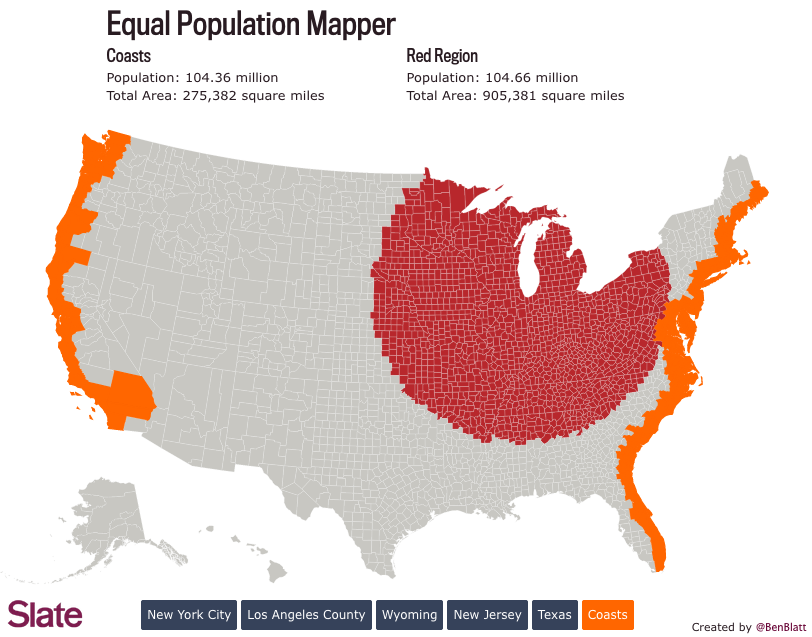
Two weeks ago we looked at comparisons of actual geographic area. These are sometimes useful comparisons. But more often than not we are talking about the people that live in said areas. And speaking as someone who has lived in either suburbs of big cities or within big cities my entire life, comprehending the not-do-dense rural flyover states is a bit hard to do. Thankfully Ben Blatt over at Slate put together a nice interactive piece that allows you to get a better sense of just how empty the middle of the country really is. (Hint, it is empty.)
Here we take a look at comparing the East and West coasts to Chicago. Turns out you have to go pretty far from the shores of Lake Michigan to equal the population of the two coasts. That’s a lot of flyover.
Credit for the piece goes to Ben Blatt.