
I am a big fan of trains, rail transit, and Amtrak. I think the rail network connecting the East Coast’s big cities from Boston down to Washington is one of the big draws of the Northeast. Not surprisingly, I have taken that route I don’t know how many times. So, when Amtrak’s Northeast Regional No. 188 derailed in Philadelphia, it ran off rails with which I am familiar.
I made a graphic tonight—so much for all my other plans—charting and mapping out what was announced by Philadelphia’s mayor, Michael Nutter. I am sure that by the time I wake up in the morning, we will know more and some things will have changed. But, let this be a simple guide to the basics as they were Tuesday night.
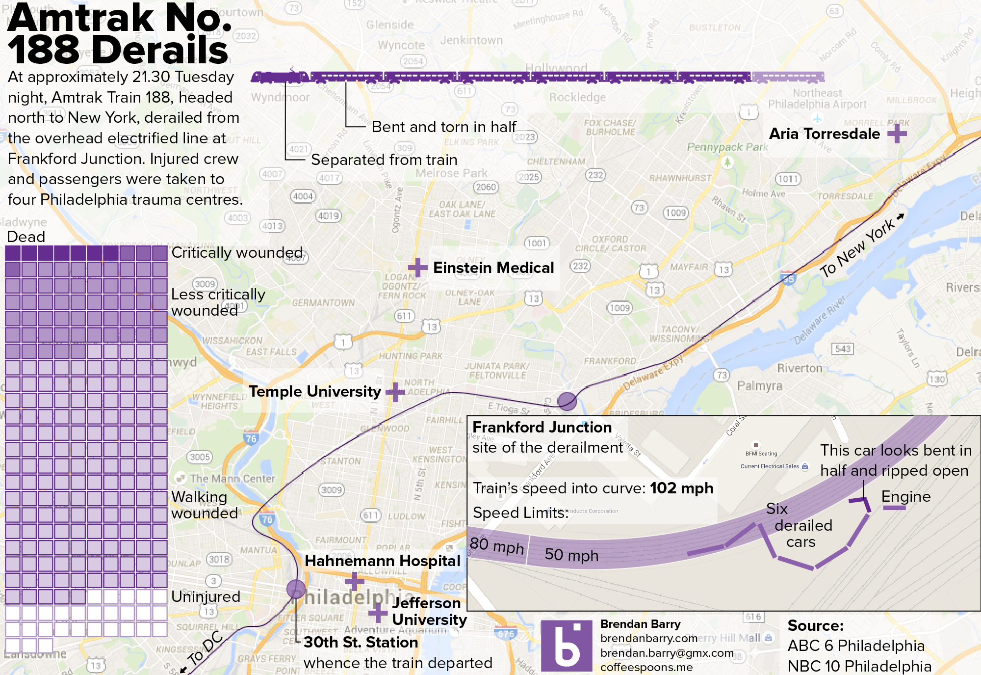
Frankford Junction is in the Port Richmond area of Philly. And what I can attest is that trains do slow down here, because it is a fairly sharp turn at a fairly flat grade (I think).
Credit for the screenshot map image goes to Google.
Nice job, Brendan. Your map depicts that the site of the accident in one of the more likely areas that such a tragedy was likely to happen.