
Taking a Friday’s break from diagrams and graphics from Québec, because it’s really just a small part of space. Space, which is presented below.

Credit for the piece goes to Randall Munroe.
Taking a Friday’s break from diagrams and graphics from Québec, because it’s really just a small part of space. Space, which is presented below.
Credit for the piece goes to Randall Munroe.
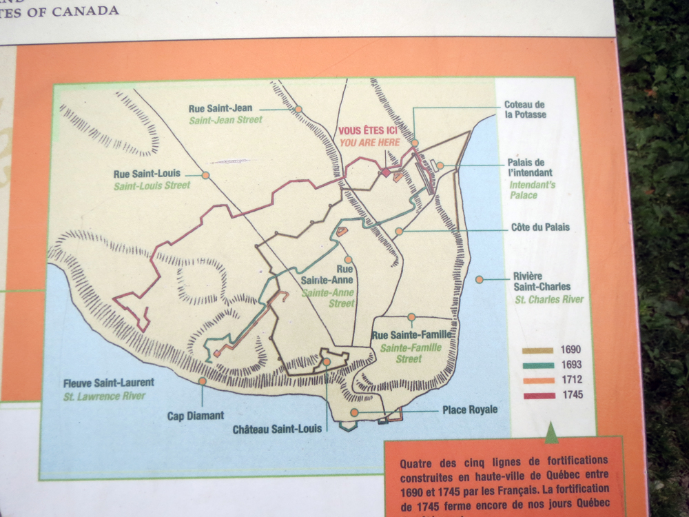
Beyond la Citadelle, Québec also enjoys a defensive wall that nearly surrounds Vieux-Québec, or Old Québec. These graphics come from the Barracks Sector, which used to house the Royal Artillery during the British period.
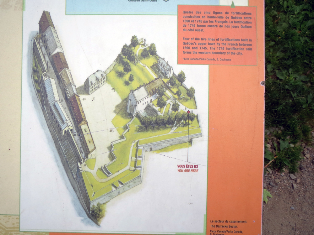
The walls in this section of the city date to 1745, but the redoubt in this area goes back to 1712, you can see that as the orange rectangle.
Credit for the pieces go to the graphics department of Parks Canada.
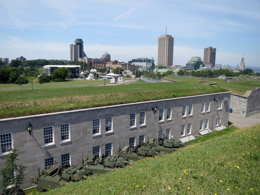
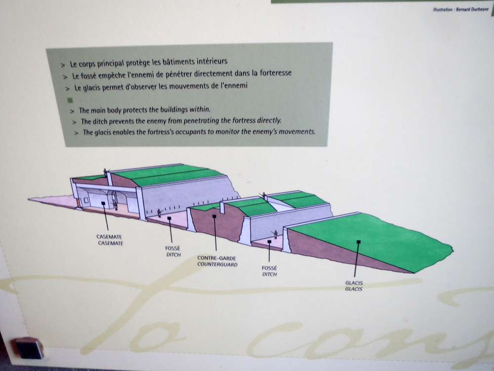
La Citadelle de Québec consists of several layers of fortifications that are not discernible to an eye outside the fortification. This has to do with the well-planned angle of the tops of the fortifications. Thankfully, designers said about explaining this through some graphics. While I do not have a great shot from outside the fortress of the angle, you can see some of the even slope in this photo from the top of the wall looking out towards Ville de Québec outside the city walls.
The fortification is composed of several different layers. This graphic colour codes them. For reference to the photo above, I am not standing “vous étes ici.” Rather, I am at the tip of bastion in the upper left of the diagram, just behind the pink—not red—line.

This graphic shows how la Citadelle would have been defended back in the 19th century. Note the lack of armoured vehicles as seen in the above photograph.
Credit for the piece goes to the design team behind the graphics.
Part of my trip to la Citadelle de Québec involved a visit to the Bastion du Roi, which features one of the oldest parts of the fortress: Cap aux Diamant Redoubt. A redoubt is a hardened fortification completely enclosed and separate from larger fortifications. Often it serves as a place of last retreat. In Québec, the redoubt is one of the surviving original French-era fortifications, albeit heavily modified by the British in the 19th century. These graphics illustrate some of those changes.
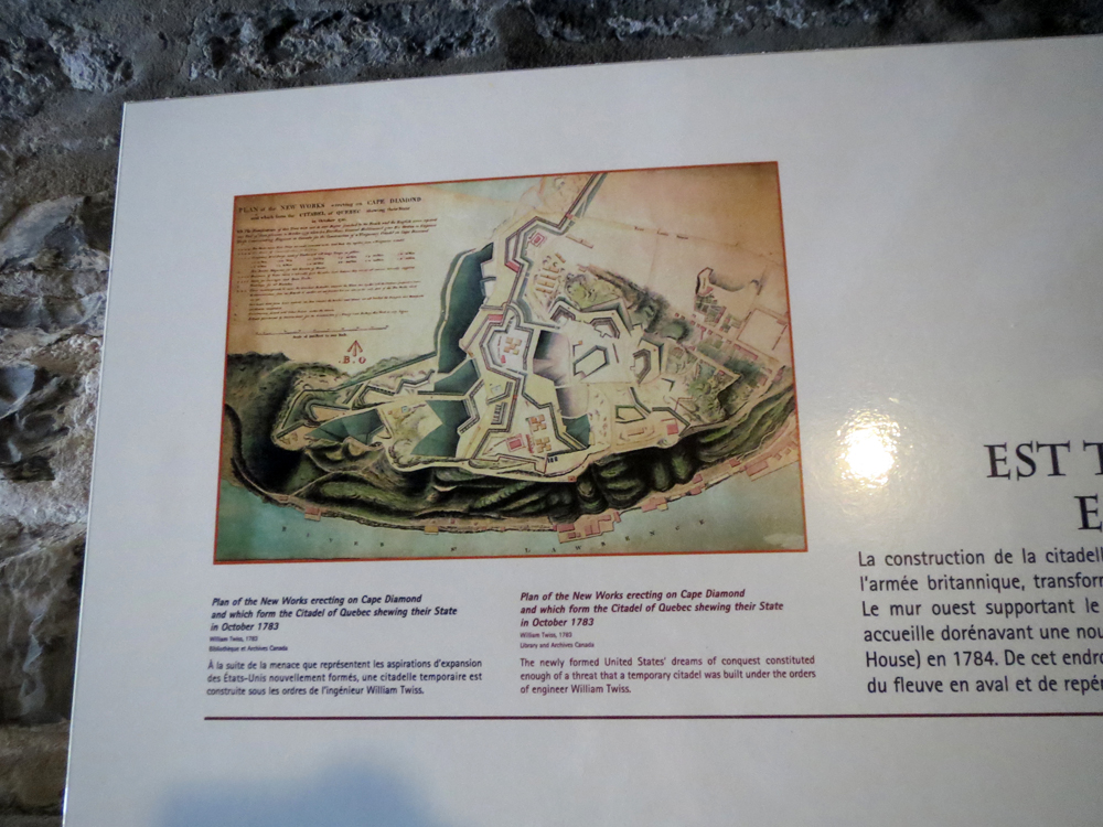
By 1783, the original French fortification existed outside the growing defensive works of the British. In this map, you can see the notably square shape of the redoubt as the pink square on the right side of the map near the cliff.
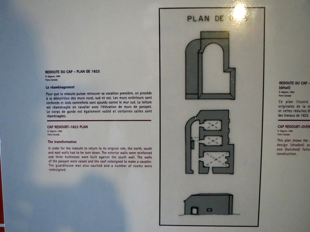
In 1823, the British decided to modify the square-shaped redoubt and undertook extensive modifications. The graphic below shows the original redoubt, the square, with the new plan, the hatched work.
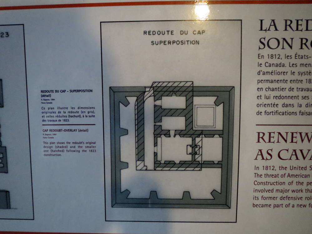
The new plan simplified the structure.
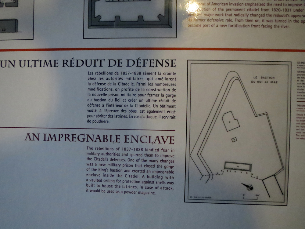
But eventually, the redoubt was entirely enclosed by the growing fortifications. This shows its location in Bastion du Roi along with the construction of a block house to further fortify the bastion.
Credit for the piece goes to the designers of the various graphics.
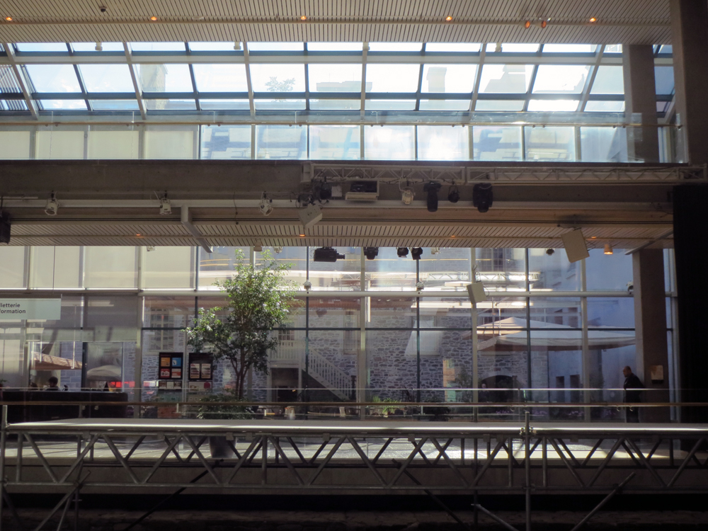
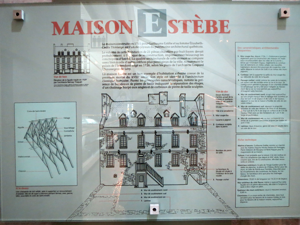
Yesterday’s piece was from the Musée de la Civilisation à Québec and looked at a bilingual exhibit on Greek and Roman mythology. The museum, of course, had many other exhibits. Today I want to show an interesting bit that explained why the museum, a modern construction dating to the late 1980s, incorporated an 18th century house called Maison Estèbe.
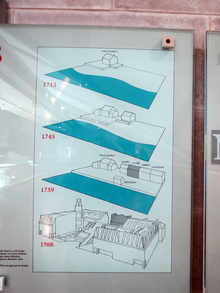
Well, the museum had a series of graphics with text explaining why. But they were only in French. But by some smart use of graphics and some thought as to how show the progression of time, the reader can piece together a good bit of the story.
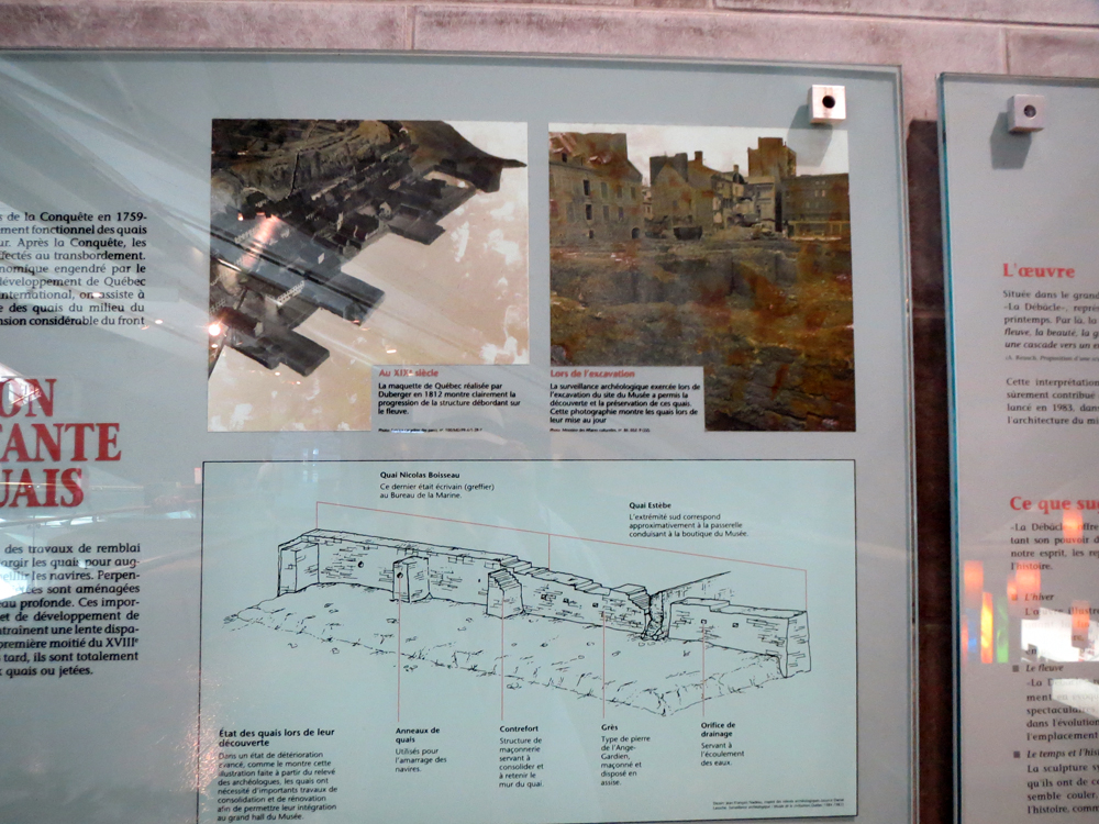
And of course to make it abundantly clear, the excavation of Québec’s foundations also revealed longboats along the old shoreline, which when placed in front of a quay like below, just make perfect sense.
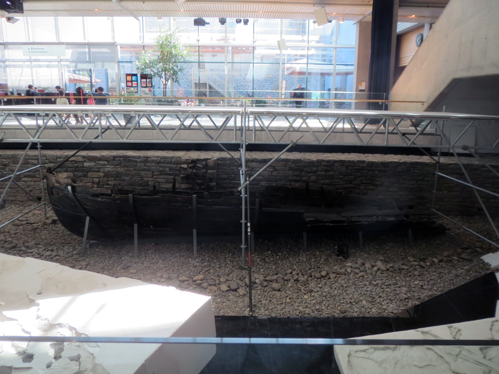
Credit for the pieces goes to the graphics department of the Musée de la Civilisation à Québec.
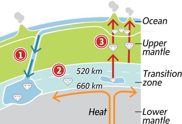
Your author is still in Canada. So here’s a graphic from the Globe and Mail that explains the process by which ringwoodite is formed. Recent research shows that the water contained within the mineral makes the mantle beneath the surface of the Earth contain more water than all the world’s oceans.
But mostly, I’m still in Canada.
Credit for the piece goes to the Globe and Mail graphics department.
Your (not-so) humble author is on holiday in Canada for a couple of days. Thankfully, he is staying away from dogs.
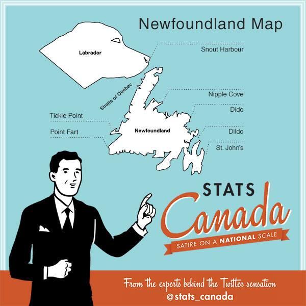
Credit for the piece goes to Stats Canada (in no way associated with Statistics Canada).
Last week President Obama announced a task force to investigate the disappearance of honeybees. While that might sound like something out of a Doctor Who episode—it is—the problem is real since bees pollinate the flowers that become the fruit and vegetables we consume. The Washington Post took a look at what might be responsible for the decline in bees through this illustrated graphic.
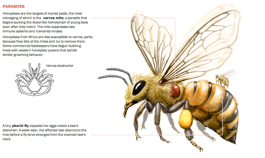
Credit for the piece goes to Patterson Clark.
America loves its gun. The big draw of this piece from the Washington Post is the illustration of the guns used in the mass shootings and whether each was legally or illegally acquired. But more interesting from a data visualisation standpoint are the charts below. They show the numbers of killers, victims, and then the demographics of the killers.
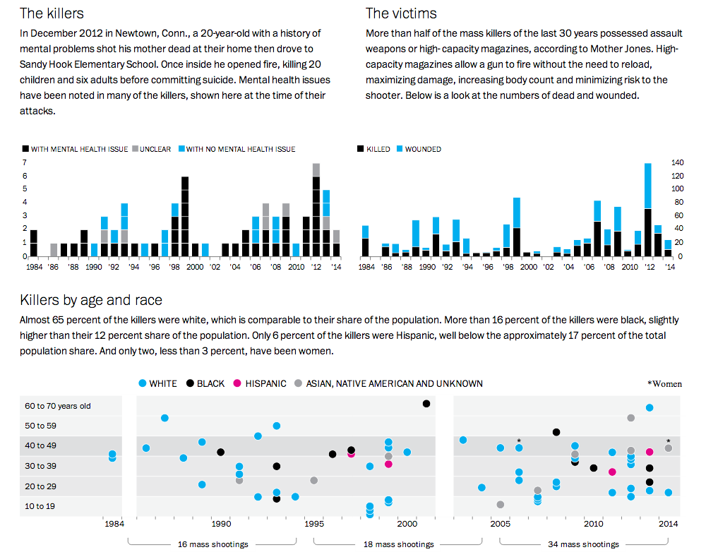
Credit for the piece goes to Alberto Cuadra, Richard Johnson, Todd Lindeman, Ted Mellnik, and Kennedy Elliott
Time for some sports. Okay, I’m admittedly thinking of it because company softball started up again. And for some reason, the teams have a horrible habit of horrendous injuries. So what better way to commemorate (a week late, whatever) the start of the season than a nice illustration of Tommy John surgery. For those of you unfamiliar with it, in baseball the injury that requires the procedure typically befalls pitchers—though not always—and keeps them away from the game for at least a year.
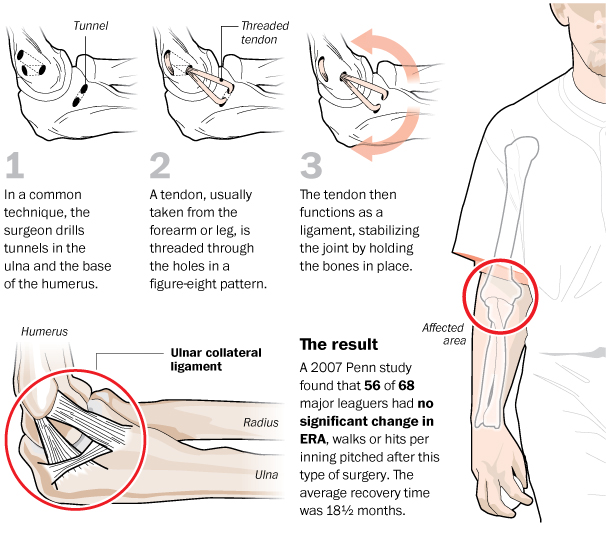
Credit for the piece goes to Bonnie Berkowitz and Alberto Cuadra.