Cannon, Howitzers, Mortars—Oh My!

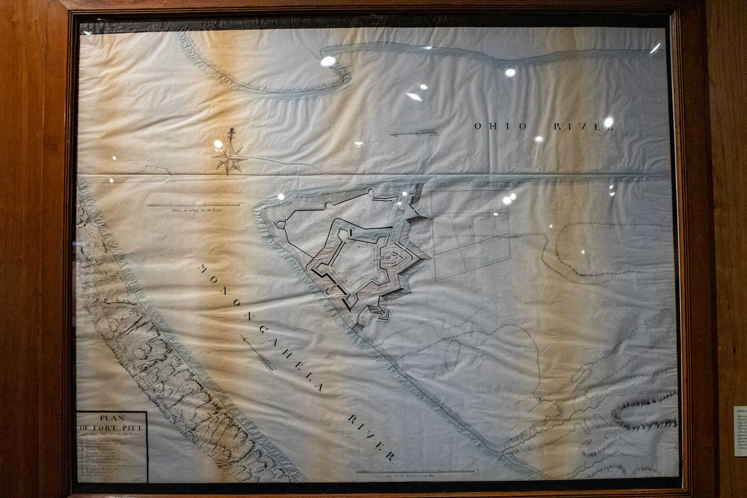
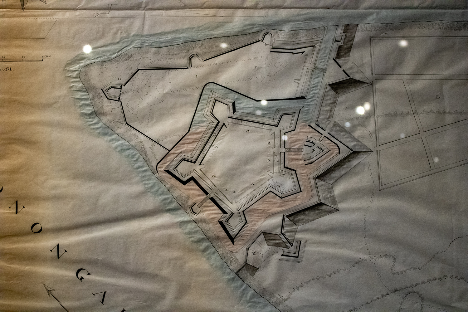
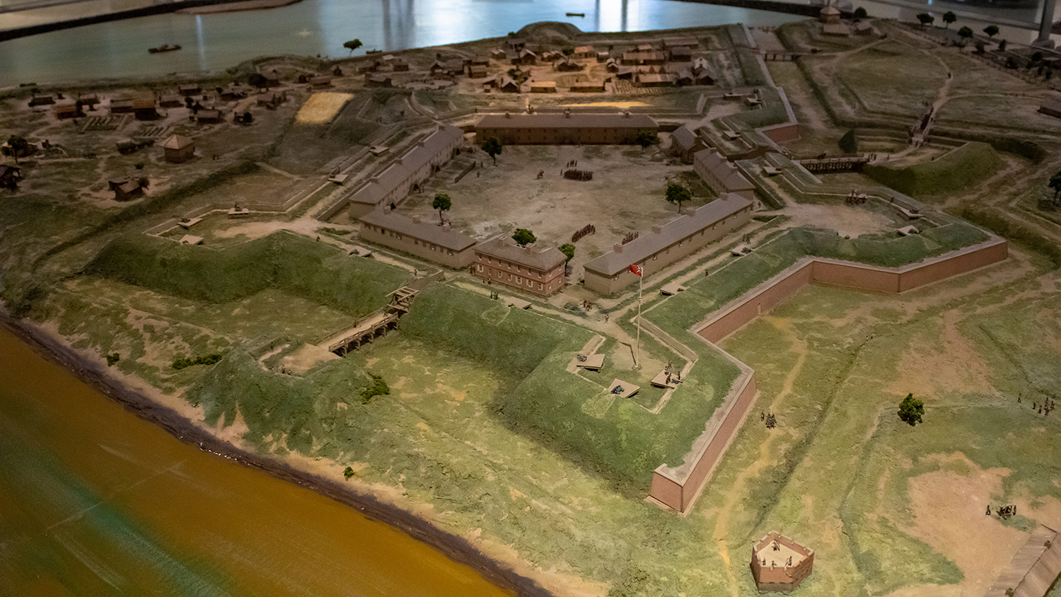
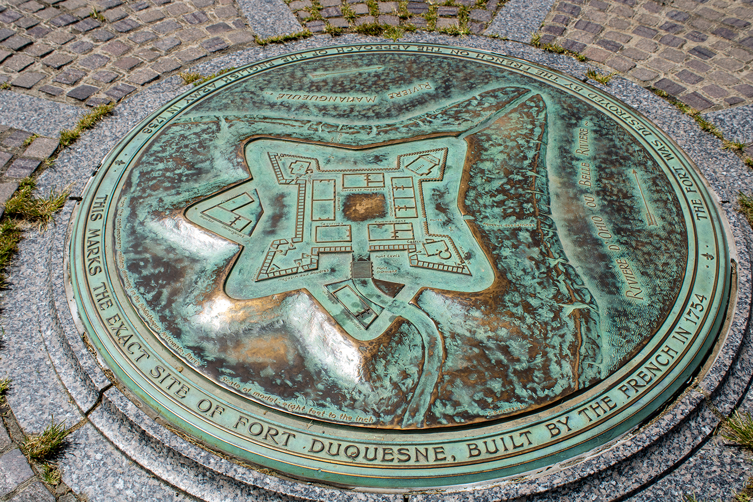
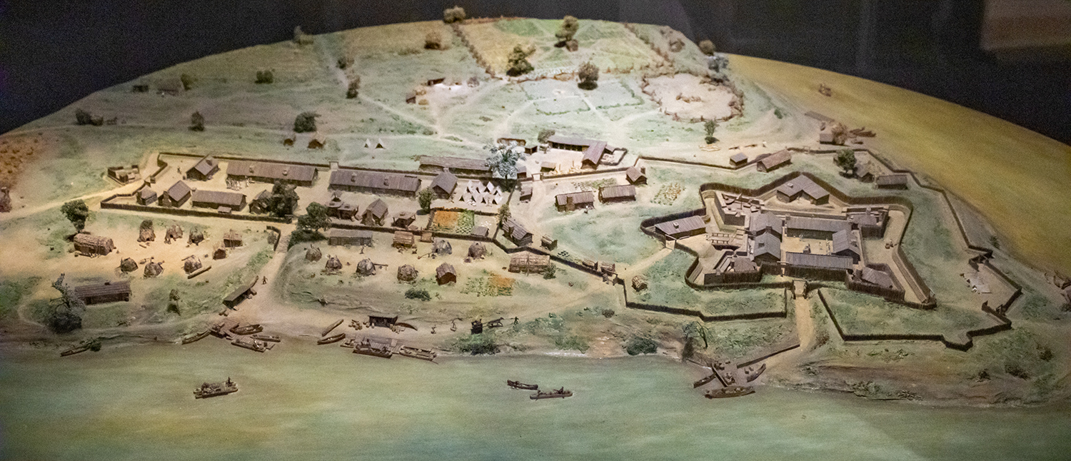
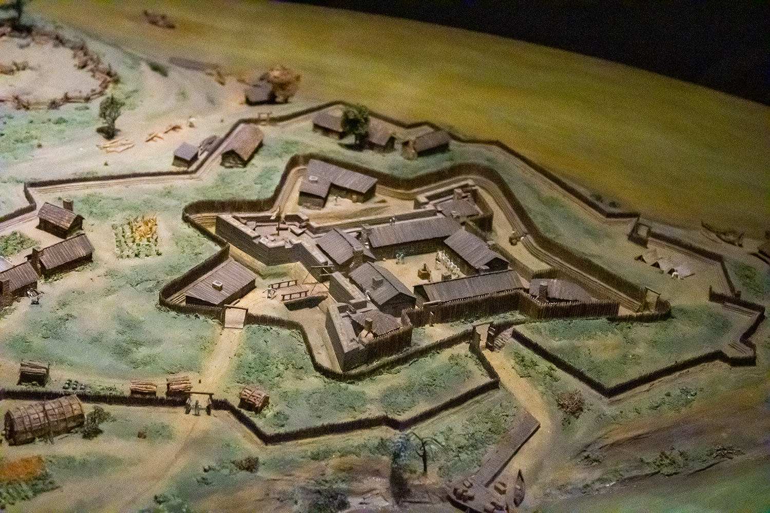
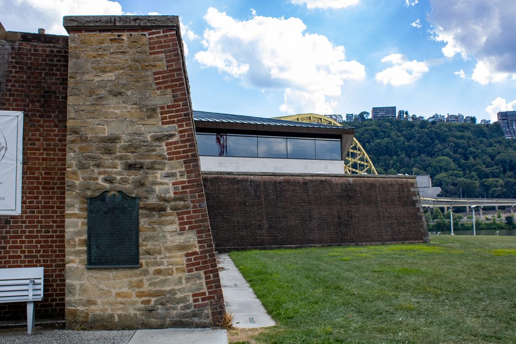
For the last two days I have been writing about the Fort Pitt Museum and some infographics, environmental graphics, diagrams, and dioramas that help explain the strategic value and thus history behind the peninsula at the confluence of the Allegheny, Monongahela, and Ohio rivers. In particular, we looked at Fort Duquesne, the French attempt to fortify the position, and then Fort Pitt, the far more successful British attempt.

But a fortress without weaponry is like a snapping turtle without a sharpened beak. And once the fortifications were built, the British began moving in artillery pieces and hundreds of soldiers to defend their claim on the land. Local Native American tribes invited the British in and to station soldiers, but relations soured after a few years when it became clear the British, unlike the French, were more interested in settling the land.

In 1763, Native American discontent coalesced around Pontiac, an Ottawa warrior chief, who directed the outrage into violent actions in the western colonial lands. Pontiac’s War had begun. The British, recently victorious over the French, suffered several defeats as Native American forces took several British forts and raided settlements killing unknown numbers of settlers.

At the forks of the Ohio, local Native Americans besieged Fort Pitt. For two months, Fort Pitt was cut off from resupply and local settlers, who had poured into the fort, even took up arms. But the biggest weapons the British had were the artillery at the fortress.

Though it should be noted this was the incident during which a small smallpox outbreak occurred amongst the settlers and British military forces used smallpox infected blankets as gifts to the Native Americans. In later letters, this tactic was commended by senior British military officials. However, the efficacy of the action from a military perspective is debatable at best.

The British had three main types of artillery at their disposal: cannon, howitzers, and mortars. And if you have no idea what the differences are, no worries, because the Fort Pitt Museum has several great graphics explaining their differences and the pros and cons to each.

Get out of the way.

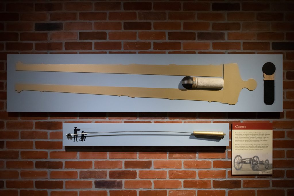
Above we have a diagram of a cannon. At the time cannon differentiated themselves by being relatively easier to construct and maintain. They fired solid, non-explosive projectiles at relatively flat trajectories. If you ever saw the Patriot with Mel Gibson, the scene where a gun fires a ball that then bounces through ranks of infantry and severs numerous legs, most likely that was a cannon.

The remaining two types were used for launching projectiles at higher angles, almost lobbing them up and over fortifications or enemy troop formations. Howitzers were the longer-ranged of the two and whilst broadly similar to cannon, at the time they differentiated themselves by being able to fire explosive projectiles. In other words, instead of a solid ball of iron as described above, this could explode and send shrapnel down on a larger area of massed infantry.

More ouchies.

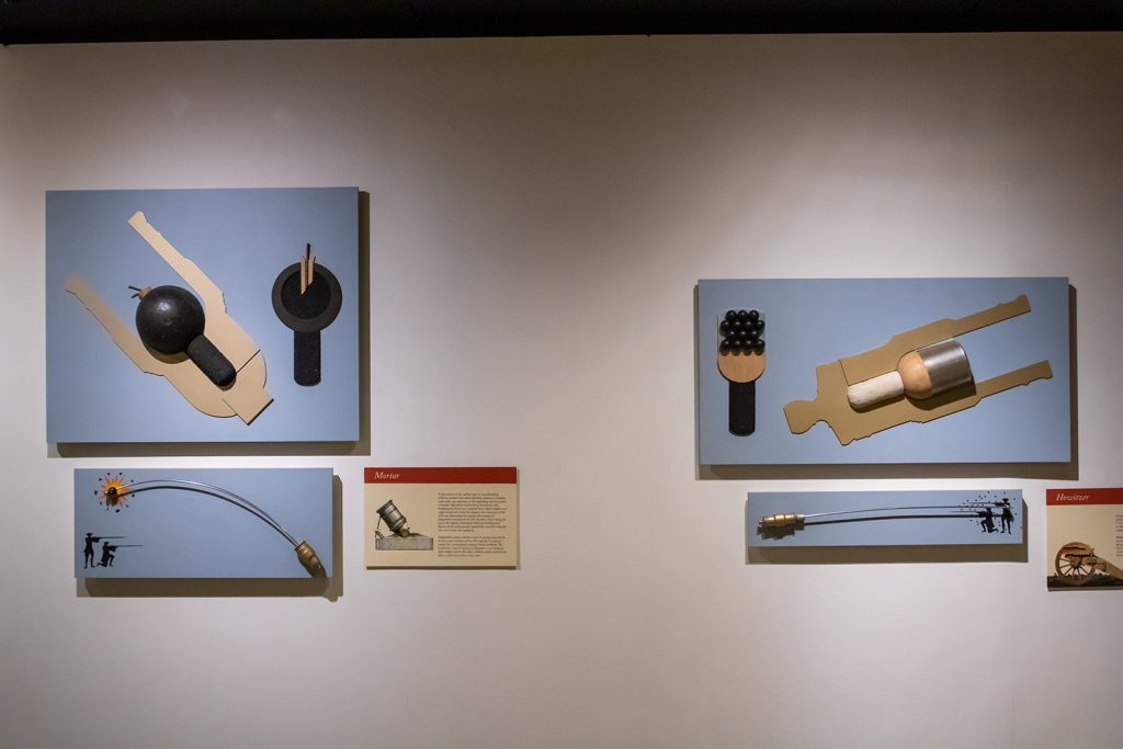
The mortar, in that sense, is similar to the howitzer. It could send explosive shells above troops and fortifications, but it was designed to do so at high-angles. This was particularly important in counter-siege warfare when the British defenders needed ways to fire at Native American soldiers who closely approached Fort Pitt’s defensive walls.

The graphics do a great job showing just how these three types of artillery were different and could be used to different effects. The graphics don’t do too much and don’t use elaborate illustrations. They are very effective and very efficient. Well done.

Credit for the pieces goes to the Fort Pitt Museum design staff.

Fort Pitt

Yesterday I discussed some of the work at the Fort Pitt Museum in Pittsburgh, Pennsylvania. Specifically we looked at Fort Duquesne, the French fortification that guarded the linchpin of their colonies along the Saint Lawrence Seaway and the Mississippi and Ohio River valleys.

In 1753, the royal governor of Virginia dispatched a British colonial military officer, a lieutenant colonel, to demand the French withdraw from the chain of forts along the Allegheny River. The French politely refused. Undeterred, the lieutenant colonel, after returning the refusal, was sent with several dozen soldiers to push the British claim.

The lieutenant colonel discovered a French force south of present-day Pittsburgh. After largely surrounding the French force, the lieutenant colonel ordered his soldiers to open fire and in the ensuing battle the French force was destroyed by killing or capturing the vast majority of the force. That was the opening battle of the Seven Years War, a global conflict that stretched across North America, South America, Africa, India, and Asia.

The lieutenant colonel who started it all? George Washington.

At the war’s outset, Washington was involved—but did not lead—in another operation to oust the French from Fort Duquesne. This operation failed spectacularly with the death of its commander, Major General Edward Braddock. Three years later, British forces had sufficiently regrouped that they again attempted to take Fort Duquesne. After some tactical losses, the British continued to press the French. The French, seeing the vastly superior numbers of British soldiers, decided to withdraw and in blowing up their ammunition stores, destroyed Fort Duquesne.

The British, operationally commanded by Lieutenant Colonel Henry Bouquet, a Swiss-born veteran British officer, occupied the smoldering ruins. There they proceeded to build an even larger fortification named after the British prime minister who ordered the site taken. The prime minister? William Pitt the Elder. The fort? Fort Pitt. The town that would develop around the fort? Pittsburgh.

When completed, Fort Pitt was the largest and most sophisticated British fortification west of the Appalachian Mountains. It guarded British colonial interests from both French and native forces who would have gladly retaken control of the area.

Today the Fort Pitt Museum has several diagrams and dioramas detailing what was at its completion. The photograph below is a reproduction of a diagram made in 1761 just prior to the fort’s completion of the fort and its immediate environs. Even the reproduction is itself a reproduction in that the creators used the same materials and methods as would have been used in the 18th century, lending it some of that aged quality.

To be clear, this is large at least maybe six feet wide.

And here we have a closer view of the fort itself. If you look closely to the left, nearer the forks of the Ohio, you can see the outline of the far smaller Fort Duquesne.

You can see more of the details in this shot.

But for me the amazing part was walking into the museum where you are greeted with an amazing diorama of the Fort as it appeared in 1765. You can already see the emerging town of Pittsburgh outside the fortifications.

A fortress for ants.

Credit for the original diagram goes to British military engineer Bernard Ratzer, its recreation was made by artists from the Carnegie Museum.

Credit for the diorama goes to Holiday Displays.

Diagramming and Diorama-ing Fort Duquesne

Pittsburgh exists because of the city sits at the confluence of the Allegheny, Monongahela, and Ohio Rivers. As far back as the early 18th century, English and French colonists had recognised the strategic value of the site and as imperial ambitions ramped up, the French finally wrested control of the area from the English and constructed a fort to defend the forks of the Ohio. They named it Fort Du Quesne (now Fort Duquesne) after Governor-General of New France, Marquis Du Quesne.

Fort Duquesne anchored a north-south chain of French forts linking the Ohio River to Lake Erie via the Allegheny River. Since the Allegheny drains into the Ohio and not Lake Erie, the French used a navigable tributary of the Allegheny, the imaginatively named French Creek, to reach just a few miles from the fort on Lake Erie, Fort Presque Isle, from which they portaged overland to Fort Le Bœuf. From there they travelled down the river or overland via the Venango Path to Fort Machault situated at the confluence of French Creek and the Allegheny River.

This chain of forts and the control they established over the Ohio allowed the French to link their colony of New France in present day Québec along the Saint Lawrence River to their colonies along the Mississippi in the Illinois Country via Lake Erie then the Allegheny and Ohio Rivers, which feed into the Mississippi River. The Mississippi of course then empties into the Gulf of Mexico through the then French colony of Louisiana and New Orleans. Strategically this allowed the French to surround and choke the British colonies along the eastern seaboard from territory and resources west of the Appalachian Mountains.

At the site of Fort Duquesne on what is now called Point State Park, a granite stone outline of the original French fort sits in a grass field. And at the centre of the outline is a plaque diagramming the fort’s design.

The marker for the centre of Fort Duquesne

Thankfully for history lovers, the park also contains a history museum dedicated to Fort Pitt, the larger British successor fortification to Fort Duquesne. But inside, the history of Fort Pitt would be incomplete without a discussion of Fort Duquesne and that includes a nice diorama. You will note more details here, however, as the initial fort seen in the above diagram was expanded to include more area for barracks, farms, and ancillary activities like forges.

Fort Duquesne and its expansion

But even still a closer shot of the fort itself shows what the physical buildings would have looked like above and beyond a two-dimensional diagram.

Closer view of Fort Duquesne

Having been to the site, however, you can see that Fort Duquesne and the later Fort Pitt weren’t necessarily as defensible as one may think. Just to the south across the Monongahela River is a ridgeline that offers clear lines of fire into the forts. Some well positioned artillery would have made holding the forts tenuous at best. Of course hauling artillery and ammunition up to the ridge’s summit is easier said than done. Here’s a photo from the Fort Pitt Museum, whose exterior walls reconstruct one of the later Fort Pitt’s bastion walls. You can see in the background the ridge line of Mount Washington (originally named Coal Hill) stands far above the fort’s defences. Artillery could easily angle down and fire into the forts, be them either Duquesne or Pitt.

It would have been like fish in a barrel.

Credit for the marker goes to I assume the designers at the Pennsylvania State Park commission.

Credit for the dioramas goes to Holiday Displays, who created the originals in the 1960s.

The Sinking of the Vasa

In 1628, Sweden launched one of its largest and most powerful warships not just in Sweden, but in all of Europe. She was to participate in the wars with Poland and Lithuania as Sweden sought to expand her growing empire. After two years of construction in Stockholm’s naval yard she set sail into a calm day with a light breeze.

After a strong gust pushed her hard to port, she righted herself and continued to set sail to a fortress to load 300 troops for the war. But only 20 minutes into her maiden voyage, a second gust of wind pushed her again hard to port so much so that water began to flood in via her open lower gunports. As the continued to rush in, she never righted herself and sank, not to be recovered for 300 years.

The recovery itself is a great story, but the question was why did she sink? This model in the large Vasa museum, built to host the recovered and preserved ship, shows just how dangerously she was designed. Take careful note of the faint blue waves signifying the waterline of the ship and how close they are to the lower gunports.

Note the waterline on the lower crossbeam of the barrel to which the model is connected

The short takeaway is that the ship was top-heavy and she needed to be both wider and deeper to support her displacement. I like the model here, but my one complaint with it is the waterline. Even when I was standing in front of it, I did not notice the waves at first. A little bit more emphasis or paint, perhaps to show the water beneath the ship, would really help to convey just how little of the ship was below the waterline.

Credit for the piece goes to the Vasa Museum design staff.

All the Crazy Models

Over the last several weeks we dealt with the impact of a few hurricanes from H to K, i.e. Harvey, Irma, Jose, and Katia. Now that the Atlantic basin has quieted a wee bit, it is time we get back to the lighter side of things.

So we turn to xkcd and its look at ensemble models, often used to try and predict the paths of hurricanes.

I like to swap the victor of the colonial revolt in North America ca. 1776…

Happy Friday, everyone.

Credit for the piece goes to Randall Munroe.