Fort Pitt

Yesterday I discussed some of the work at the Fort Pitt Museum in Pittsburgh, Pennsylvania. Specifically we looked at Fort Duquesne, the French fortification that guarded the linchpin of their colonies along the Saint Lawrence Seaway and the Mississippi and Ohio River valleys.

In 1753, the royal governor of Virginia dispatched a British colonial military officer, a lieutenant colonel, to demand the French withdraw from the chain of forts along the Allegheny River. The French politely refused. Undeterred, the lieutenant colonel, after returning the refusal, was sent with several dozen soldiers to push the British claim.

The lieutenant colonel discovered a French force south of present-day Pittsburgh. After largely surrounding the French force, the lieutenant colonel ordered his soldiers to open fire and in the ensuing battle the French force was destroyed by killing or capturing the vast majority of the force. That was the opening battle of the Seven Years War, a global conflict that stretched across North America, South America, Africa, India, and Asia.

The lieutenant colonel who started it all? George Washington.

At the war’s outset, Washington was involved—but did not lead—in another operation to oust the French from Fort Duquesne. This operation failed spectacularly with the death of its commander, Major General Edward Braddock. Three years later, British forces had sufficiently regrouped that they again attempted to take Fort Duquesne. After some tactical losses, the British continued to press the French. The French, seeing the vastly superior numbers of British soldiers, decided to withdraw and in blowing up their ammunition stores, destroyed Fort Duquesne.

The British, operationally commanded by Lieutenant Colonel Henry Bouquet, a Swiss-born veteran British officer, occupied the smoldering ruins. There they proceeded to build an even larger fortification named after the British prime minister who ordered the site taken. The prime minister? William Pitt the Elder. The fort? Fort Pitt. The town that would develop around the fort? Pittsburgh.

When completed, Fort Pitt was the largest and most sophisticated British fortification west of the Appalachian Mountains. It guarded British colonial interests from both French and native forces who would have gladly retaken control of the area.

Today the Fort Pitt Museum has several diagrams and dioramas detailing what was at its completion. The photograph below is a reproduction of a diagram made in 1761 just prior to the fort’s completion of the fort and its immediate environs. Even the reproduction is itself a reproduction in that the creators used the same materials and methods as would have been used in the 18th century, lending it some of that aged quality.
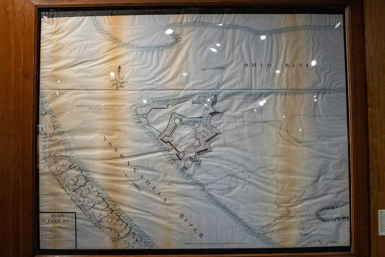
To be clear, this is large at least maybe six feet wide.

And here we have a closer view of the fort itself. If you look closely to the left, nearer the forks of the Ohio, you can see the outline of the far smaller Fort Duquesne.
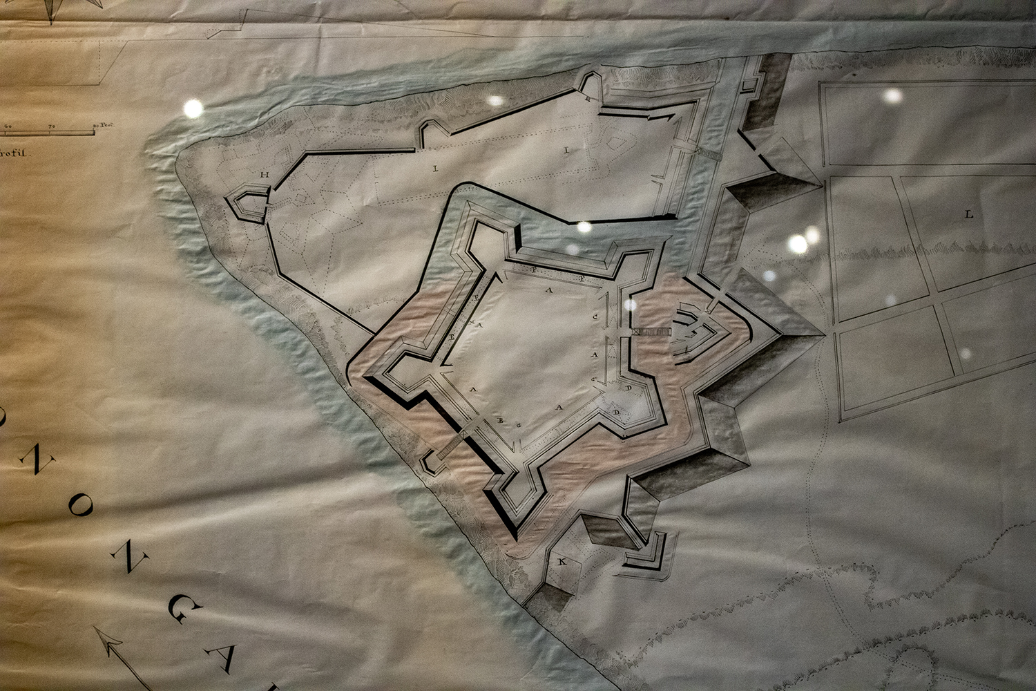
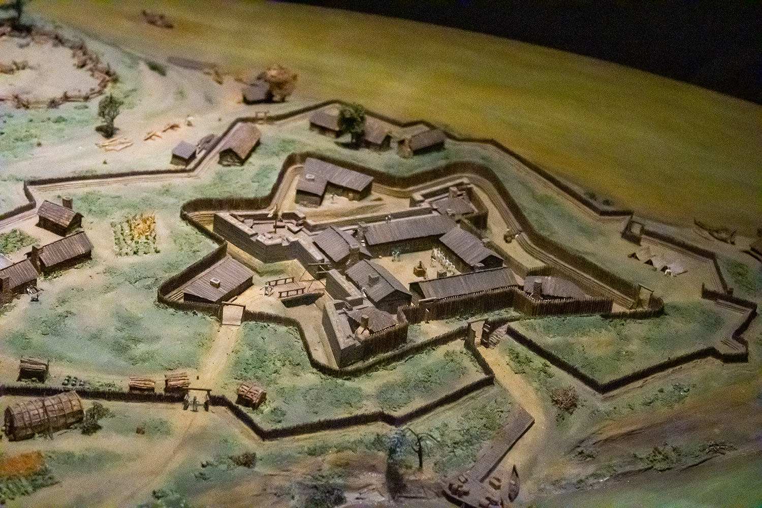
You can see more of the details in this shot.

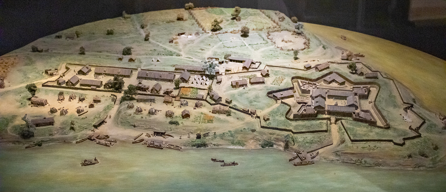
But for me the amazing part was walking into the museum where you are greeted with an amazing diorama of the Fort as it appeared in 1765. You can already see the emerging town of Pittsburgh outside the fortifications.
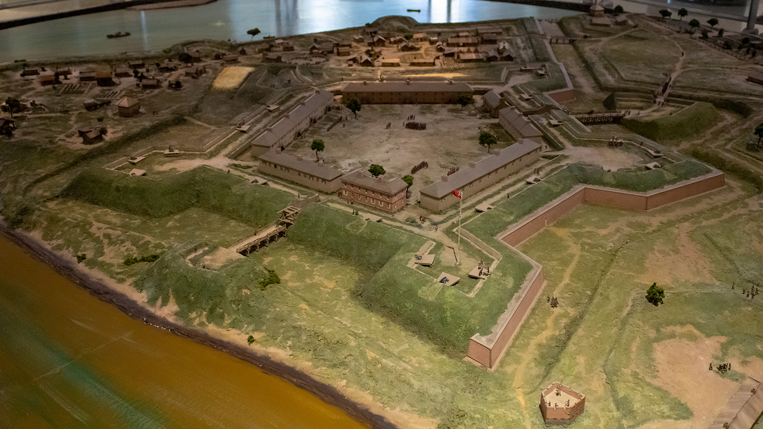
A fortress for ants.

Credit for the original diagram goes to British military engineer Bernard Ratzer, its recreation was made by artists from the Carnegie Museum.

Credit for the diorama goes to Holiday Displays.

Diagramming and Diorama-ing Fort Duquesne

Pittsburgh exists because of the city sits at the confluence of the Allegheny, Monongahela, and Ohio Rivers. As far back as the early 18th century, English and French colonists had recognised the strategic value of the site and as imperial ambitions ramped up, the French finally wrested control of the area from the English and constructed a fort to defend the forks of the Ohio. They named it Fort Du Quesne (now Fort Duquesne) after Governor-General of New France, Marquis Du Quesne.

Fort Duquesne anchored a north-south chain of French forts linking the Ohio River to Lake Erie via the Allegheny River. Since the Allegheny drains into the Ohio and not Lake Erie, the French used a navigable tributary of the Allegheny, the imaginatively named French Creek, to reach just a few miles from the fort on Lake Erie, Fort Presque Isle, from which they portaged overland to Fort Le Bœuf. From there they travelled down the river or overland via the Venango Path to Fort Machault situated at the confluence of French Creek and the Allegheny River.

This chain of forts and the control they established over the Ohio allowed the French to link their colony of New France in present day Québec along the Saint Lawrence River to their colonies along the Mississippi in the Illinois Country via Lake Erie then the Allegheny and Ohio Rivers, which feed into the Mississippi River. The Mississippi of course then empties into the Gulf of Mexico through the then French colony of Louisiana and New Orleans. Strategically this allowed the French to surround and choke the British colonies along the eastern seaboard from territory and resources west of the Appalachian Mountains.

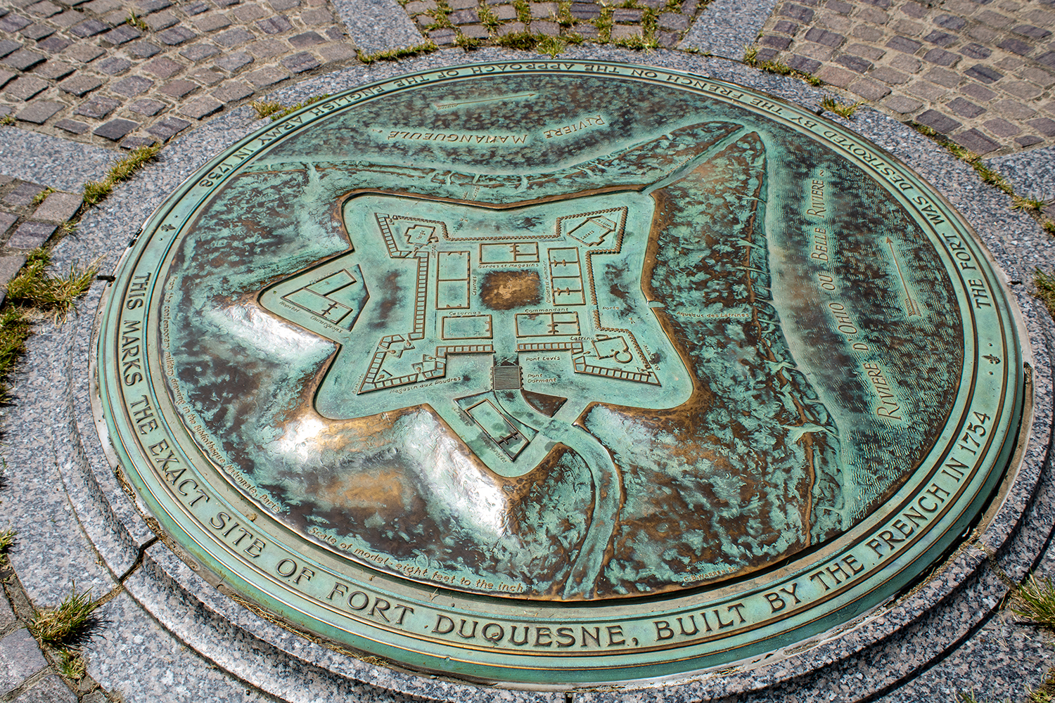
At the site of Fort Duquesne on what is now called Point State Park, a granite stone outline of the original French fort sits in a grass field. And at the centre of the outline is a plaque diagramming the fort’s design.

The marker for the centre of Fort Duquesne

Thankfully for history lovers, the park also contains a history museum dedicated to Fort Pitt, the larger British successor fortification to Fort Duquesne. But inside, the history of Fort Pitt would be incomplete without a discussion of Fort Duquesne and that includes a nice diorama. You will note more details here, however, as the initial fort seen in the above diagram was expanded to include more area for barracks, farms, and ancillary activities like forges.

Fort Duquesne and its expansion

But even still a closer shot of the fort itself shows what the physical buildings would have looked like above and beyond a two-dimensional diagram.

Closer view of Fort Duquesne

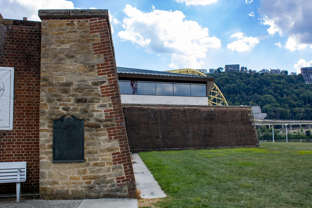
Having been to the site, however, you can see that Fort Duquesne and the later Fort Pitt weren’t necessarily as defensible as one may think. Just to the south across the Monongahela River is a ridgeline that offers clear lines of fire into the forts. Some well positioned artillery would have made holding the forts tenuous at best. Of course hauling artillery and ammunition up to the ridge’s summit is easier said than done. Here’s a photo from the Fort Pitt Museum, whose exterior walls reconstruct one of the later Fort Pitt’s bastion walls. You can see in the background the ridge line of Mount Washington (originally named Coal Hill) stands far above the fort’s defences. Artillery could easily angle down and fire into the forts, be them either Duquesne or Pitt.

It would have been like fish in a barrel.

Credit for the marker goes to I assume the designers at the Pennsylvania State Park commission.

Credit for the dioramas goes to Holiday Displays, who created the originals in the 1960s.