Brexit Deal 2.0

I’ve been trying to work on a Syrian changing alliances graphic, but the Brexit news today scuppered that. Instead, we take a look at Boris’ deal, which differs from May’s in that it chucks out the notion of territorial integrity, creating a border in the Irish Sea where goods will have to be inspected. My old Brexit trilemma graphic shows the new deal’s fundamental choices.
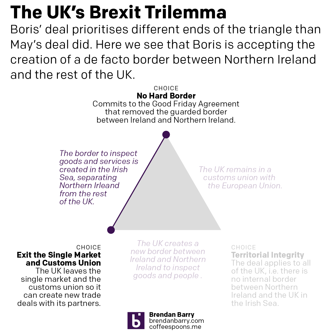
Shifting priorities
Shifting priorities

But how does this exiting the customs union and single market work? Well, the whole of the UK is leaving the customs union, but on the single market, there Northern Ireland remains in, aligned to the EU, whereas the rest of the UK is leaving. Ports will screen for some goods to ensure compliance with UK officials ensuring EU standards.
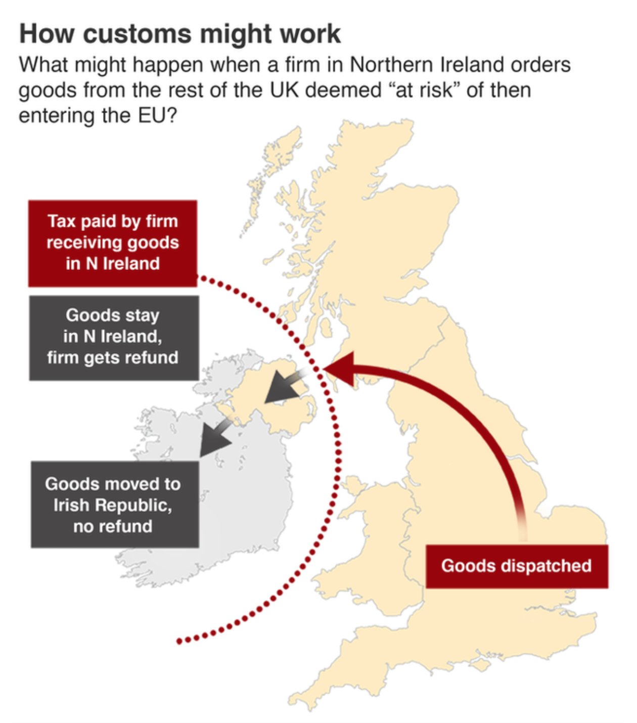
There are still questions about how this will all shake out

The BBC graphic above is pretty straightforward, showing the new border as a dotted line. But the border is there. There is still quite a bit we don’t know. And most important of those questions is can Boris get his deal through Parliament? Remember, he tossed 20 MPs out of the party. And there are signals that the DUP, a conservative Northern Irish party that provides the crucial backing votes to the Tories to ensure the Tory majority (before, again, Boris kicked out 20 of his own MPs), will vote against the deal because it separates them from the rest of the UK.

Credit for the trilemma is mine.

Credit for the BBC graphic goes to the BBC graphics department.

The Trilemma Remains for Boris

This is a repost of sorts, but it is important. Now prime minister, Boris Johnson had an opportunity to seek a more reasonable approach to Brexit. Unfortunately, he is drawing even harder red lines than his predecessor, Theresa May. And that brings us back to my Brexit trilemma graphic from back in March.

Essentially, Johnson wants three things that are mutually—or whatever the word is for three, maybe tri-mutually—semi-exclusive. In other words, of the three red lines, the United Kingdom can only have two, because those two then make the third impossible.

Doing the same thing but expecting results…pick two already, Boris.

I made the first version of this back in March. Sad it still applies.

Credit for the piece goes to me.

Demanding the Impossible

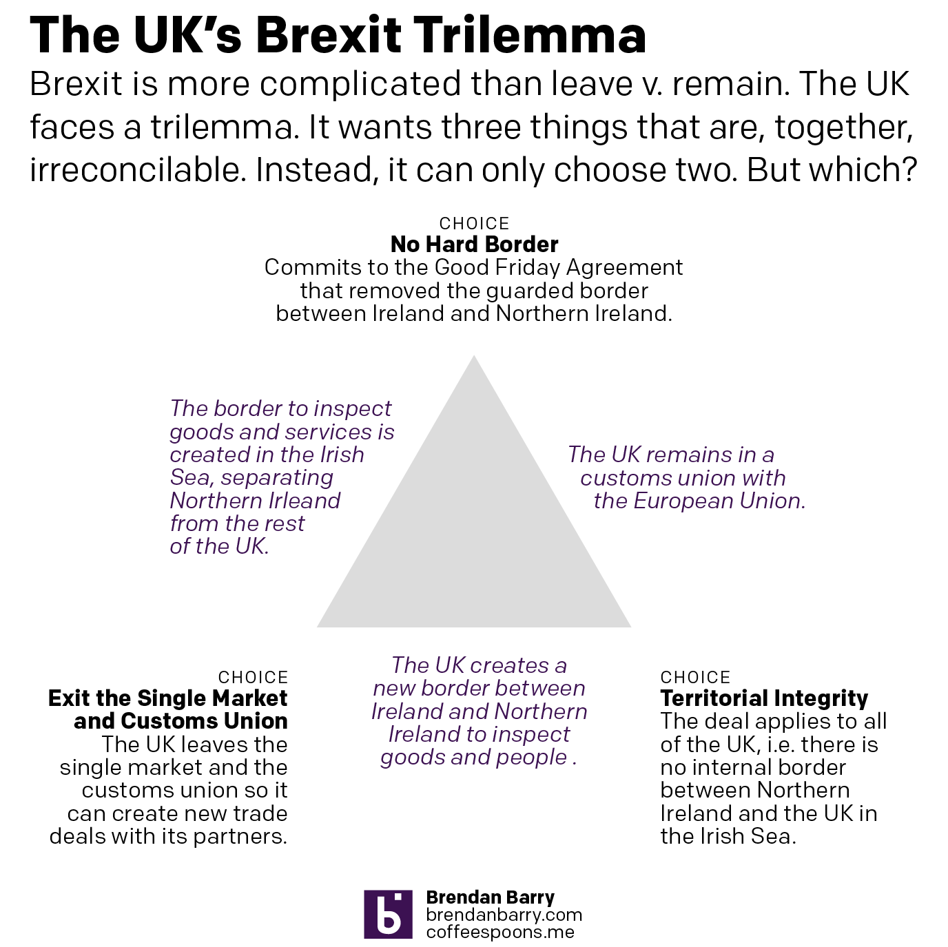
The key problem in the Brexit deal remains what to do with the Irish border. In essence, the UK faces the same trilemma it has since the beginning. It wants three things it cannot have at the same time: exiting the EU single market and customs union, so it can create a free and independent trade policy; no hard border between Ireland and Northern Ireland, per the Good Friday Agreement that ended the Troubles; and territorial integrity, i.e. no hard border between Northern Ireland and the rest of the UK in the Irish Sea.

Essentially, the UK can choose two of these three options. Below, I have attempted to show how they relate and what the result is once two of the options have been chosen.

Choose two and only two.

Credit for the piece is mine.

Northern Ireland Assembly Election Results

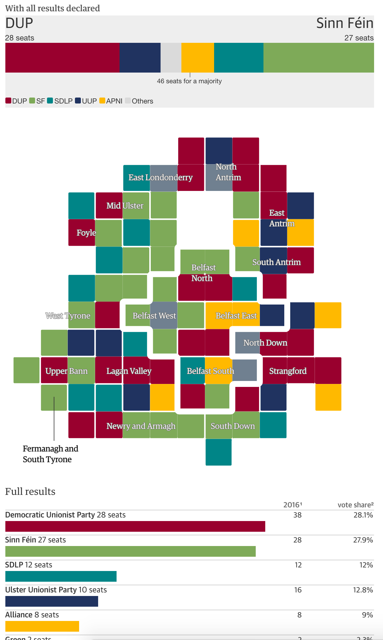
Friday was election day across Northern Ireland as voters elected their representatives for the assembly at Stormont. The headline results: the Nationalists have gained significant ground on the Unionists. The Guardian captured the tallies in this results page.

An almost even split

Credit for the piece goes to the Guardian’s graphics department.

Brexit and Ireland

This week I really wanted to hold off on commenting about Brexit graphics until things settled down—admittedly thinking Remain would win. Now that Thursday has arrived, I think we can all agree that settling down is not happening and the UK really is leaving the EU.

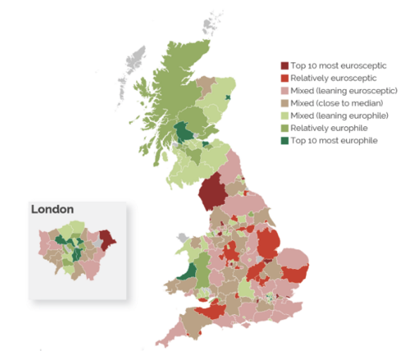
As an Irish American, I grew up with frequent commentary about the Troubles and the general situation in Ireland. So by dint of my heritage, I care about how Brexit impacts Northern Ireland. Unfortunately this graphic from the New York Times on Brexit sentiments entirely omitted Northern Ireland. (It is far from the first time graphics about the UK omit Northern Ireland.)

Where is Northern Ireland?

But, what irritates me in particular about this graphic at this historic time, is what the designers did choose to include. If you look to the north and west of Scotland, you will find the Outer Hebrides and Orkney Islands. From the legend it appears there are no results, accordingly the islands remain—pun intended—grey for, I presume, a classification of not applicable or something similar. (Although, that should also be clarified in the legend.) But, while we are given an inset of Greater London’s results, the entire home nation of Northern Ireland is omitted from the results. (I could then mention how Northern Ireland was not ignored when it came to the Euro 2016 Round of 16 participant results, but I do not understand football enough to comment intelligently.)

And since we mentioned Northern Ireland, we should also mention that Gibraltar is absent from the results map presented here. Gibraltar was once Spanish territory. However, Spain ceded it to the United Kingdom in 1713 as part of the Peace of Utrecht made to end the War of the Spanish Succession. Gibraltar voted overwhelmingly to Remain. And as with Scotland and Northern Ireland, it will (likely) be dragged out of the EU against its people’s wishes.

Credit for the piece goes to the New York Times graphics department.