Tag: data visualisation
-
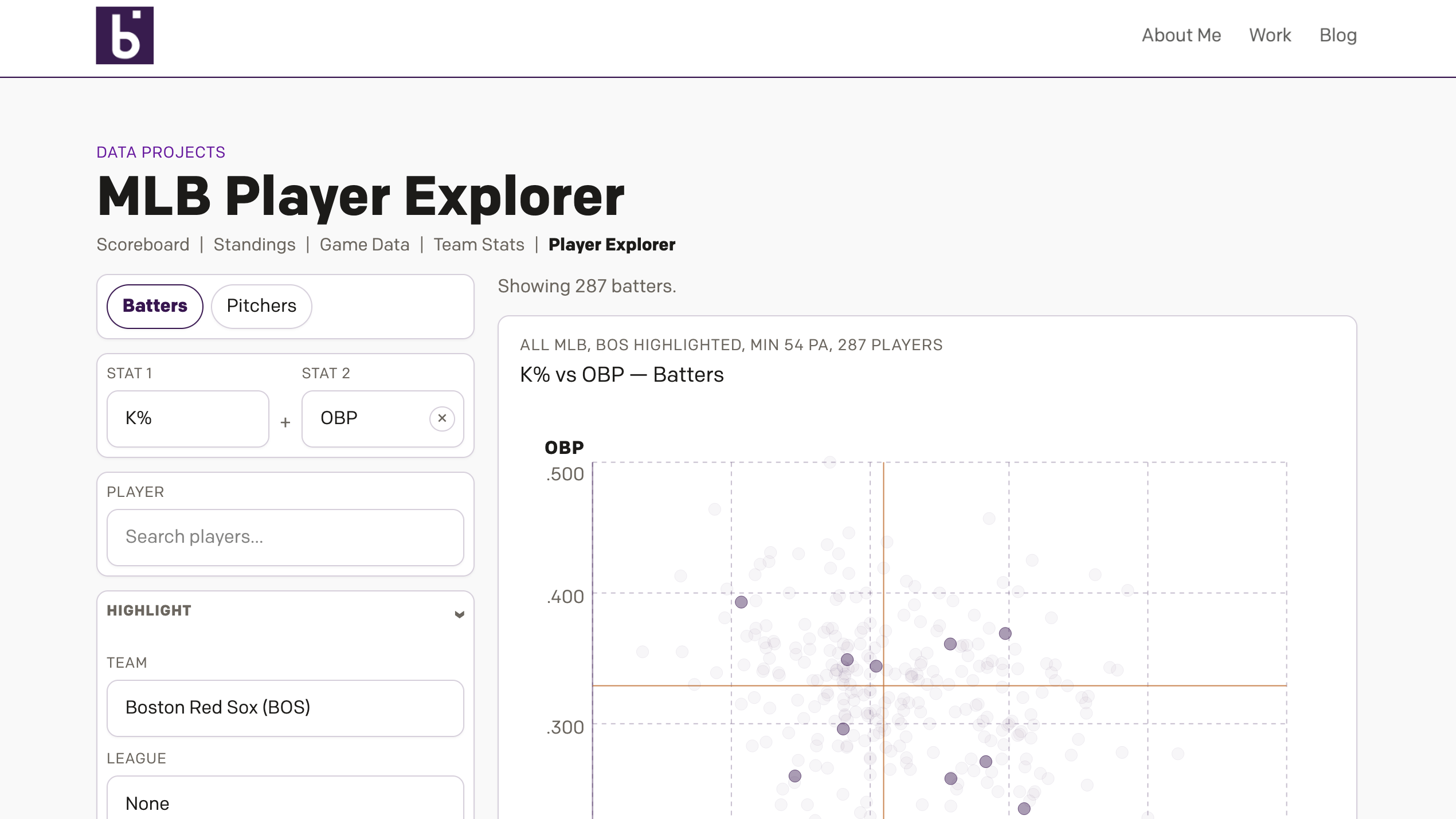
Revenge of the Nerds
This past weekend I thought I would be writing about something else, and perhaps I still will later this week, but for now we turn to the Boston Red Sox firing Alex Cora, their manager; Jason Varitek, beloved Sox icon and in the dugout as game planning and run prevention coach; Ramon Vazquez, bench coach;…
-
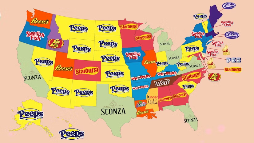
Peeps People in Pennsylvania
As many long-time readers know, my Carpatho–Rusyn origins means my family observes Orthodox Easter, which usually does not coincide with what I call Catholic Easter—because the other part of my background is Irish Catholic, so growing up there were two Easters. Now we just observe the one and so later today I am headed back…
-
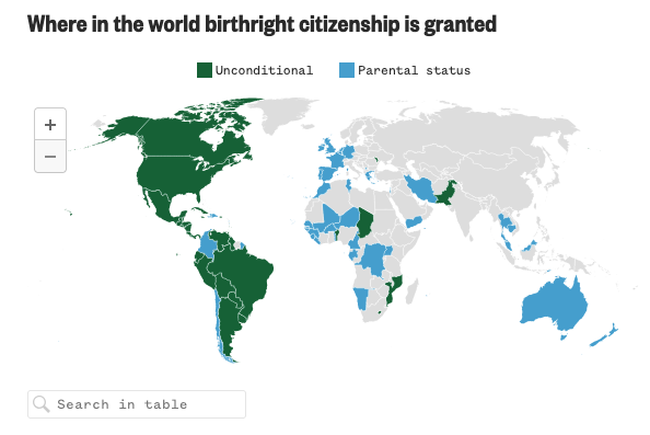
Born in the U.S.A.
Last Wednesday, when I was more focused on the Artemis II launch, the Supreme Court held oral arguments about the administration’s attempt to end birthright citizenship and overturn the 14th Amendment to the United States’ constitution. Kind of a big deal. NBC News ran a live blog covering the arguments and included an interactive map…
-
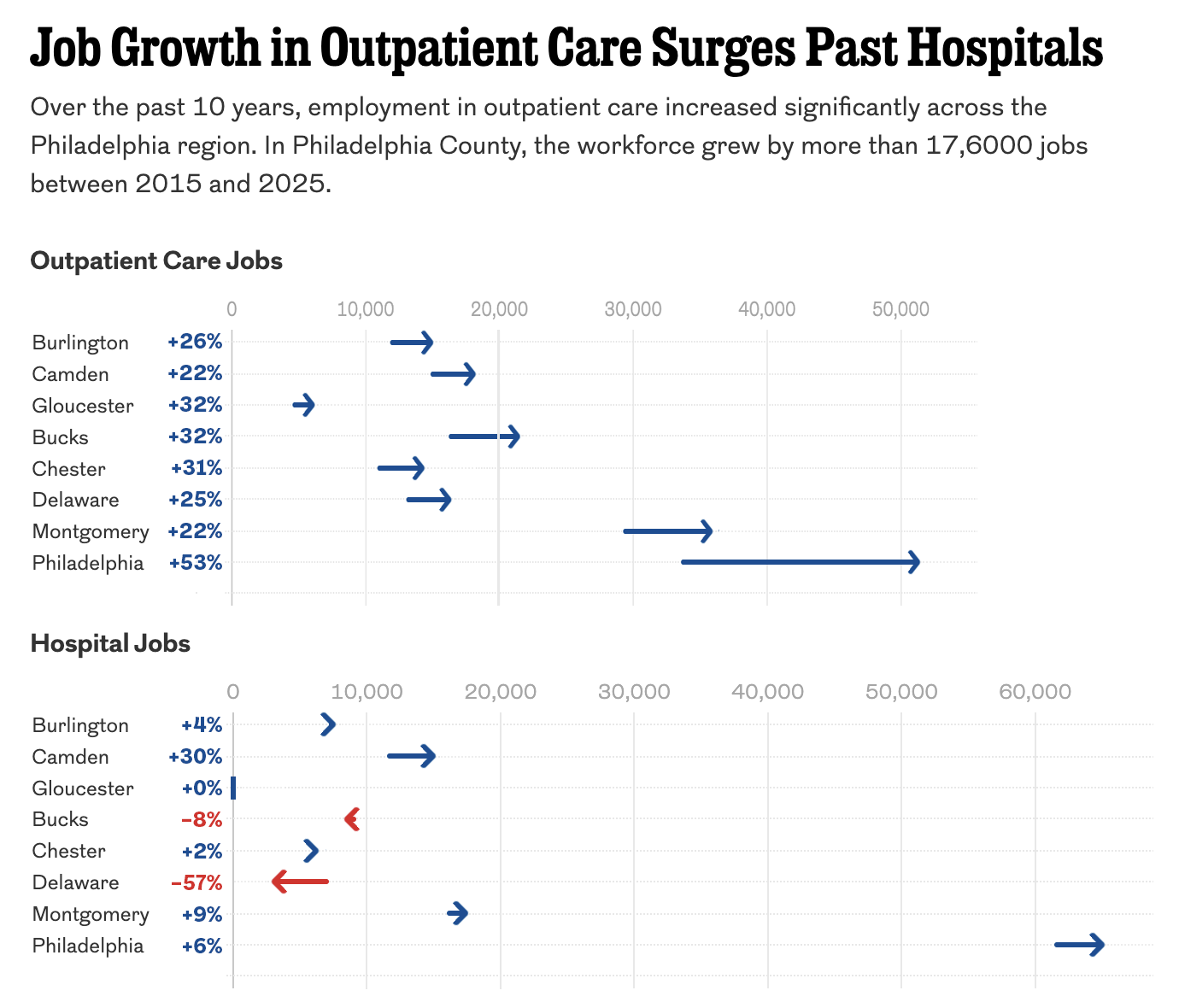
The Arrow Is Pointing Sideways
I was reading an article in my local rag, the Philadelphia Inquirer, when I came upon an article about the healthcare industry’s outsized role in the region’s job growth. The article led off with a staff illustration of medical-looking types on a graphic swirl background—nothing inherently wrong with that. The Inquirer would know best what…
-
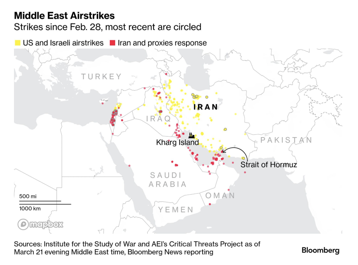
Gooood Morning, Bomb Iran?
As I ate breakfast this morning, I read through the Morning Briefing I receive from Bloomberg. These days, it provides a good update of what happened in Iran and the Middle East. Every once in a while I will flag one of their graphics to share here, but never decide to ultimately do it because…
-
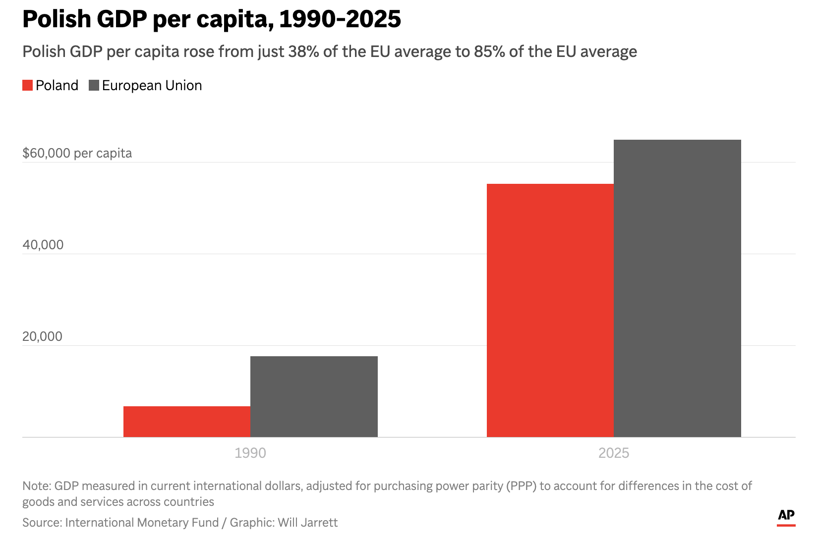
The Axis in Poland
Earlier this week I read an Associated Press (AP) article about Poland’s economic growth since the end of Communism in the former Soviet-bloc state. Generally speaking, things are good in Eastern Europe, though a revanchist Russia to Poland’s east rekindles memories of an earlier era and the disaster after the Molotov–Ribbentrop Pact. The article included…
-
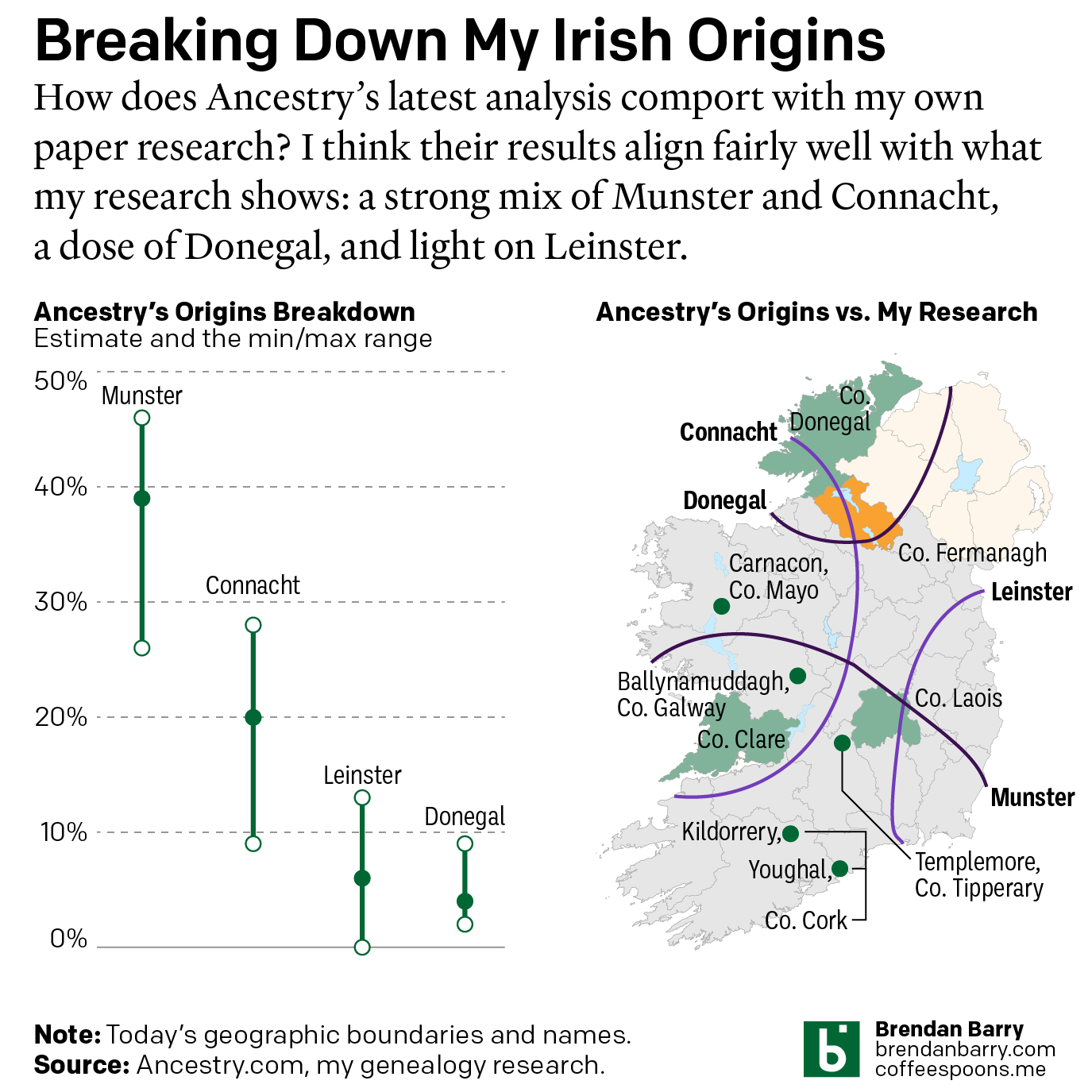
Still Irish
Last October Ancestry.com updated their ethnic origins breakdowns. Longtime readers will know these are not the most useful tools for helping one in their genealogical research. But, if they garner interest in one’s family history and motivate people to explore their own pasts, more power to them. I only encourage those people to dig a…
-

The Women in My Ancestry
International Women’s Day was Sunday and last weekend I attempted to research the occupations and careers of my direct line female ancestors. Including the scope to aunts and cousins broadened things too much in my mind. Unfortunately, there were too few who had recorded careers outside of “keeping house” or similar descriptions in census records.…
-
Mission Accomplished
Last weekend the United States and Israel preemptively struck Iran and kicked off a regional war. As I type this Monday morning, the US–Israeli strike forced assassinated the ayatollah and numerous other senior Iranian officials—but this seems to have been anticipated to a degree and the regime quickly retaliated and has delegated roles and responsibilities.…
-
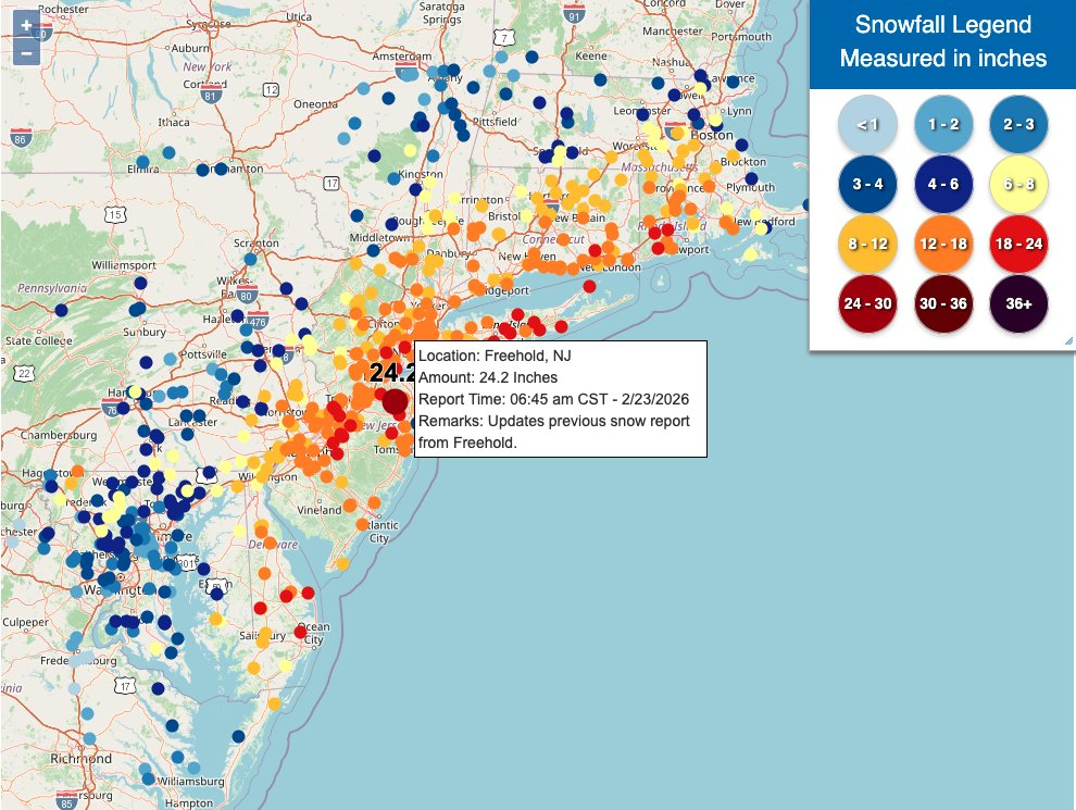
Winter Is Still Here
Ah, a blizzard. Even if the worst of the storm that recently impacted Philadelphia struck mostly at night, it still left a picturesque mess for the morning. I, however, was struck by some of the maps of the snowfall totals and I figured that would be worth sharing today. What got me started on this…