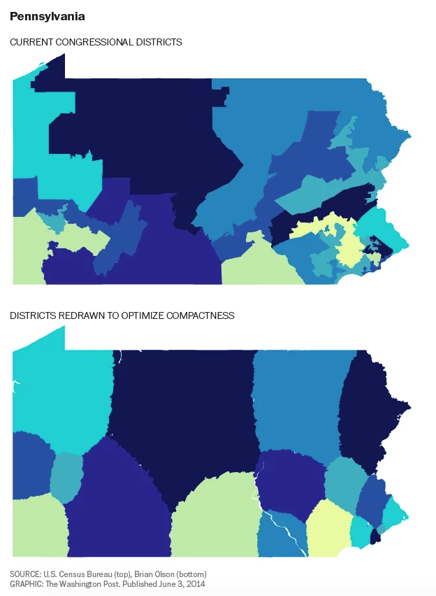
Well last night was the debate and it was a doozy. But while I was looking for some graphics capturing the debate itself, I came upon an article over on the Washington Post about gerrymandering. For those that do not know, gerrymandering is when state-level politicians draw the maps for congressional districts to preserve or diminish support for various representatives. And Pennsylvania is one of those states with a lot of oddly shaped districts.
Credit for the piece goes to the Washington Post graphics department.
Leave a Reply
You must be logged in to post a comment.