On Friday I flagged this article from the New York Times for the first post in the new year here on Coffeespoons. The article discussed a Venezuelan oil tanker fleeing US Coast Guard and US Navy forces attempting to interdict the vessel as she steams into the North Atlantic. Whilst the article led with a photograph of the vessel in question, when you read the article you very quickly arrive at a map of the world.
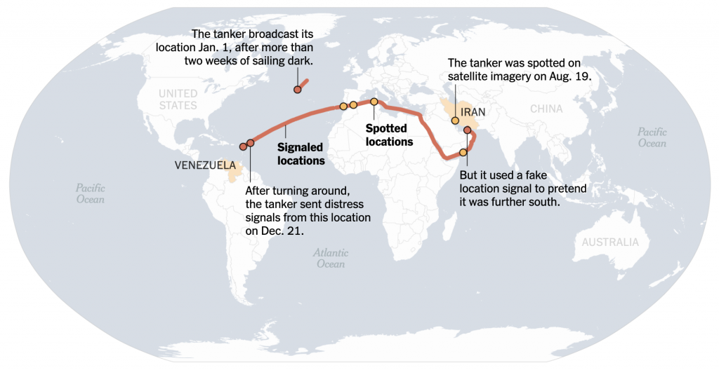
I really enjoyed how the map blended together two different data sources. Ships are tracked by automated signals, similar to aircraft. But, like aircraft—remember Malaysia Airlines Flight 370?—those signals can be turned off and then you are left to search old-fashioned like with binoculars trained to the horizon. (Hyperbole, of course, as mariners now have things like radar and satellite imagery.)
Did anything else happen with Venezuela this past weekend?
Credit for the piece goes to Daniel Wood and Elena Shao.