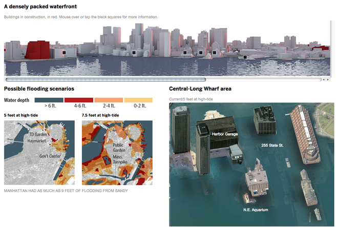
Sometimes maps just do not carry the visual weight of the potential impact of climate change, specifically rising tides. Swathes of blue over city maps from high altitude are intellectual exercises. Who works where? Where do I live? But when you can begin to see familiar buildings and sites swallowed up by a modest rise in the sea level, the hope is that people feel the impact.

My guess is that was the intention of the Boston Globe in this piece, which lets you explore a bit of an underwater Boston waterfront.
Credit for the piece goes to Chiqui Esteban.
Leave a Reply
You must be logged in to post a comment.