Yesterday the Pennsylvania Supreme Court published the new congressional district map of Pennsylvania, the latest chapter in this tale. Republicans in the state legislature have already said they will take this to the federal courts, but they tried that just a few weeks ago and the Supreme Court refused to hear the case.
So the Washington Post put together a map showing precinct-level data aggregated to the new borders and the result is a far more competitive map. Despite there being more Democrats in Pennsylvania, overall the map still remains leaning towards Republican, but there are more light blue and red, again meaning competitive, districts to be fought over.
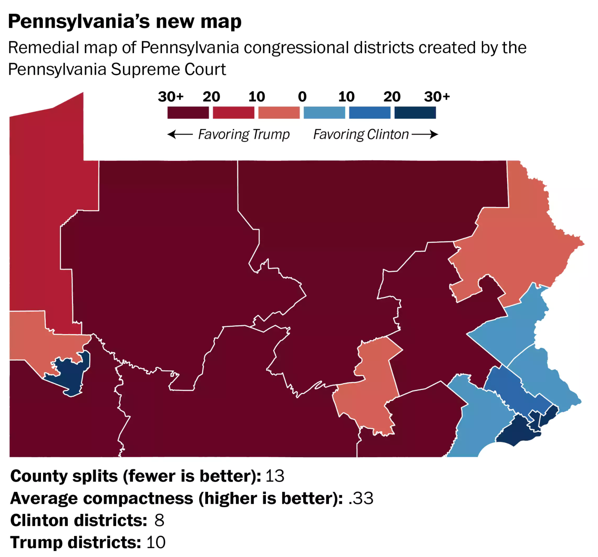
I did hear on the radio this morning, however, that one implication will be in the new Pennsylvania 4th, which is comprised mainly of the Philadelphia suburban county of Montgomery. Right now, that area is so gerrymandered that there is not a candidate right now living with the new borders.
Credit for the piece goes to the Washington Post Wonkblog.
Leave a Reply
You must be logged in to post a comment.