Pittsburgh exists because of the city sits at the confluence of the Allegheny, Monongahela, and Ohio Rivers. As far back as the early 18th century, English and French colonists had recognised the strategic value of the site and as imperial ambitions ramped up, the French finally wrested control of the area from the English and constructed a fort to defend the forks of the Ohio. They named it Fort Du Quesne (now Fort Duquesne) after Governor-General of New France, Marquis Du Quesne.
Fort Duquesne anchored a north-south chain of French forts linking the Ohio River to Lake Erie via the Allegheny River. Since the Allegheny drains into the Ohio and not Lake Erie, the French used a navigable tributary of the Allegheny, the imaginatively named French Creek, to reach just a few miles from the fort on Lake Erie, Fort Presque Isle, from which they portaged overland to Fort Le Bœuf. From there they travelled down the river or overland via the Venango Path to Fort Machault situated at the confluence of French Creek and the Allegheny River.
This chain of forts and the control they established over the Ohio allowed the French to link their colony of New France in present day Québec along the Saint Lawrence River to their colonies along the Mississippi in the Illinois Country via Lake Erie then the Allegheny and Ohio Rivers, which feed into the Mississippi River. The Mississippi of course then empties into the Gulf of Mexico through the then French colony of Louisiana and New Orleans. Strategically this allowed the French to surround and choke the British colonies along the eastern seaboard from territory and resources west of the Appalachian Mountains.
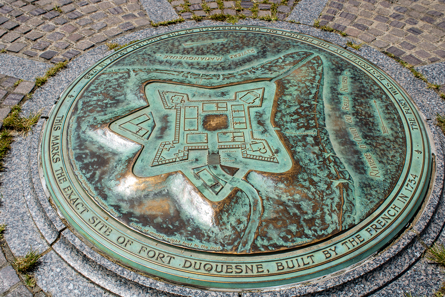
At the site of Fort Duquesne on what is now called Point State Park, a granite stone outline of the original French fort sits in a grass field. And at the centre of the outline is a plaque diagramming the fort’s design.

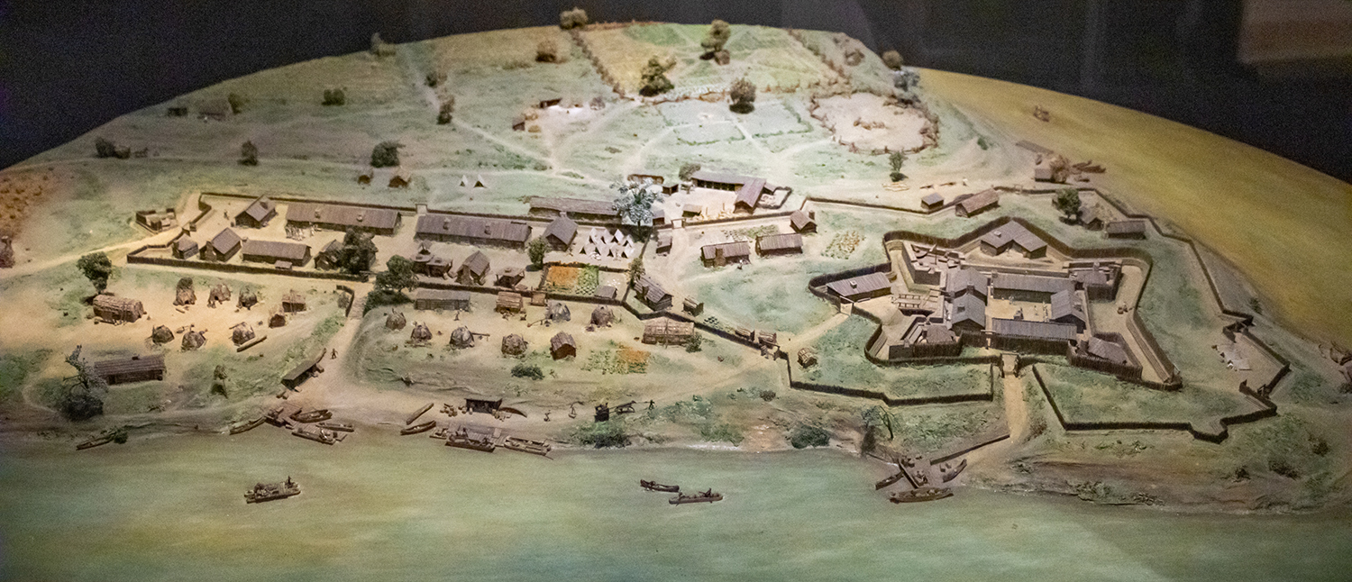
Thankfully for history lovers, the park also contains a history museum dedicated to Fort Pitt, the larger British successor fortification to Fort Duquesne. But inside, the history of Fort Pitt would be incomplete without a discussion of Fort Duquesne and that includes a nice diorama. You will note more details here, however, as the initial fort seen in the above diagram was expanded to include more area for barracks, farms, and ancillary activities like forges.

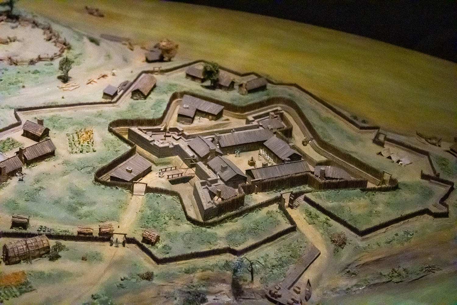
But even still a closer shot of the fort itself shows what the physical buildings would have looked like above and beyond a two-dimensional diagram.

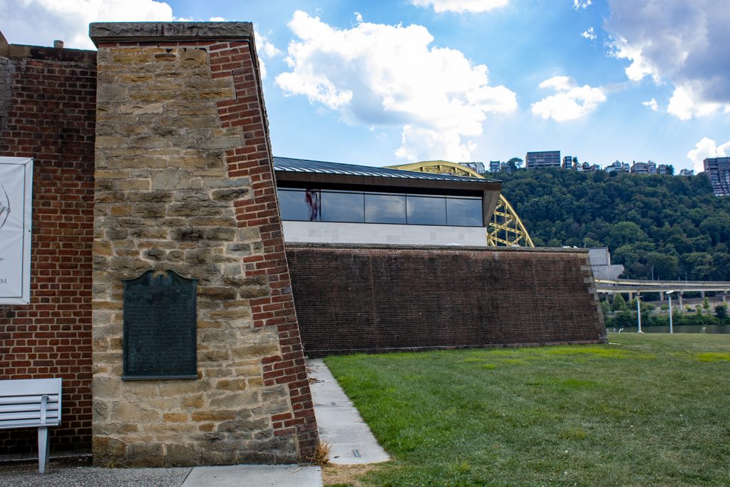
Having been to the site, however, you can see that Fort Duquesne and the later Fort Pitt weren’t necessarily as defensible as one may think. Just to the south across the Monongahela River is a ridgeline that offers clear lines of fire into the forts. Some well positioned artillery would have made holding the forts tenuous at best. Of course hauling artillery and ammunition up to the ridge’s summit is easier said than done. Here’s a photo from the Fort Pitt Museum, whose exterior walls reconstruct one of the later Fort Pitt’s bastion walls. You can see in the background the ridge line of Mount Washington (originally named Coal Hill) stands far above the fort’s defences. Artillery could easily angle down and fire into the forts, be them either Duquesne or Pitt.

Credit for the marker goes to I assume the designers at the Pennsylvania State Park commission.
Credit for the dioramas goes to Holiday Displays, who created the originals in the 1960s.
