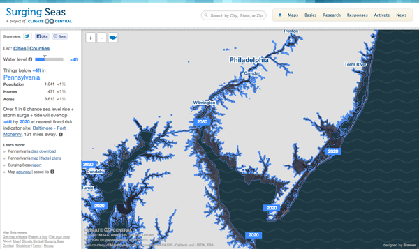
Via the Guardian, Stamen Design has teamed up with Climate Central to create an interactive piece that maps the potential effects of rising sea levels. The user has control over the amount of the rise—this graphic says four feet—after which the coastline recedes to reveal the devastation. This is complemented by statistics of the land, including the population potentially affected along with the number of homes and total acres. In this case you see South Jersey, which is where I spent my summers. As you can see, the coastal beach towns I called home would be underwater. (And the little blue specks inland in Pennsylvania near my hometown, those are quarries; nobody lives there. No need to worry.)

The problem, of course, is that a large percent of the Earth’s population lives near the ocean. There are not, after all, many people living in the interiors of the continents. So receding coasts may very well be a problem in the coming years.
