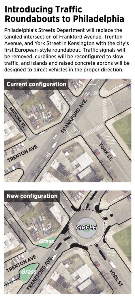
This is a piece I’ve been sitting on for a little while now, okay half a year now. There isn’t too much to it as it’s an illustration overlay on a satellite photo. But the graphic supports an article about the construction of a new roundabout in Philadelphia, coincidentally where I used to live.
That intersection is…tricky to navigate at best as a pedestrian because there are six and a half streets converging at the junction—I give a half to Arizona St because, well, you’ll see shortly. When I lived in the neighbourhood I saw several near accidents between vehicles and pedestrians and vehicles and cyclists. Anything to help improve the safety will be welcome. And that improvement is what the Philadelphia Inquirer covered back in January.

This definitely fits in the category of well done, small graphics. Not everything needs to be large and interactive. This does a great job by using transparency over the satellite image and layering illustration atop the photo.
Now if we could only restore the old rails on Trenton Ave to be some kind of tram/trolley or light rain corridor. Regardless, there are some good restaurants and drinks options in the neighbourhood, so maybe I’ll have to go investigate in person now that going out is an option again. You know, to a do a proper follow-up.
Credit for the piece goes to John Duchneskie.
