I spent the better part of the last two weeks travelling and hanging out in the Berkshires and Connecticut River Valley in western Massachusetts. One of the coolest experiences was driving up the automobile route for Mt Greylock, the tallest point in Massachusetts.
Most of the drive itself was just regularly spectacular as the mid-morning sunlight hit the trees above the road, creating a warm yellow-orange light that bathed the route. But maybe about halfway or two-thirds of the way up, I rounded a bend in the road and came upon a clearing—and convenient pullover. The scene elicited an audible swear and not surprisingly I stopped the car to enjoy the scenery and take some photos.
Whilst there, I also noticed a small sign that, among other things diagrammed the cross section of Mt Greylock and points to the east and west. And I figured that would be a good way to start the week.
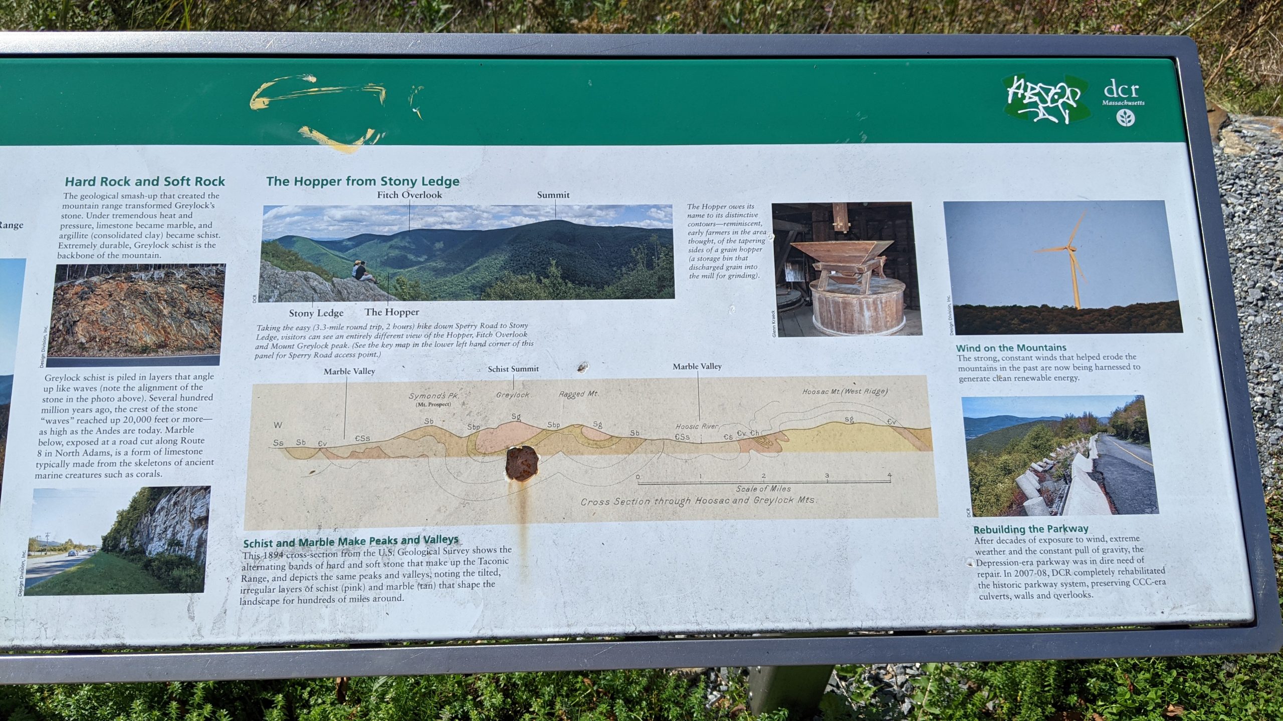
The sign uses an old map to illustrate the different rock layers that define the mountain. Marble, which is a soft rock, erodes during glaciation whereas schist, a hard rock, does not. And during the recent ice ages, when glaciers covered the area, most of the marble areas of the mountain range were eroded away, leaving just the sharp stony peaks of schist.
Credit for the piece goes to the US Geological Survey designers, ca. 1894.
Leave a Reply
You must be logged in to post a comment.