I woke up this morning and the breaking news was that the local basketball team, the 76ers, proposed a new downtown arena just four blocks from my office. The article included a graphic showing the precise location of the site.
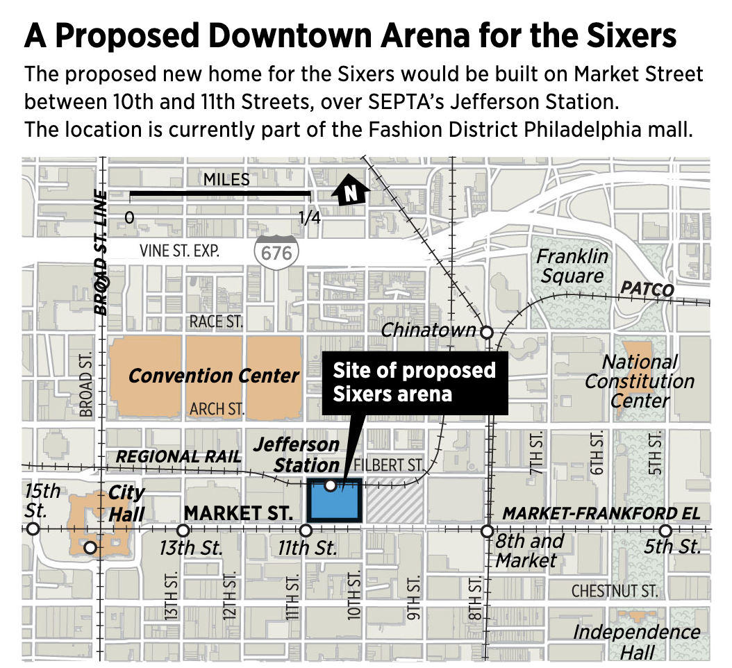
For our purposes this is just a little locator map in a larger article. But I wanted to draw attention to two things in an otherwise nice map. First, if you look carefully on the left you can see the label for the Broad Street Line placed over the actual railway line, which is what makes it so difficult to read. I probably would have shifted the label to the left to increase its legibility.
Second, and this is a common for maps of Philadelphia, is the actual north-south route of said Broad Street Line, one of the three subway lines running in the city. (You all know of the Broad Street and Market–Frankford Elevated, but don’t forget the PATCO.) If you look closely enough it appears to run directly underneath Broad Street in a straight line. But where it passes beneath City Hall you will see the little white dot locating the station is placed to the left of the railway line.
Why is that?
Well when it was built, Philadelphia’s City Hall was the tallest habitable building in the world. Whilst clearly supplanted in that record, the building remains the largest free-standing masonry building in the world. But that means it has deep and enormous foundations. Foundations that could not be disturbed when the city was running a subway line directly beneath Broad Street.
Consequently, the Broad Street Line is not actually straight—ride it heading south into City Hall Station and you’ll notice the sharp turn both in its bend and the loud screeching of metal. The line bends around parts of the building’s foundations, sharply on the north side and more gently on the south side. So the actual station is still beneath City Hall, but offset to the west.
But most of the time it’s easier just to depict the route as a straight line running directly beneath City Hall.
Credit for the piece goes to John Duchneskie.