For my readers in the northern hemisphere, which is the vast majority of you, we are in the middle of meteorological summer, the dog days. And whilst my UK and Europe readers continue to bake under temperatures greater than 40ºC (104ºF), the northeast United States and Philadelphia in particular is looking at a heatwave starting today that’s forecast to peak at a temperature of 38ºC (100ºF) this weekend and a heat index reaching 41ºC (106ºF) tomorrow.
Not cool.
Yesterday we examined a completely different topic, property tax increases in Philadelphia, but we contrasted that work with a heat index map from the New York Times. With the heatwave beginning this afternoon, however, it seemed apropos to revisit that contrasting article.
It begins with the map that we looked at yesterday. Of course yesterday was Tuesday. Today is Wednesday, and so you can already compare these two maps to see how and where the heat has shifted. Spoiler: the Southeast and Midwest.
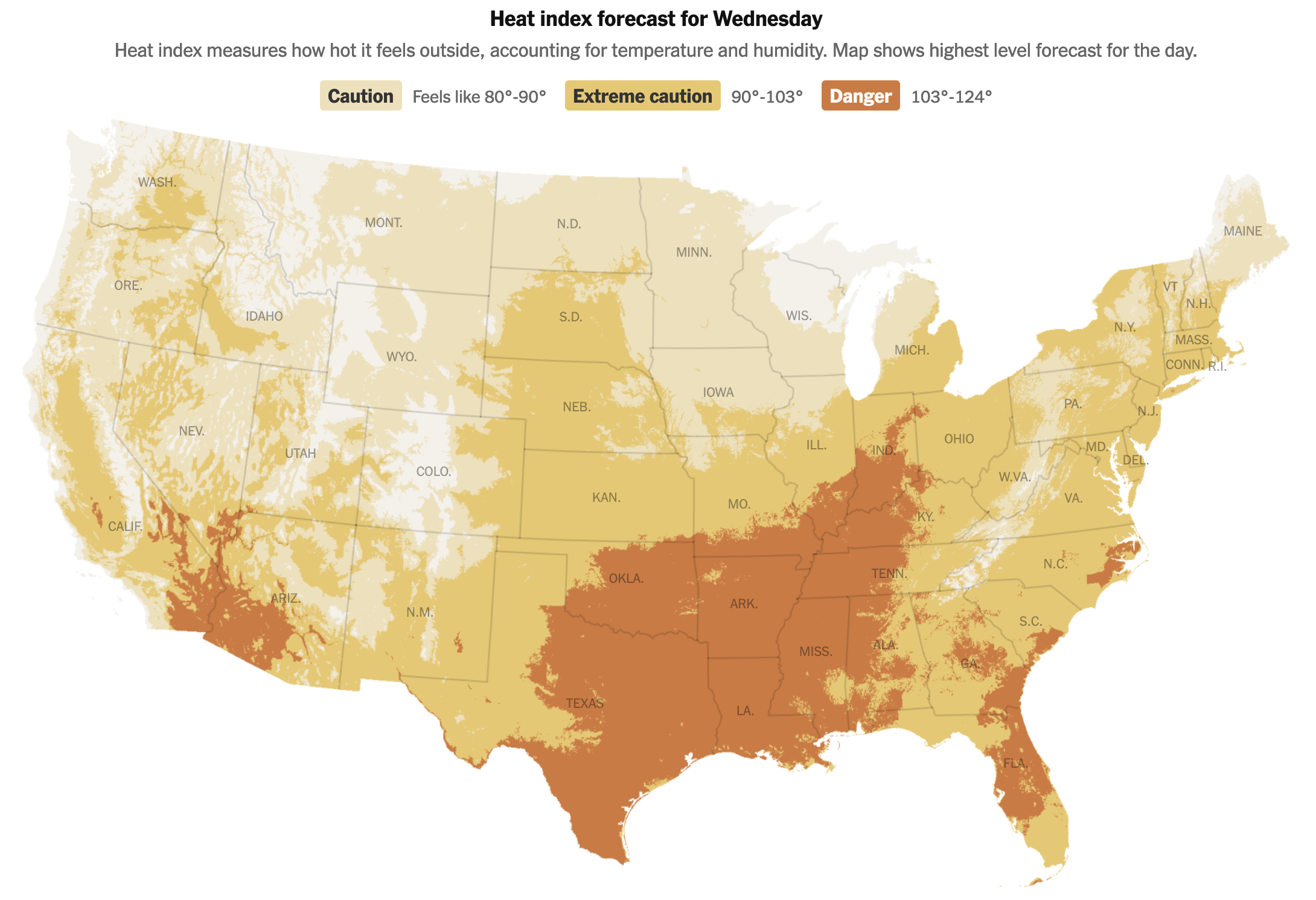
It does so with a nice simple three-colour unidirectional spectrum from a light yellow to a burnt orange. And you can see the orange spreading up from the Gulf Coast and along the southeastern Atlantic Seaboard.
For those not familiar, the heat index is basically what the air “feels like” taking into consideration the actual temperature and the relative humidity in the air. Humans cool themselves via perspiration and when the air is excessively humid our ability to perspire decreases and thus the body begins to run hotter. Warmer temperatures allow the atmosphere to increase the amount of moisture it can contain and you can see all that Gulf and subtropical moisture carrying itself into the hot air moving up from the south.
Very not cool.
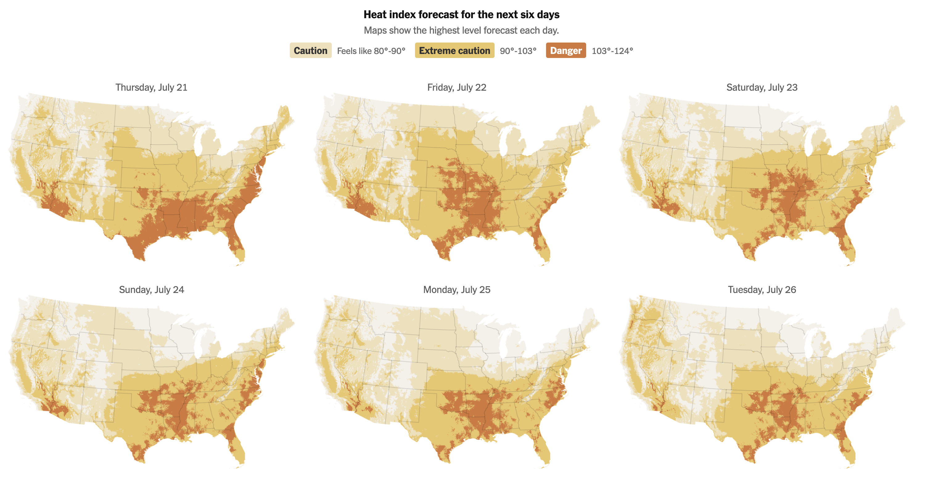
The piece also offers a look at the forecast for the heat index, showing the next six days. These small multiples allow the reader to see the geographic progression of the heat. Whereas today will be particularly for parts of the Midwest in southern Illinois and Indiana, tomorrow will see the worst for the Eastern Seaboard. Luckily the heat index retreats a bit, though as I noted above, the temperatures will continue to rise until Sunday, meaning higher temperatures, but lower relative humidity. For Philadelphia in particular we talking about 50% relative humidity tomorrow and only 35% on Sunday. That makes a big difference.
Overall this is a great piece despite the content.
Personally, I just can’t wait until summer.
Credit for the piece goes to Matthew Bloch, Lazaro Gamio, Zach Levitt, Eleanor Lutz, and John-Michael Murphy.