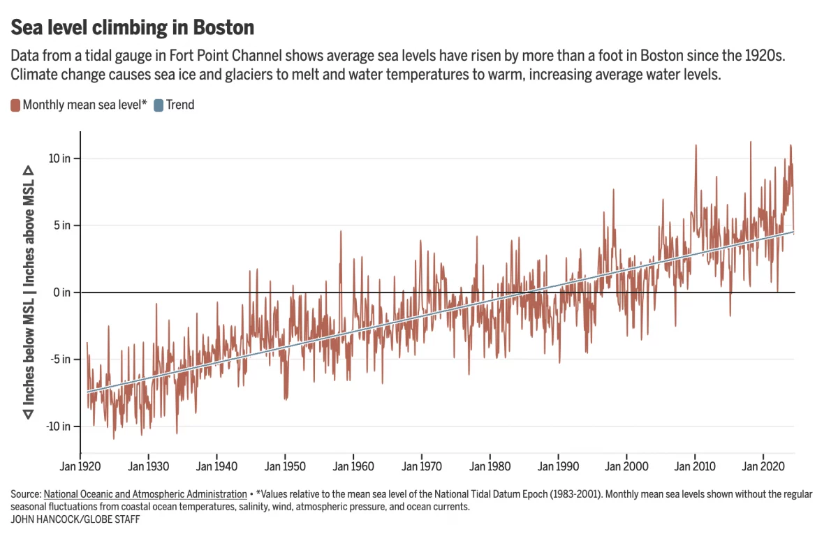
There Goes the Shore

The National Oceanic and Atmospheric Administration (NOAA) released its 2022 report, Sea Level Rise Technical Report, that details projected changes to sea level over the next 30 years. Spoiler alert: it’s not good news for the coasts. In essence the sea level rise we’ve seen over the past 100 years, about a foot on average, we will witness in just thirty years to 2050.

Now I’ve spent a good chunk of my life “down the shore” as we say in the Philadelphia dialect and those shore towns will all have a special place in my life. But that looks more to be like a cherished memory fading into time. I took a screenshot of the Philadelphia region and South Jersey in particular.

Not just the Shore, but also the Beaches

To be fair, that big blob of blue is Delaware Bay. That’s already the inlet to the Atlantic. But the parts that ought to disturb people are just how much blue snakes into New Jersey and Delaware, how much/little space there is between those very small ribbons of land land off the Jersey coast.

You can also see little blue dots. When the user clicks on those, the application presents the user with a small interactive popup that models sea level rise on a representative photograph. In this case, the dot nearest to my heart is that of the Avalon Dunes, with which I’m very familiar. As the sea level rises, more and more of the street behind protected by the dunes disappears.

My only real issue with the application is how long it takes to load and refresh the images every single time you adjust the zoom or change your focus. I had a number of additional screenshots I wanted to take, but frankly the application was taking too long to load the data. That could be down to a million things, true, but it frustrated me nonetheless.

Regardless of my frustration, I do highly recommend you check out the application, especially if you have any connection to the coast.

Credit for the piece goes to NOAA.