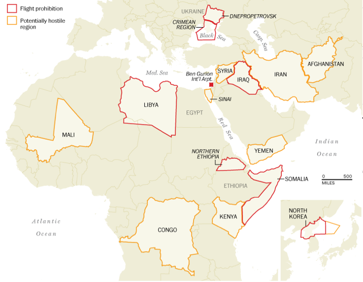
One of the questions in the wake of last week’s shoot down of Malaysia Airlines Flight 17 is why was the aircraft even flying over eastern Ukraine? Generally speaking, because it was not banned from doing so. In today’s graphic, the Washington Post takes a look at those areas that the United States’ Federal Aviation Administration (FAA) restricts flights or warns against travel due to hostile threats, e.g. war. Also note that the Post has included Ben Gurion Airport, which is still under the 24-hour period ban because of a Hamas rocket landing a mile away from the airport in Tel Aviv, Israel.
FAA restriction areas
Credit for the piece goes to Katie Park, Kevin Schaul, and Gene Thorp.
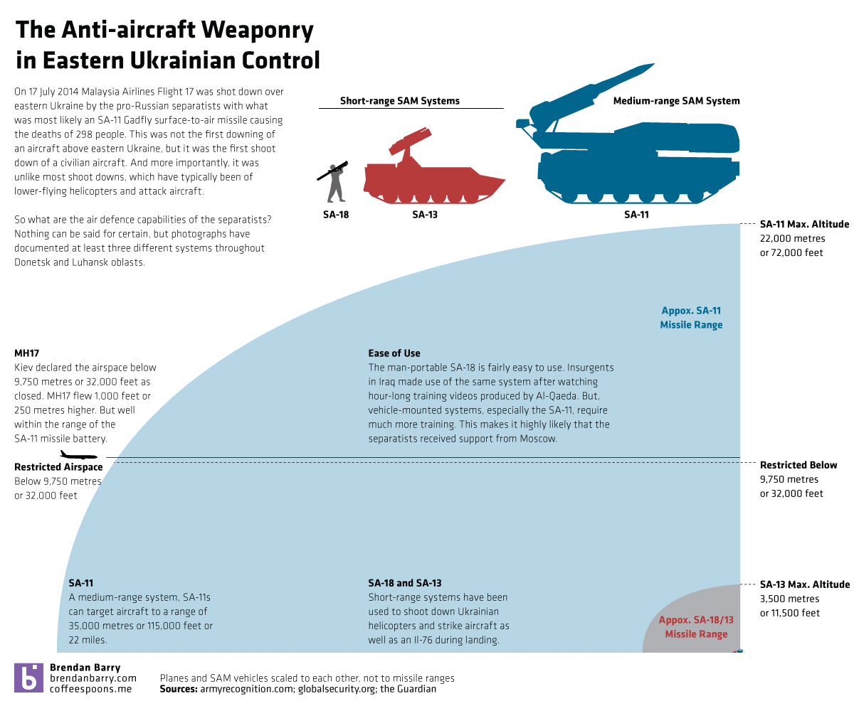
Last week, separatists in eastern Ukraine shot down Malaysia Airlines Flight 17 with what appears to have been an SA-11 Gadfly missile. Separatists had previously claimed to have had this system in operation and days earlier shot down a high-altitude Ukrainian military aircraft—though not necessarily with the SA-11. How much more powerful is the SA-11 than the other two known surface-to-air missile systems the separatists have used to shoot down Ukrainian military helicopter and aircraft? Well, I decided to create a small graphic to show you that the SA-11 is a significant advancement over the shorter range systems in use up to now.
Talk about an airline with bad luck this year. Malaysia Airlines—yes of the missing flight in the Indian Ocean fame—lost another aircraft yesterday as separatists in eastern Ukraine allegedly shot it down with an SA-11 Gadfly surface-to-air missile. For those unaware, that is a much more deadly and capable system than the shoulder-launched missiles separatists have been using to shoot down Ukrainian aircraft. (In my non-expert opinion, the separatists probably thought they were doing just that, shooting down a Ukrainian transport plane.)
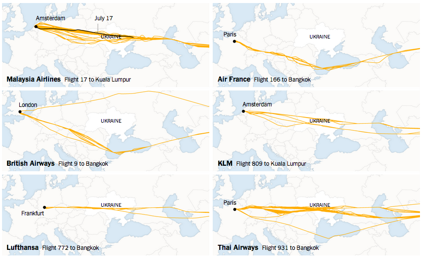
In short, there is quite a bit going on in eastern Ukraine today. Thankfully we have the New York Times creating a page of maps to explain the shoot-down of MH17.
Not all airlines have flown over Ukraine
Credit for the piece goes to the graphics department of the New York Times.
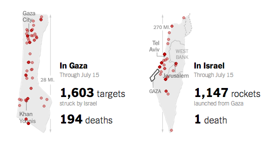
Today’s piece, the first not on Québec, is a small but poignant reminder of the disparity between the number of deaths in Gaza and in Israel during this most recent conflict. According to the article, as of 16 July there has been one death in Israel for 194 in Gaza. This small piece from the New York Times shows the geographic location of the attacks from both sides and tallies the number of strikes. And the number of dead.
Comparing the death toll
Credit for the piece goes to Craig Allen, David Furst, Nilkanth Patel, Archie Tse, and Derek Watkins.
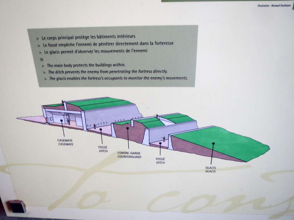
In what I think is the last set of diagrams and illustrations describing the fortifications of Ville de Québec, we have the reason why the overall design and construction were so difficult as well as why there are so many star-like bastions pointing out of the walls.
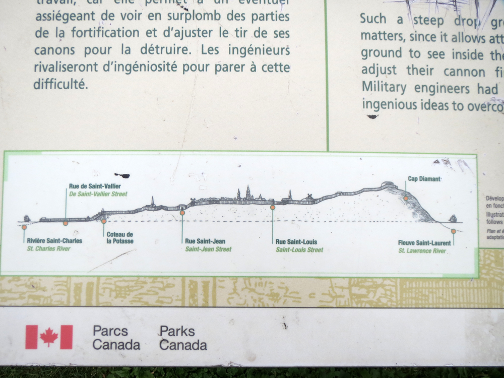
The difficulty comes from the topography. Québec was, as I mentioned earlier, described by Charles Dickens as the Gibraltar of North America. It features a high, defensible cliff and then a city on the lowlands below it. But building a wall that defends it from the cliffs to the river is not easy. Especially because the angles and slopes of the walls have to account for the fact that enemy cannon near Cap Diamant could otherwise see very well into the city below. And therefore target the city. But how drastic was the descent?
A 73 metre or 240 foot drop from Cap Diamant to the Saint Charles River
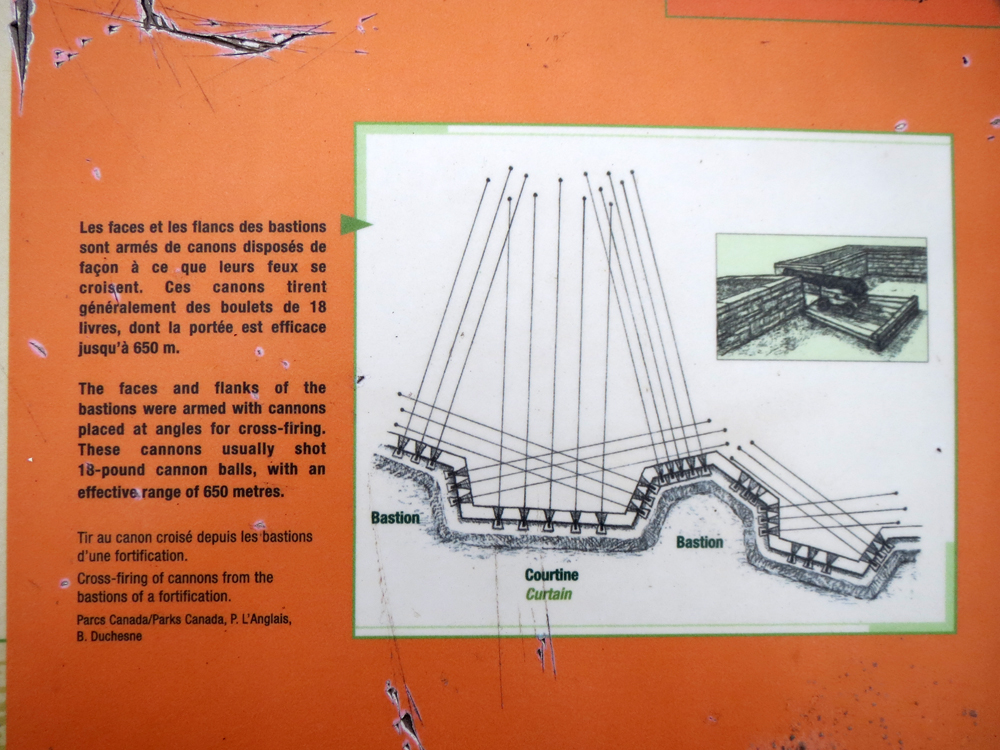
And then to point the second, why so many stars? Well, the problem with straight walls is that if you manage to get beneath the firing range of the cannon along the wall, the defenders really cannot fire at you. And that gives you all the time to plant explosives and blow a massive hole in the fortifications. So the stars actually give the defenders nearly a complete field of fire along the entirety of the city walls.
Defending the city walls with cannon
Credit for the pieces go to the graphics department of Parks Canada.
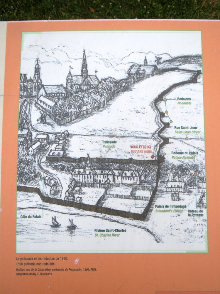
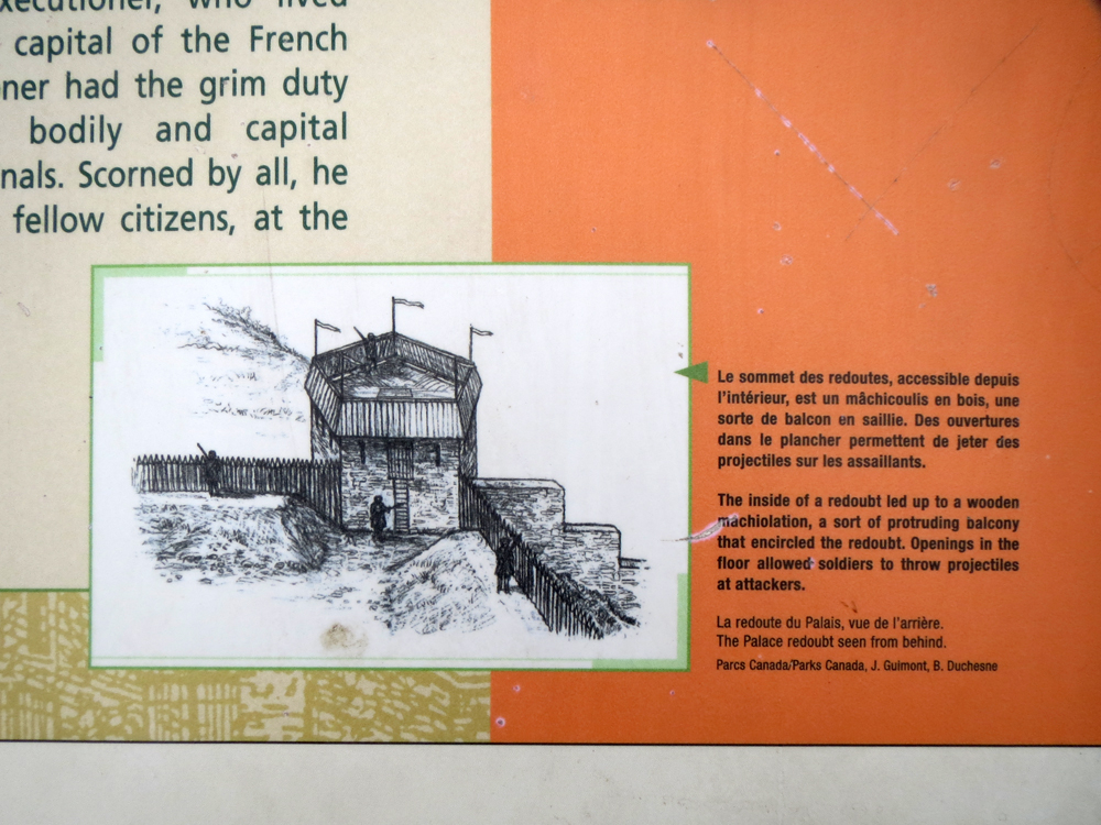
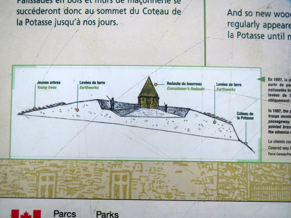
Today I have a little bit more about the fortifications near Artillery Park. The original fortifications were not massive stone works, because those take time. Instead, a lot of the original defences of the town were wooden palisades and earthworks. The following illustration shows the wooden defences of 1690.
Wooden defences of Québec
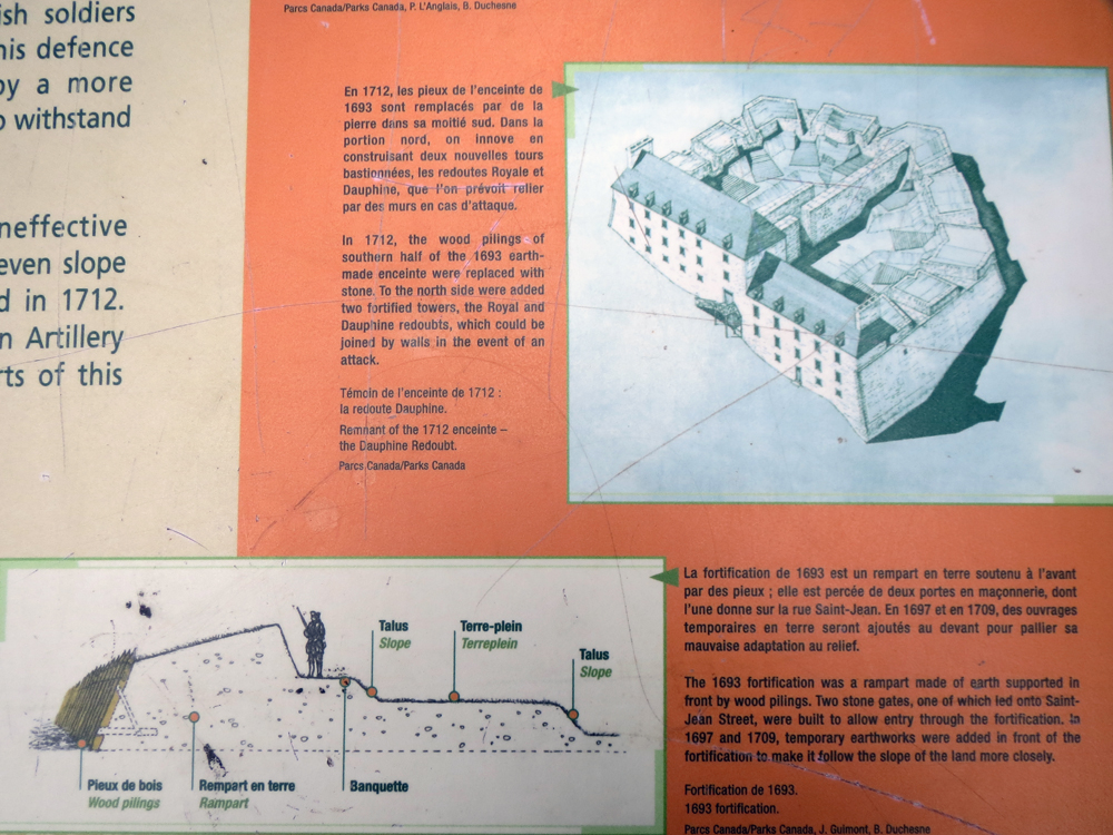
The woodworks were more than just timber inserted into the ground. It involved some earthworks to support the wooden posts, but also to give the defenders a better view of the approaches. And a better firing position.
Rampart design
The palisades were divided into sections by redoubts. These were the strongpoints along the town walls.
Redoubts of 1690
But due to the ever-present fear of an amphibious invasion, the palisades were eventually replaced with an earthwork fortification. Trees were planted along the walls and they served as spikes to deter forces from scaling the walls.
Replacing the palisade
Credit for the piece goes to the Parks Canada graphics department.
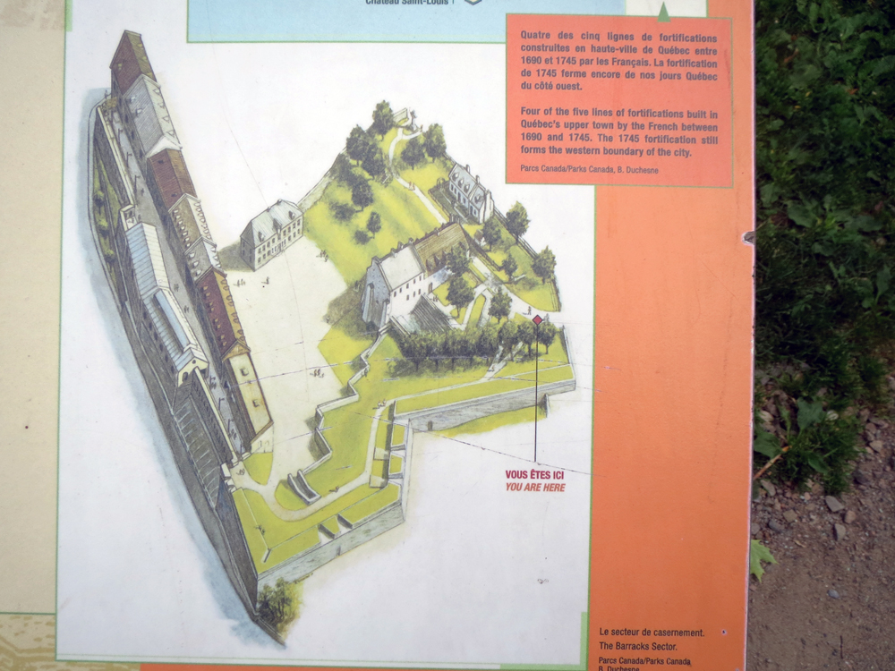
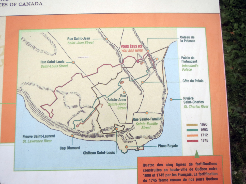
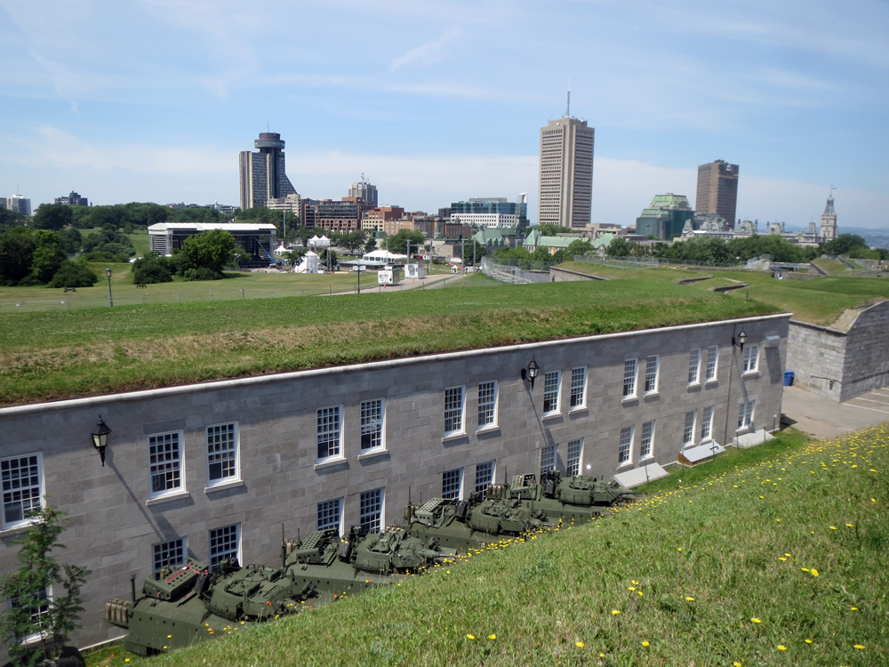
Beyond la Citadelle, Québec also enjoys a defensive wall that nearly surrounds Vieux-Québec, or Old Québec. These graphics come from the Barracks Sector, which used to house the Royal Artillery during the British period.
The Barracks Sector
The walls in this section of the city date to 1745, but the redoubt in this area goes back to 1712, you can see that as the orange rectangle.
City walls over time
Credit for the pieces go to the graphics department of Parks Canada.
La Citadelle de Québec consists of several layers of fortifications that are not discernible to an eye outside the fortification. This has to do with the well-planned angle of the tops of the fortifications. Thankfully, designers said about explaining this through some graphics. While I do not have a great shot from outside the fortress of the angle, you can see some of the even slope in this photo from the top of the wall looking out towards Ville de Québec outside the city walls.
La Citadelle today, looking towards modern Québec
The fortification is composed of several different layers. This graphic colour codes them. For reference to the photo above, I am not standing “vous étes ici.” Rather, I am at the tip of bastion in the upper left of the diagram, just behind the pink—not red—line.
Colour-coded map of the fortification
This graphic shows how la Citadelle would have been defended back in the 19th century. Note the lack of armoured vehicles as seen in the above photograph.
Cutaway of the fortification walls
Credit for the piece goes to the design team behind the graphics.
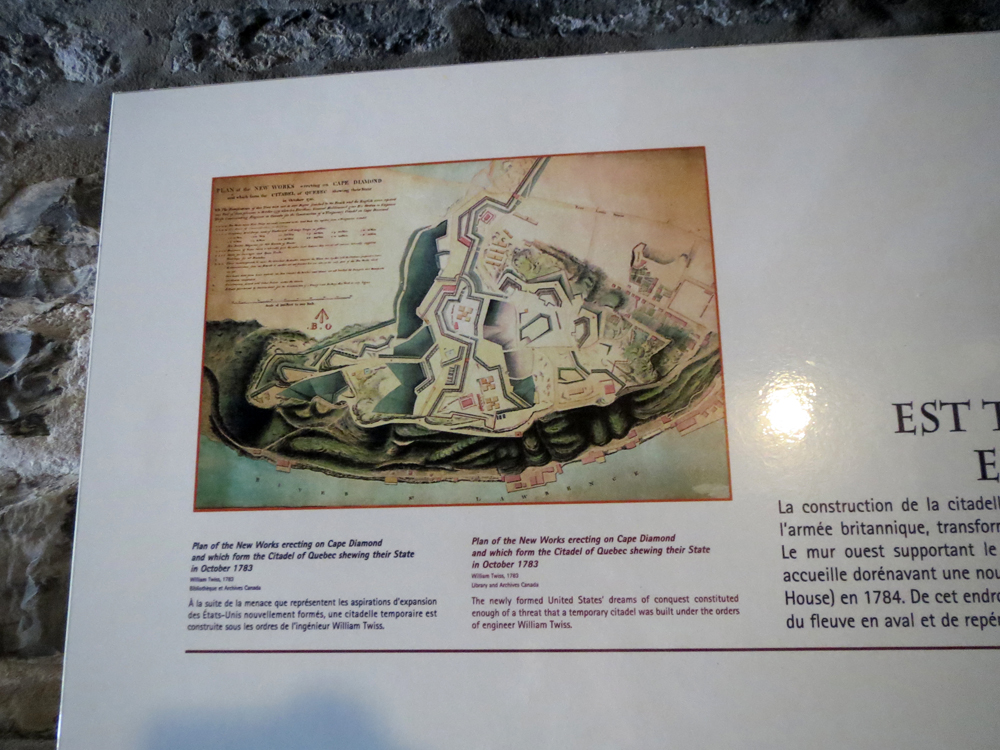
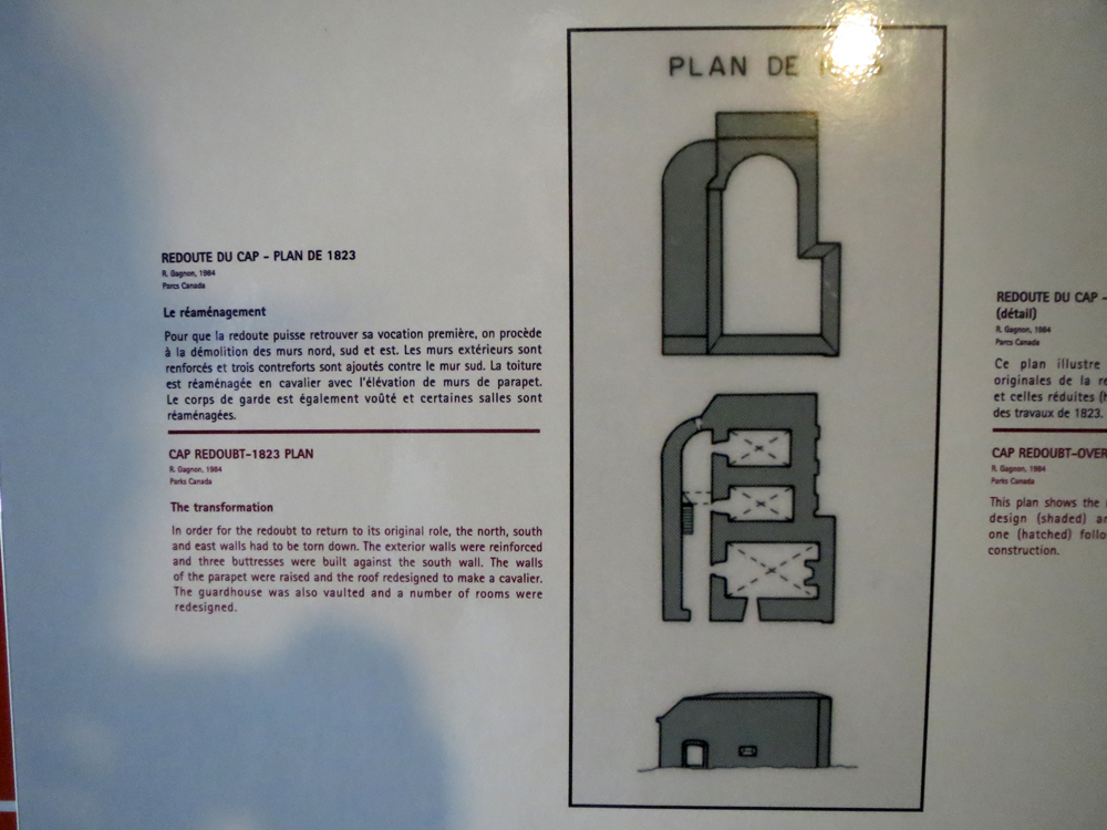
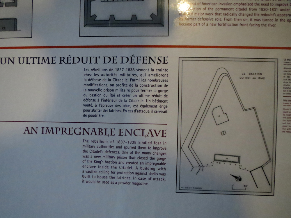
Part of my trip to la Citadelle de Québec involved a visit to the Bastion du Roi, which features one of the oldest parts of the fortress: Cap aux Diamant Redoubt. A redoubt is a hardened fortification completely enclosed and separate from larger fortifications. Often it serves as a place of last retreat. In Québec, the redoubt is one of the surviving original French-era fortifications, albeit heavily modified by the British in the 19th century. These graphics illustrate some of those changes.
By 1783, the original French fortification existed outside the growing defensive works of the British. In this map, you can see the notably square shape of the redoubt as the pink square on the right side of the map near the cliff.
La Citadelle, about 1793
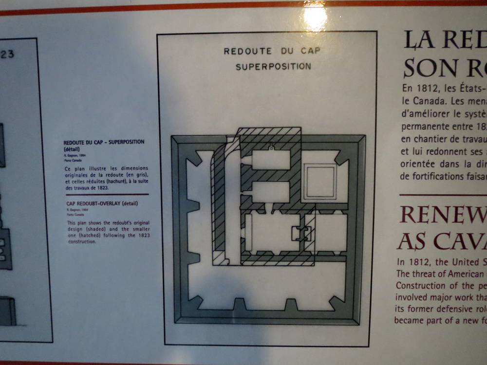
In 1823, the British decided to modify the square-shaped redoubt and undertook extensive modifications. The graphic below shows the original redoubt, the square, with the new plan, the hatched work.
Changes to the original redoubt
The new plan simplified the structure.
Redoubt as of 1823
But eventually, the redoubt was entirely enclosed by the growing fortifications. This shows its location in Bastion du Roi along with the construction of a block house to further fortify the bastion.
Redoubt in Bastion du Roi
Credit for the piece goes to the designers of the various graphics.
When I was in Québec I had the good fortune to take photographs of multiple signs and graphics aiming to educate readers about various things. I have spent a bit of my weekend combing through my photographs to see what I can present.
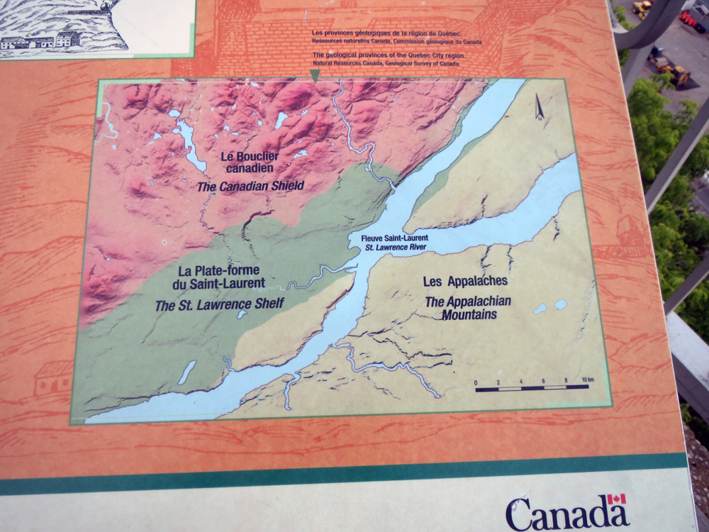
The first in today’s post is simply why Québec was so important. It sat at the narrowest part of the St. Lawrence River upstream from the Atlantic and, most importantly, was defendable from a high, rocky terrain that fell into the river via a sheer cliff face. But why was all of that? Geology explains all (in this graphic). Cap Diamant, where la Citadelle de Québec resides, sits atop an outcropping of the Appalachian Mountains while a sedimentary valley separates it from the Laurentian Mountains. The St. Lawrence just happens to cut through it and voila, natural defensible territory. Or as Charles Dickens put it, the Gibraltar of North America.
The geology of Québec
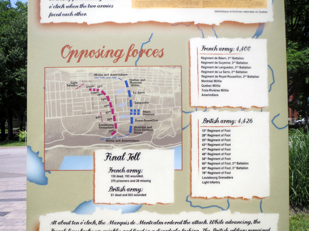
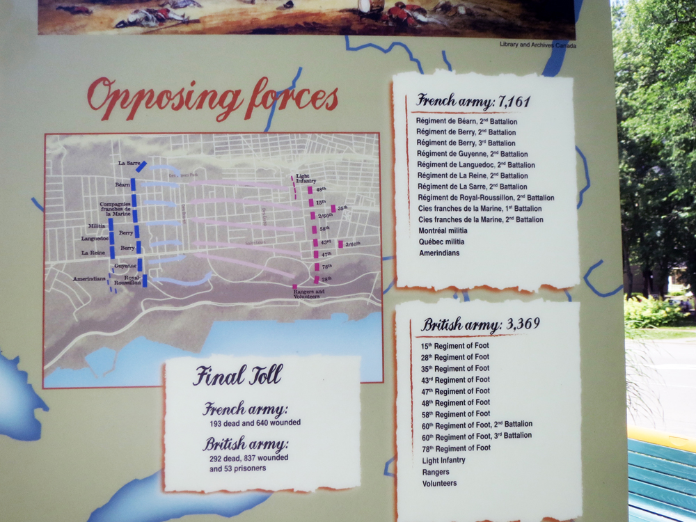
The second is a quick series of graphics that basically explain why, despite the heavy French influence, Québec is a province of the majority English-speaking country of Canada, a former British colony. In short, the Battle of the Plains of Abraham (and to a lesser extent the Battle of Sainte-Foy.
In 15 minutes on the Plains of Abraham, a British infantry force under General Wolfe defeated a French infantry force under General Montcalm. Both generals died in the battle and just a few days later, the city of Québec surrendered to the British. This gave control of the entrance to the Saint Lawrence to the British. And with the British then entrenched behind the city walls, they were capable of withstanding any French siege.
The Battle of the Plains of Abraham
The second graphic explores the Battle of Sainte-Foy, which was a French victory over General Murray. The British then retreated to the defences of Québec, but the French forces failed to capitalise on their victory—and were in general too under-resourced. So the city remained in British hands while the Royal Navy destroyed the French Navy off the coast of France. And without supplies sent via the French Navy, the French were forced to surrender not just Québec, but Montreal and the whole of Canada to the United Kingdom. Fearing rebellion, London allowed Canada to retain its religion, language, and culture. Hence, a Francophone population in an otherwise English-speaking North America.
The Battle of Sainte-Foy
Credit for the pieces goes to unknown persons who designed the signage for various parks in Québec.