Mt Greylock Covered in Ice

Yesterday I referenced a photo of a sign along the drive to the summit of Massachusetts’ Mt Greylock. When I finally arrived at the summit, well, there were quite a few people as the day was very pleasant. But walking about the summit I also found a few more signs. One that impressed me was the following.

Yesterday I had mentioned how glaciers carved the geography we see today. But just how big were these glaciers? Massive. This graphic shows how high the glaciers would have been over the summit, already nearly 4,000 feet above sea level.
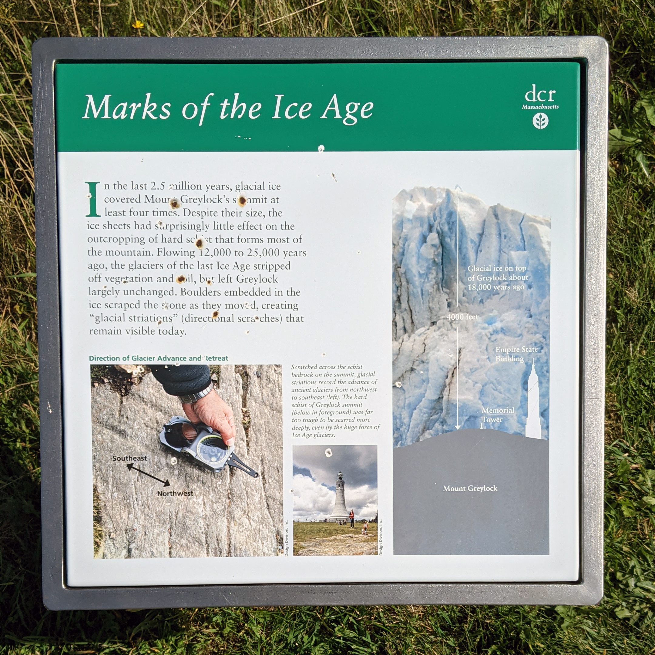
That’s a lot of ice.

Naturally the silhouettes of both the Memorial Tower and Empire State Building help given additional context of just how large these glaciers were. This sign isn’t far from the tower, which just reinforces the mental image the sign creates.

But the glaciers retreated thousands of years ago, and since then nature has reclaimed the summit. One of the things that impressed upon me was how the whole summit smelled. I grew up in a house where we frequently burned balsam fir incense and candles scented the same. Opening the car door I immediately was hit by that very same smell.

It turns out that the elevation is sufficiently high that the summit of Mt Greylock supports a sub-alpine environment, including a boreal forest, which you’d typically find near the Arctic Circle. And those kinds of forest are full of those kinds of evergreens and balsam firs. This sign detailed just that.
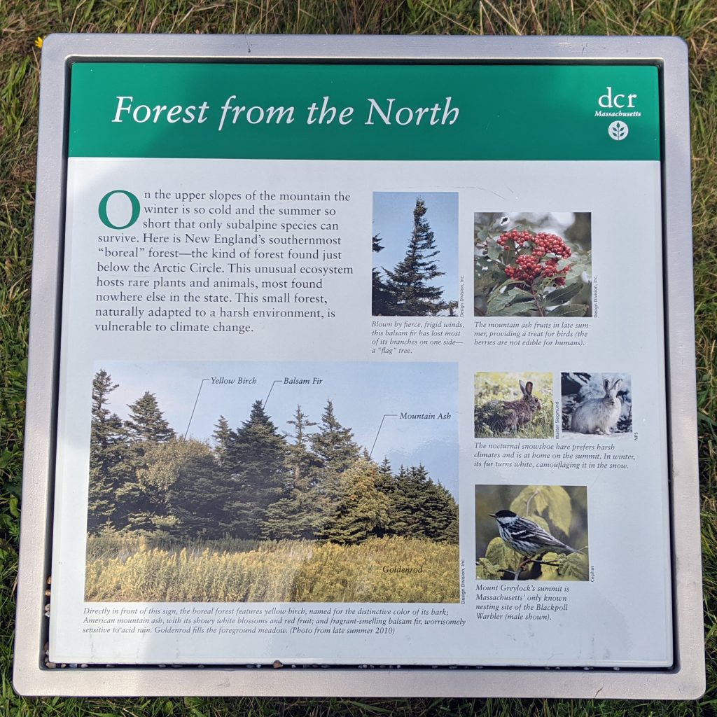
Need smell-o-vision for this…

Credit for the piece goes to the Massachusetts Department of Conservation and Recreation (DCR) designers.

Finding Yourself on the Pennsylvania Turnpike

I hope you all enjoyed your Easter holidays. Easter, wasn’t that two weekends ago you ask. Catholic/Protestant Easter, yes. This past weekend was Orthodox Easter. And since that is what my family celebrates, I was away on holiday this past weekend and only got back in town last night. But on the way out to the ancestral stomping grounds in western Pennsylvania, I realised that the Pennsylvania Turnpike Commission put a little bit of thought into the signage at their more modern service plazas.

The façade of the service plaza

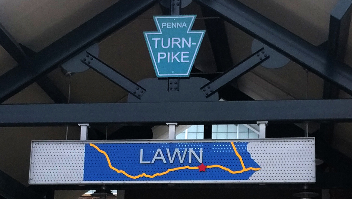
The outside is basically what you expect, the symbol of the Pennsylvania Turnpike and the name of the plaza. But if you look closer, the name of the plaza, in this case the Lawn plaza outside of Lawn, Pennsylvania, is set not just on a blue sign, but a cropping of a blue map of the commonwealth.

This is where I was, where were you?

The yellow lines represent the Pennsylvania Turnpike and, with right being east, the Northeast Extension. The red star represents your current location along the turnpike system. Is this going to tell you how many miles until your next exit? No. I had to go inside and find out how many miles to Bedford, PA on a larger display map. But, this provides a wonderful low-fidelity display. After all, I roughly know where I am headed on the turnpike, and I know whence I came. So I can see that I am a little under half-way to my destination.

Credit for the piece goes to the designers of the Pennsylvania Turnpike Commission.

Below Stockholm’s Streets

I survived my holidays and hopefully you did as well. My holiday included a two-week trip to Stockholm, Copenhagen, London, and York. Over the next few weeks, you can expect to see posts with graphics and diagrams that I captured whilst on holiday.

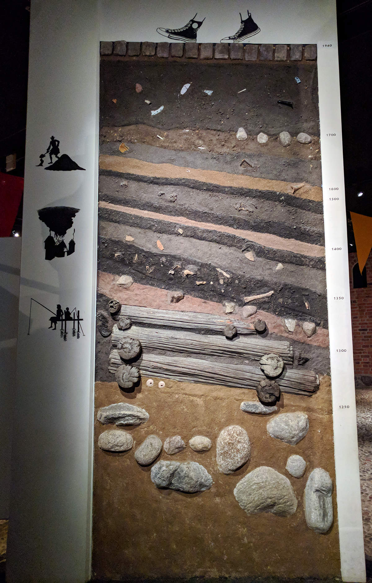
Today’s post is about a rather large piece from the Medieval Museum in Stockholm. The city dates probably from the 13th century, but there is no definite date nor any definite explanation of the origin of the name Stockholm. A lot of work thus has to be done via archaeology and this piece, easily twice as tall as me, shows just how deep those artifacts are buried. The years can be seen to the right for a sense of scale.

Layers of history
Layers of history

But why did I love it? Because Converse trainers. And did I ever see so many black Converse walking around.