Tag: military
-
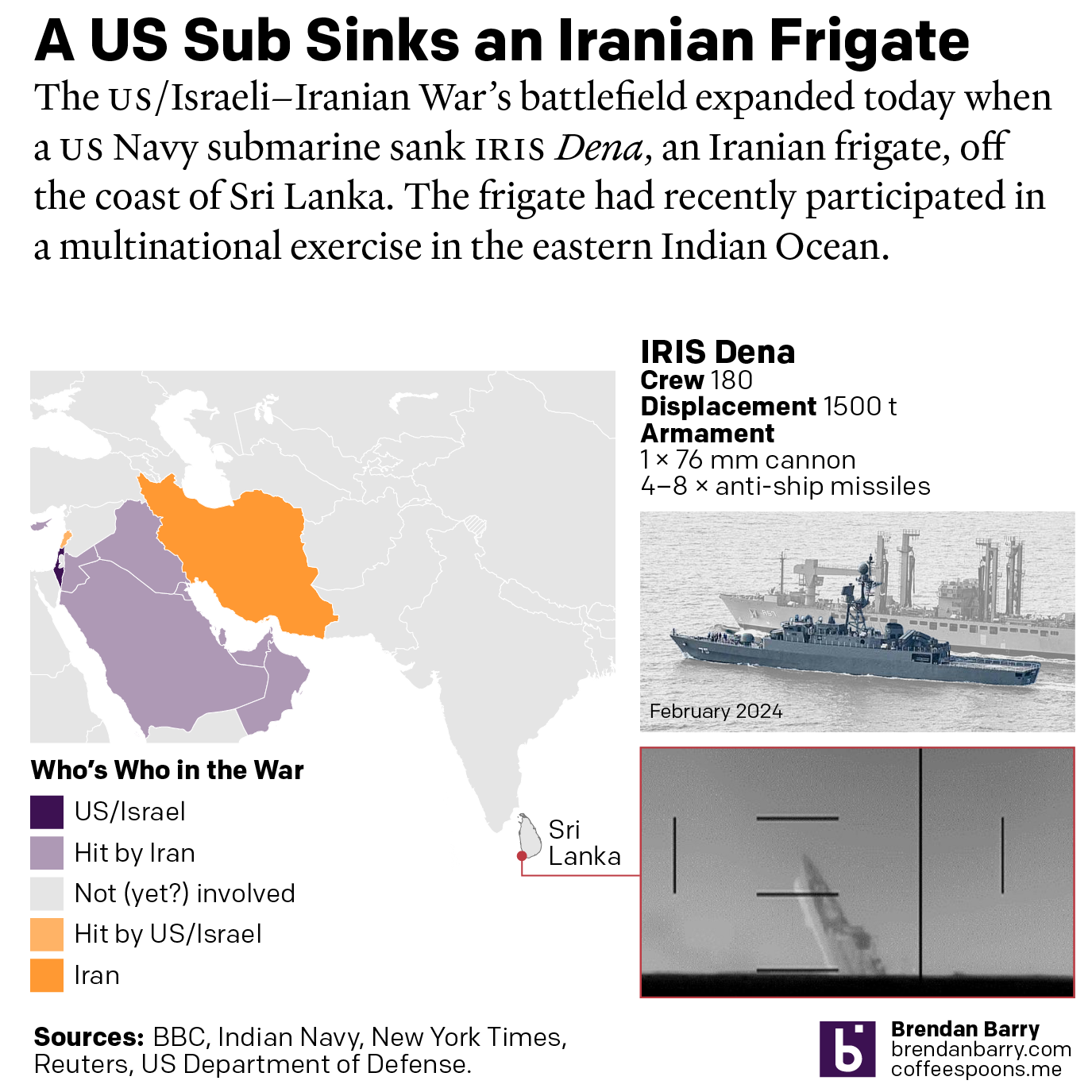
US Sub Sinks Ship off Sri Lanka
I woke up this morning thinking I was going to write about the graphics I mentioned on Monday. Instead, reading the news over breakfast brought me up to speed on the US Navy’s sinking of an Iranian frigate off the southwestern coast of Sri Lanka in the wee hours of the morning local time. Longtime…
-
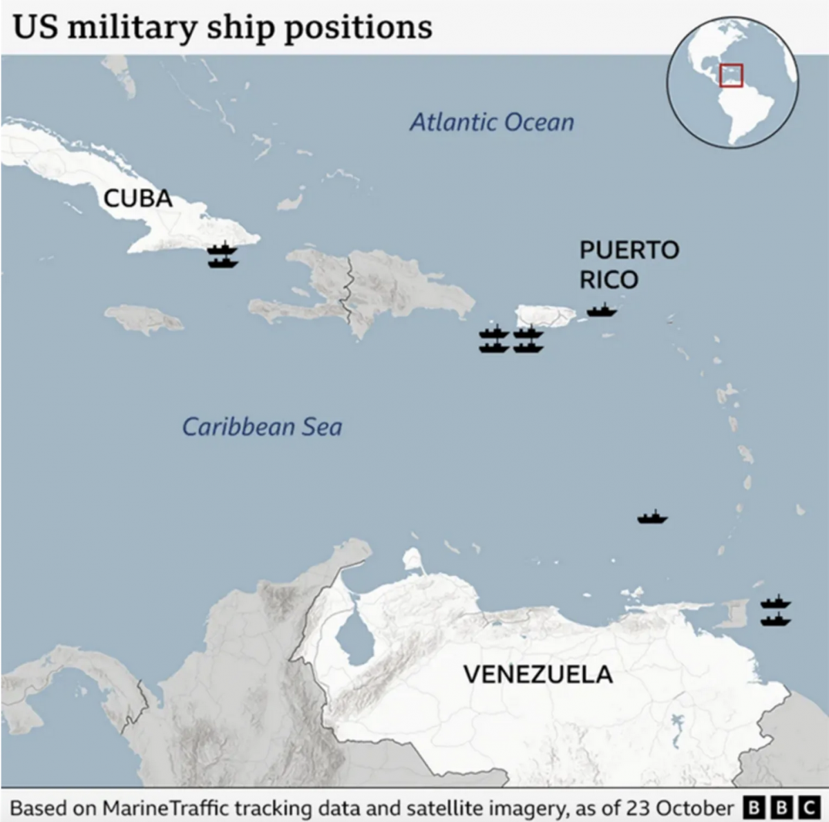
Where’s the Tin Can?
After a few weeks away for some much needed R&R, I returned to Philadelphia and began catching up on the news I missed over the last few weeks. (I generally try to make a point and stay away from news, social media, e-mail, &c.) One story I see still active is the US threatening Venezuela.…
-
Cannon, Howitzers, Mortars—Oh My!
For the last two days I have been writing about the Fort Pitt Museum and some infographics, environmental graphics, diagrams, and dioramas that help explain the strategic value and thus history behind the peninsula at the confluence of the Allegheny, Monongahela, and Ohio rivers. In particular, we looked at Fort Duquesne, the French attempt to…
-
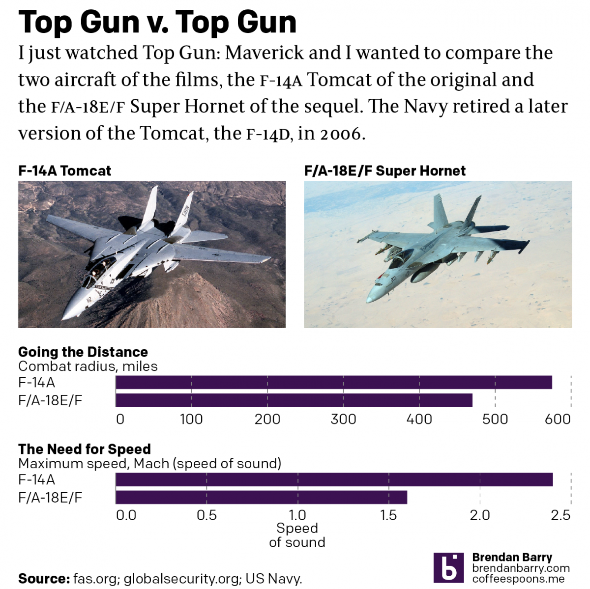
Top Gun
Last night I went to see Top Gun: Maverick, the sequel to the 1986 film Top Gun. Don’t worry, no spoilers here. But for those that don’t know, the first film starred Tom Cruise as a naval aviator, pilot, who flew around in F-14 Tomcats learning to become an expert dogfighter. Top Gun is the…
-
Battalion Tactical Groups
As Russia redeploys its forces in and around Ukraine, you can expect to hear more about how they are attempting to reconstitute their battalion tactical groups. But what exactly is a battalion tactical group? Recently in Russia, the army has been reorganised increasingly away from regiments and divisions and towards smaller, more integrated units that…
-
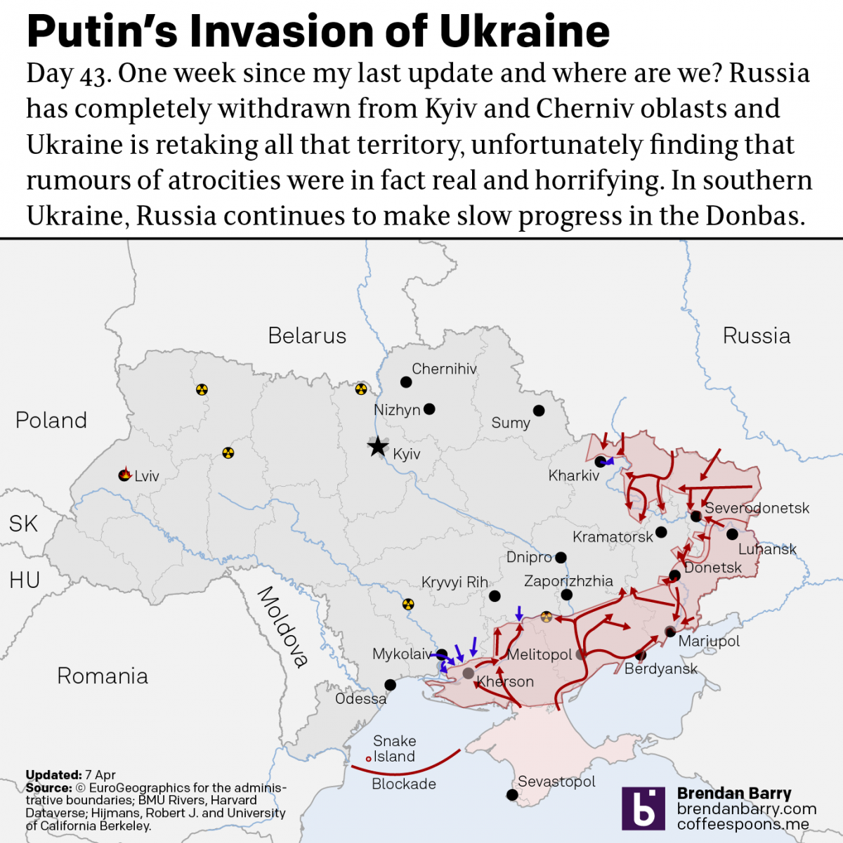
Russo-Ukrainian War Update: 6 April
It’s been a week since my last update and that’s in part because a lot has changed. When we last spoke, the Russians had announced they had successfully completed the first phase of the “special military operation”. They didn’t. Instead, Russian forces have completed a full-on retreat from northern Ukraine, sending troops and equipment back…
-
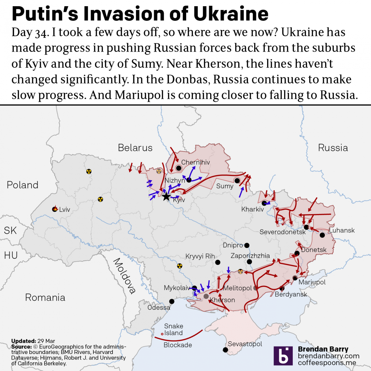
Russo-Ukrainian War Update: 29 March
I took a few days off from covering the war in Ukraine. Now it’s time to jump back in and catch up on things. Putin and his generals have declared the first phase of his “special military operation” over and that it was a success. They claimed that their goal was never the capture of…
-
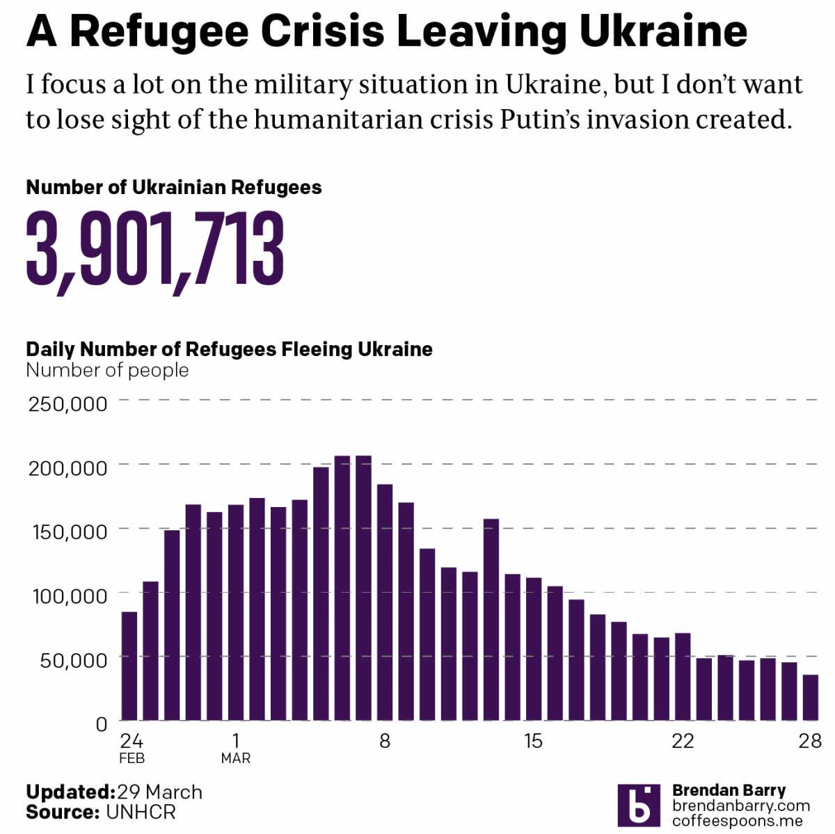
Russo-Ukrainian War Refugees
This data took far longer to clean up than it should have. And for that reason I’m going to have to keep the text here relatively short. We still see tens of thousands of refugees fleeing Putin’s war in Ukraine. Although, we are down from the peaks early on in this war. In total, nearly…
-
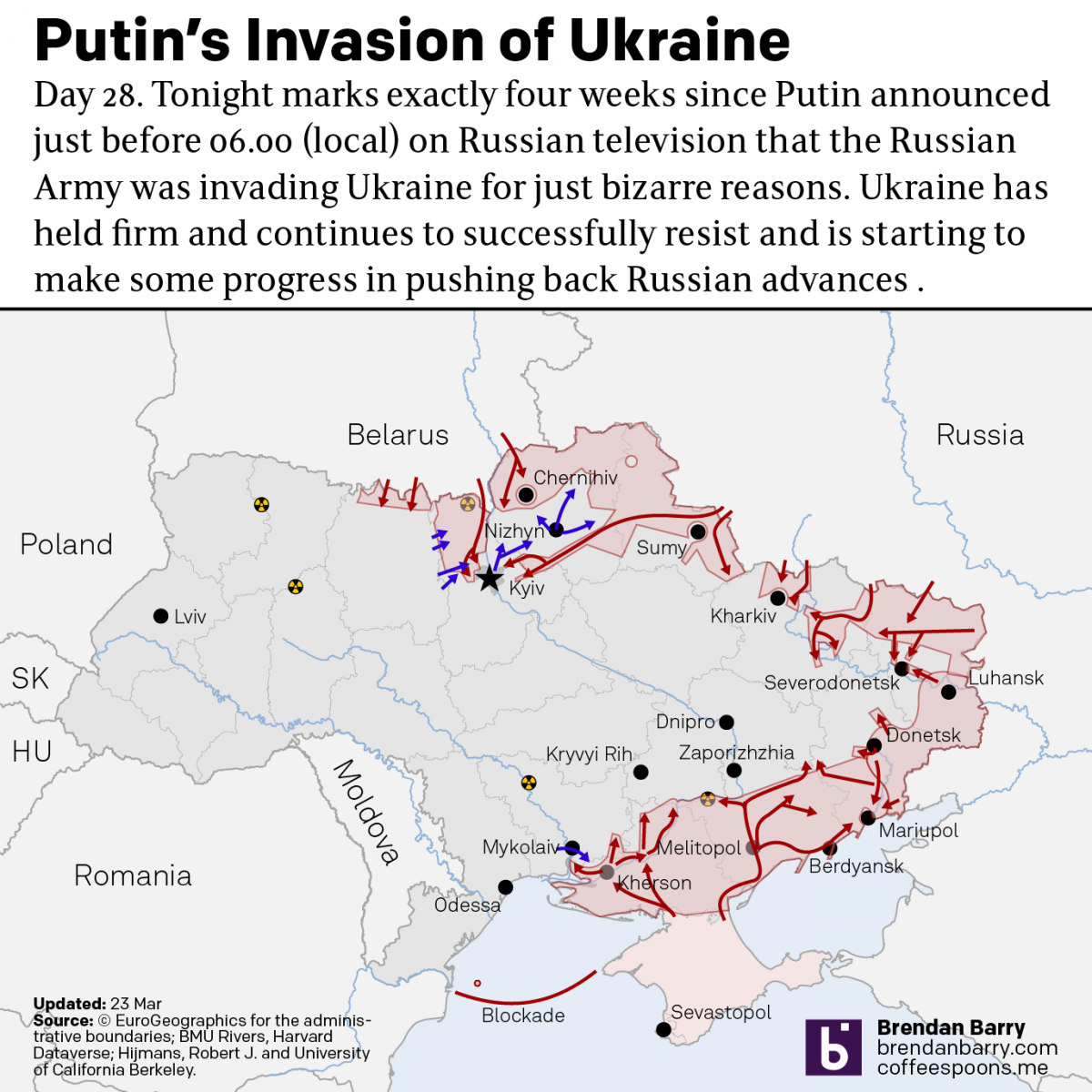
Russo-Ukrainian War Update: 23 March
Just when I thought I wasn’t going to post an update, we get some news out of Kyiv itself. The municipal government allowed journalists to see an unclassified map of the battlefield as they understand it. It highlighted those areas where Ukrainians have recaptured areas captured by the Russians in the first four weeks. A…
-
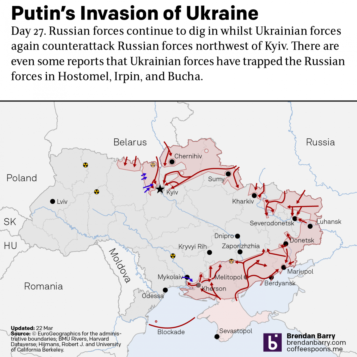
Russo-Ukrainian War: 22 March Update
I’m still trying to post these updates in the morning about what happened yesterday, even though we’re well into the afternoon in Ukraine. The situation on the ground, at least in terms of territorial change, remains largely static. I mentioned yesterday how Ukraine recaptured the town of Makariv. Yesterday, Ukrainian forces made a broader push…