Tag: US Navy
-
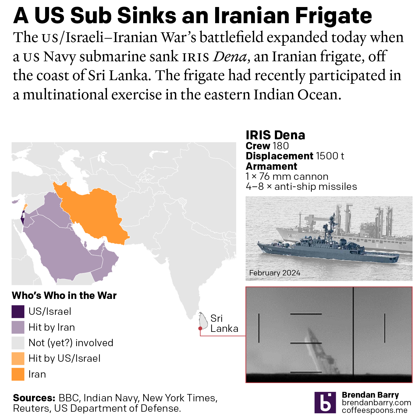
US Sub Sinks Ship off Sri Lanka
I woke up this morning thinking I was going to write about the graphics I mentioned on Monday. Instead, reading the news over breakfast brought me up to speed on the US Navy’s sinking of an Iranian frigate off the southwestern coast of Sri Lanka in the wee hours of the morning local time. Longtime…
-
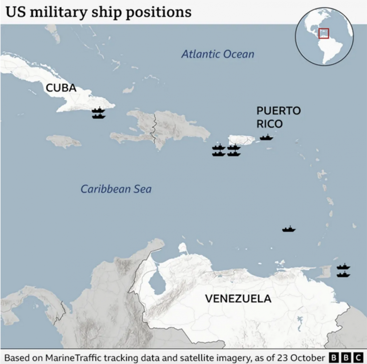
Where’s the Tin Can?
After a few weeks away for some much needed R&R, I returned to Philadelphia and began catching up on the news I missed over the last few weeks. (I generally try to make a point and stay away from news, social media, e-mail, &c.) One story I see still active is the US threatening Venezuela.…
-
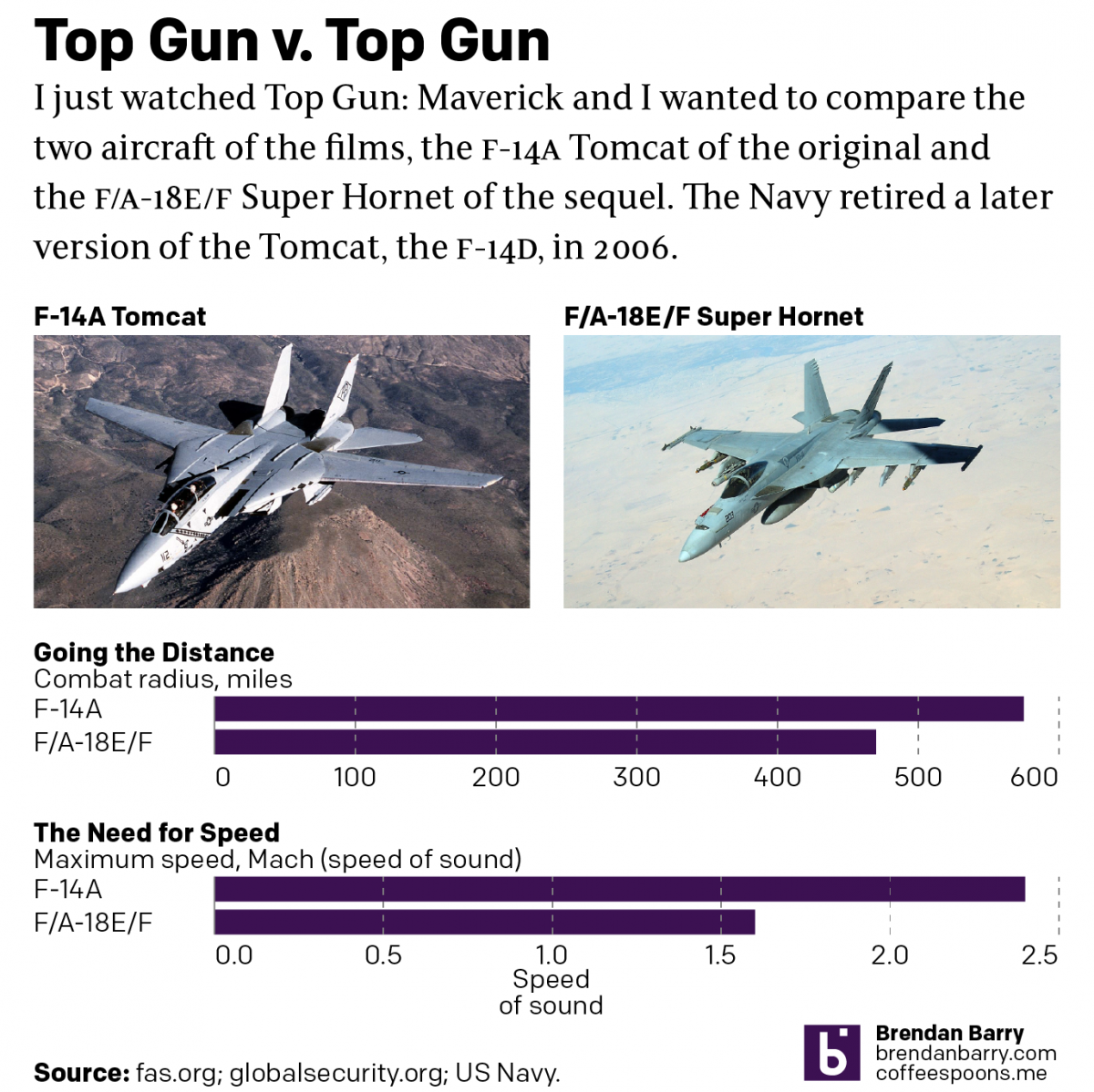
Top Gun
Last night I went to see Top Gun: Maverick, the sequel to the 1986 film Top Gun. Don’t worry, no spoilers here. But for those that don’t know, the first film starred Tom Cruise as a naval aviator, pilot, who flew around in F-14 Tomcats learning to become an expert dogfighter. Top Gun is the…
-
Capturing a US Navy Drone Submersible
Last Friday China seized a US Navy submersible drone—like the drones the Air Force uses but for underwater purposes—in international waters off the coast of the Philippines. This graphic from the Washington Post shows how, while in international waters, the seizure occurred not far outside China’s Nine-dash Line, which they claim as territorial waters. Credit…