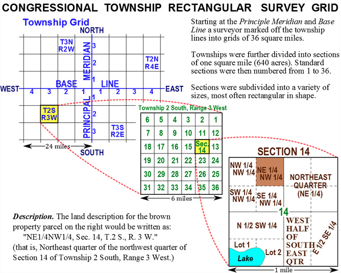
A few weeks back I looked at my ancestral family’s land grant in Wisconsin. Unlike land on the East Coast that was surveyed and organised by pioneers in different colonies using different sets of rules, after the formation of the United States, surveyed land was organised into townships that had subdivisions. In this blog post I found about the subject, there are several diagrams and maps that explain just how this system worked.
How western lands were organised
If you’re curious about how western land was organised, its worth a quick read.
Credit for the piece goes to Living History Farms.
Author: Brendan Barry
I am a graphic designer who focuses on information design. My day job? Well, they asked me not to say. But to be clear, this blog is my something I do on my own time and does not represent the views of…my employers. I think what I can say is that given my interest in information design—be it in the shape of clear charts, maps, diagrams, or wayfinding systems—I am fortunate that my day job focuses on data visualisation. Outside of work, I try to stay busy with personal design work. Away from the world of design, I have become an amateur genealogist and family historian. You will sometimes see that area of work bleed into my posts.
View all posts by Brendan Barry