
I was not sure if I wanted to file this under either my humourous Friday posts or my regular weekday posts, but I ultimately decided to go with the weekly postings. Why?
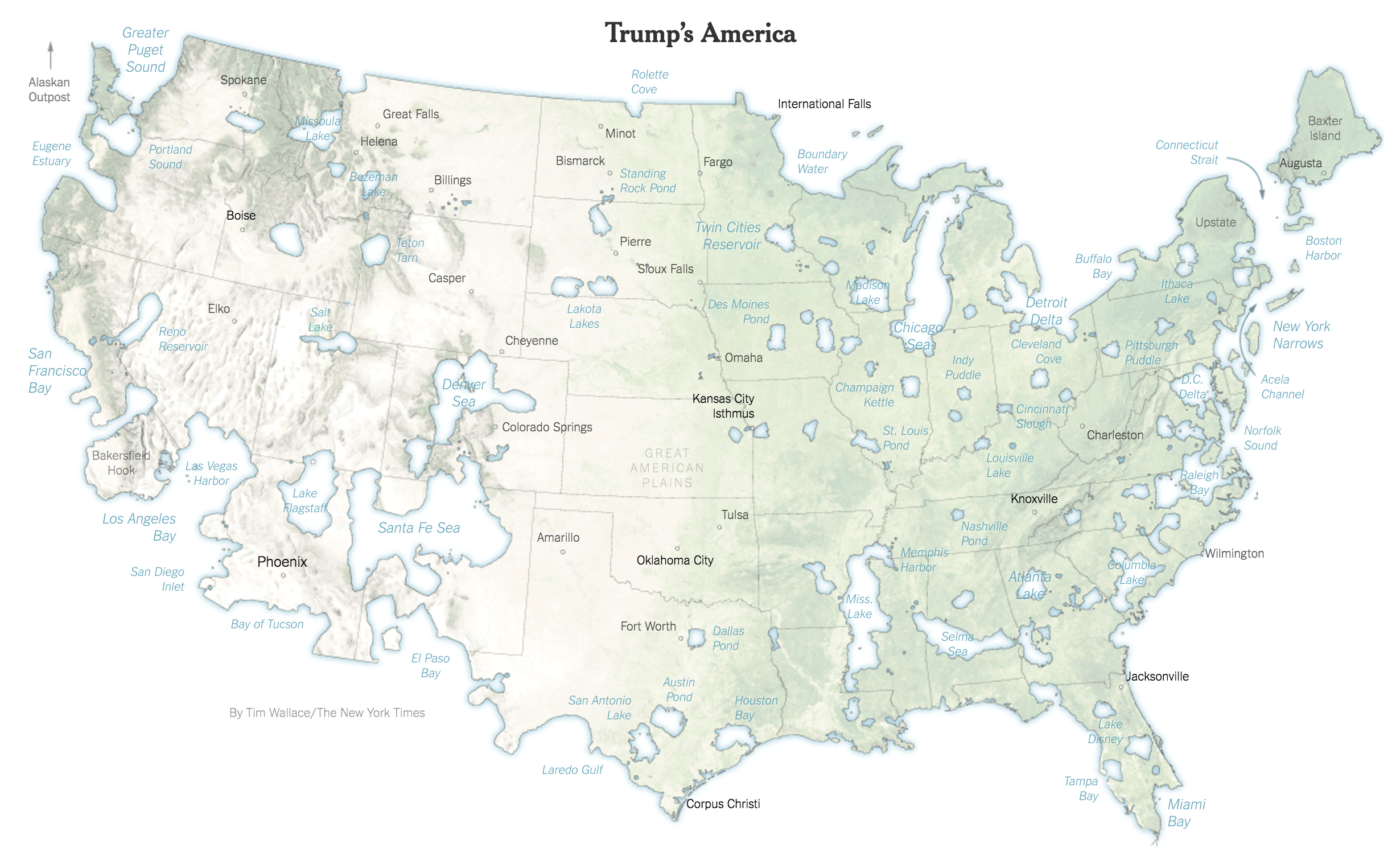
It’s simply a different way of visualising the election results, by separating the two camps into two separate Americas. One is the geography connected by Trump’s victory, the other are those disconnected cities and geographies united around Clinton. A collection of almost Greek-like city states.
Trumpland.
Clintonopolis.
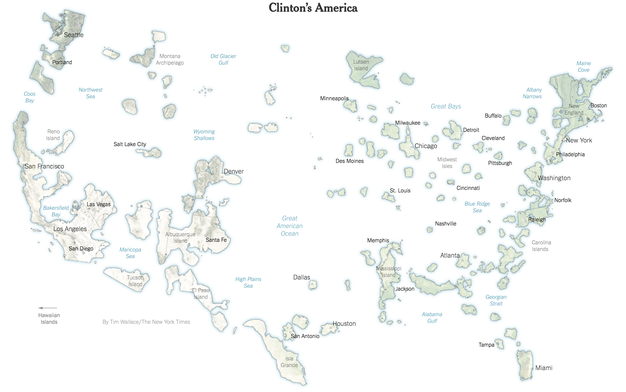
And what I can say as someone who often drove from the Chicago Sea to the Acela Channel, the United States is very much divided by economics and by culture. But in theory that is the great advantage of the pluralist, multicultural society—it allows for all people of all different types to cohabit an entire continent. Well, in theory at least.
Credit for the piece goes to Tim Wallace.