Five years ago, I covered the Russian invasion of Ukraine a little tiny bit. Five years on and Russia has formally annexed Crimea and Russian “patriotic volunteers” continue to destabilise the Donbass. About two weeks ago, this article from the BBC caught my eye as it recounted the story of Ukraine’s deadliest day in the conflict. Initially I read it simply because I have long been fascinated by that undeclared war.
Since at least high school, but probably most definitely earlier, I have long been interested in military history. And I distinctly recall being awestruck by maps depicting the bombing of Pearl Harbour, or the Roman defeat at Cannae, or the Battle of Waterloo.
So I loved scrolling through the article and finding this graphic.
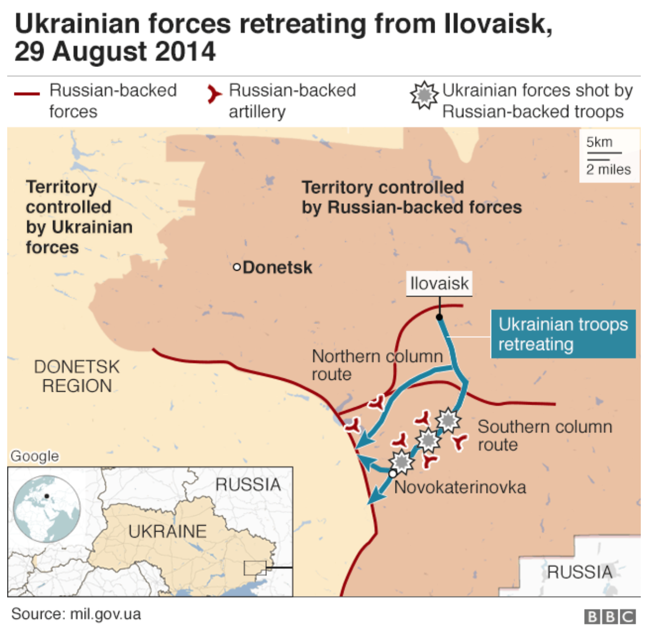
It’s a fairly simple map, showing the alignment of forces. It’s not quite a tactical map showing unit size/formations, but it does show the Ukrainian forces essentially surrounded. And how their retreat brought them through essentially a shooting gallery of Russian artillery.
Credit for the piece goes to the BBC graphics department.
Leave a Reply
You must be logged in to post a comment.