Living in Chicago, hurricane season means rather little. Perhaps at worst the city would see a major rain system moving up from Texas or the Gulf Coast. But, from all my time living on the East Coast makes hurricane season a bit more meaningful if now just as an outside observer. The Weather Channel has launched a site called the Hurricane Tracker that allows you to follow the current season’s storms.

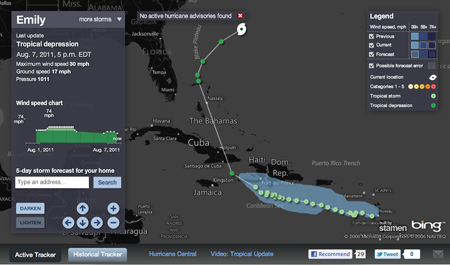
While there has yet to be any major activity, there have been a few named tropical systems that are present in what is called the Active Tracker. The storms are tracked geographically, showing you the precise locations where the storm was recorded and then filling out the path between points. The data includes information on strength—hurricanes are classed on a 1–5 scale with 5 being really most unpleasant—such as windspeed and pressure—hurricanes are enormous low pressure systems. The panel on the left of the screen provides a detailed history of the storm and links the recorded data points to the corresponding geographic points on the map. Currently, the storms have all been relatively minor and short-lived; watching a major storm of some duration through the charts and the map progression could be quite fascinating.

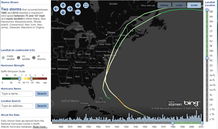
But there is also the Historical Tracker that catalogues an impressive number of previous storms. The view first loads with an overwhelming number of storm tracks, but filters for controlling the years—which includes a interactive mini-graphic of the total number of storms for each year that when clicked filters for only that year—and for location of landfall begin to significantly bring your search or exploration into focus. I have yet to find any detailed information about specific storms, the one in this screenshot being those that made landfall in the Northeast roughly during my lifespan. (I have memories of being at the shore during Hurricane Bob with the winds and rain and warning sirens making an impression.) You cannot click to focus on a particular storm, instead, a mouseover is the only way of discovering the name of a particular track. But, that may simply be an unavailable level of data, especially with the storms from the 19th and early 20th centuries.
Now I just hope we can use this sort of information to help develop better forecasting and modelling to help save lives and property.
Credit for the design goes to Stamen Design.
Leave a Reply
You must be logged in to post a comment.