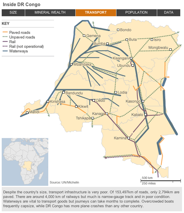
The Democratic Republic of the Congo is preparing for elections at the end of the month. For decades since independence from Belgium, the country has been beset by insurrection and civil war. Eastern portions of the country are all lawless and beyond the control of the government in the capital Kinshasa. Yet, DR Congo, which is almost the size of all of Western Europe, holds vast mineral and energy reserves.
Much like with the independence of South Sudan, the BBC has released a small interactive piece detailing DR Congo through maps. While not as extensive and lacking in visualising anything about the warfare and bloodshed, the piece is useful to gain a brief insight into the complexities of the country and the sheer scale of its problems. But that is not wholly surprising as the title of the piece is Failed State: Can DR Congo Recover?.

