We are warming the planet. And like ice cubes in a glass of water on a hot summer’s day, Earth’s ice caps will, over the course of centuries, begin to melt and contribute to a rise in sea level. Unfortunately, most of the world’s population lives close to shorelines or the rivers connecting continental interiors to the sea. The world for the generations of children following us may very well look much different than it does today.
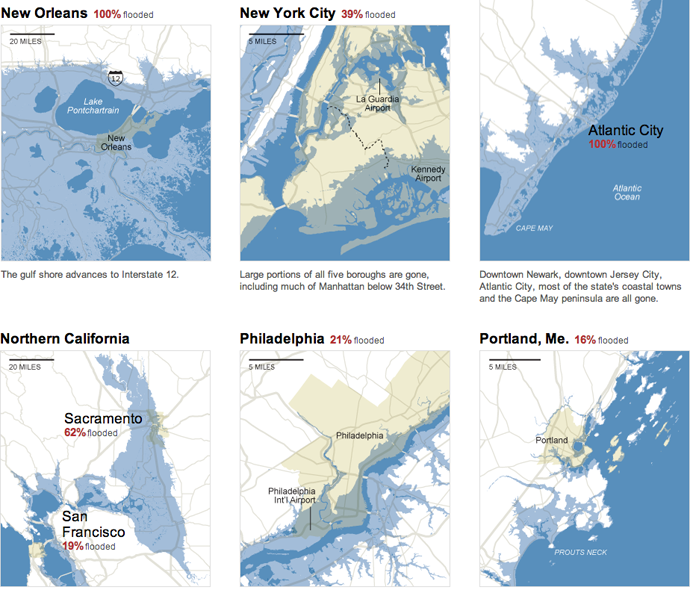
The New York Times uses an interactive piece to show how sea level rises will impact coastlines and inland ports in the United States. Using a slider, the user can investigate sea level changes of the expected five feet over the next one to three centuries, or two longer-term scenarios that are not yet certain but possible. Below are a few of the 24 cities and metropolitan areas.

In Philadelphia, a rise of 25 feet inundates South Philly, Old City, Fishtown, Kensington, Port Richmond and the other neighbourhoods close to the Delaware. The Jersey Shore still exists. It has just moved dozens of miles inland. The Cape May Peninsula is well submerged.
Credit for the piece goes to Baden Copeland, Josh Keller, and Bill Marsh.
