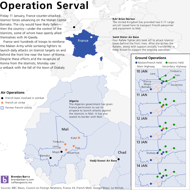
The tricky part about doing an infographic on a current event, like the conflict/war in northern Mali, is to keep the graphics updated and timely. Alas, I don’t have the necessary amount of time to do that. But, I still do want decent graphics explaining just what is happening.
With Mali, the hard part is that the Islamist/Tuareg rebellion against the democracy-overthrowing military government originally backed by the US in an attempt to beef up that military against the rebellion that then defeated that military is so far away and so foreign to much of the American public that so very much needs to be explained and be made relevant. This piece of mine doesn’t quite do that, but my infographic does attempt to show that France is now fighting a war far from its shores (and largely on its own). It also tries to highlight the fluidity of the ground war, especially around the fighting in and around Konna. Konna is the gateway to the city of Mopti which leads straight to the capital Bamako.


One thought on “Operation Serval”