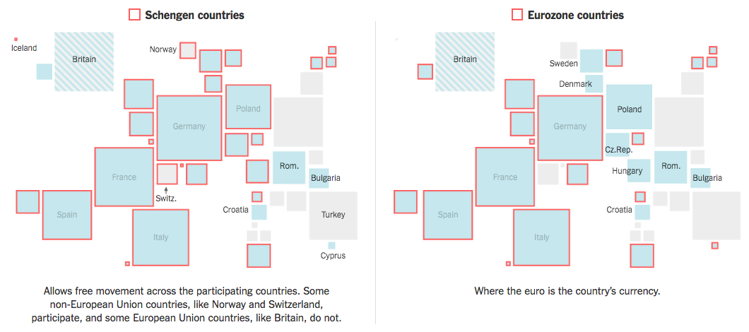
The United Kingdom voted to leave the European Union. Kind of a big deal, right? After the vote, the New York Times put together a piece on just how connected Europe remains. For example, European defence can largely be considered guaranteed through NATO, to which the United Kingdom remains. The screenshot below details which European countries participate in the Schengen Zone and the Eurozone, the former creates a common border the latter a common currency.
I personally dislike the use of squares to represent European countries, with the size determined by the population. Granted the piece opens with a large map labelling every country, but it does require a user to have the ability to abstract the geography of Europe. Adding a degree of interactivity over each square would partially resolve the issue.
Credit for the piece goes to James Kanter and Iaryna Mykhyalyshyn.
Leave a Reply
You must be logged in to post a comment.