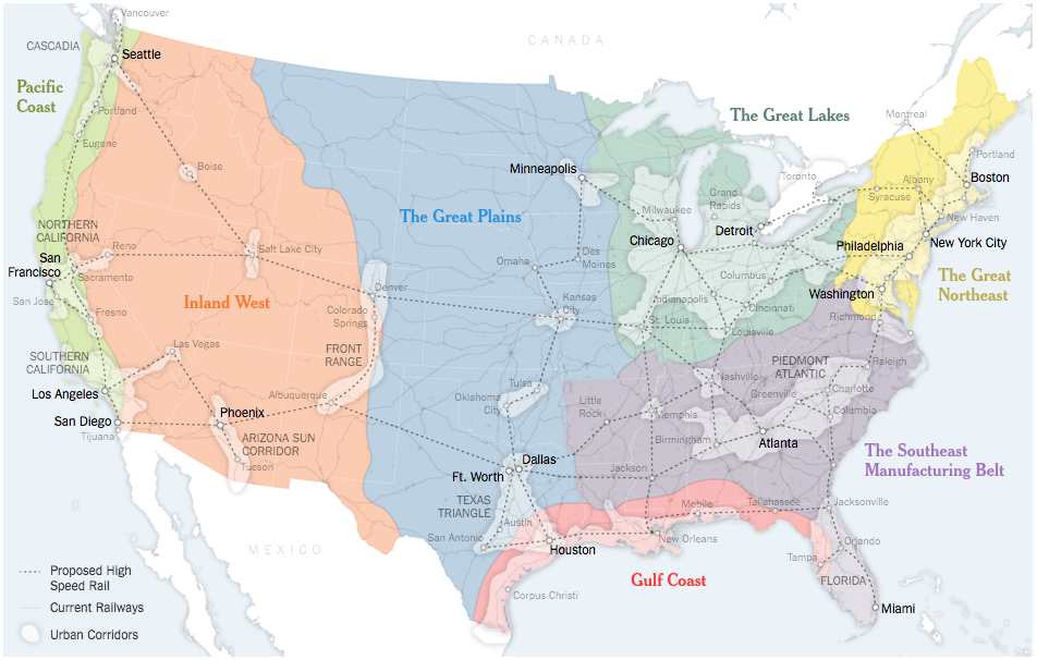
The United States of America consists of 50 states and hundreds of cities. In Sunday’s edition of the New York Times Parag Khanna argued for the switch of priority away from the state-level and to effectively the city-level. We have clusters of cities that dominate and drive the national economy.
The classic case-in-point is Bowash, the megapolis of interconnected cities from Boston to Washington, where there is a plan to extend Baltimore’s MARC public transit train to Wilmington, Delaware. If that were to happen, one could take public transit from the northern suburbs of New York City to Washington through Trenton, Philadelphia, Wilmington, and Baltimore. But today, those decisions must be taken as many as six different states. What if it were handled by a single, regional body?

The above map looks at what a New America could look like, as grouped into seven different regions and their urban clusters.
Credit for the piece goes to the New York Times graphics department.
