Irma swept the northern coast of Puerto Rico last night after devastating some of the Leeward Islands. What’s next? Well after the Turks and Caicos, Cuba, and the Bahamas we are probably looking at a Florida landfall. (Though in the last 24 hours the track has shifted ever eastward so Tampa Bay looks fine from a direct impact standpoint.)
Harvey was an exception in many ways because most deaths occur not from rainfall flooding, but from the storm surge. Basically a massive wave of water driven by low pressure and strong winds that is literally pushed ashore.
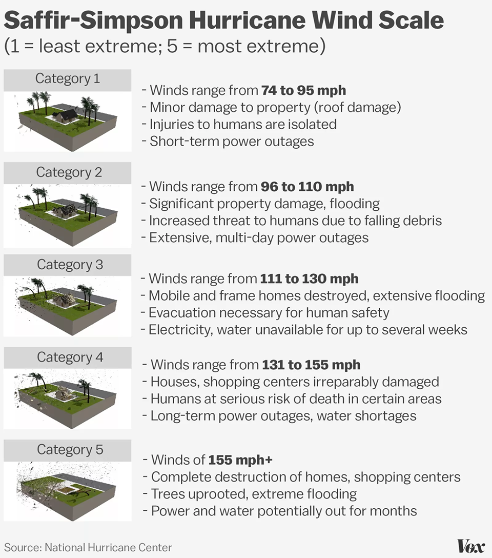
Now even though I just said that, I wanted to talk about the winds for a second. Why? Well it turns out that at 185mph, Irma has some of the strongest sustained winds ever recorded for an Atlantic hurricane. And 185mph winds, they can do quite a bit of damage. How much? Well for that we turn to this illustration from Vox.

Assuming the worst case scenario and Irma would strike just southwest of Miami, say Homestead or Key Largo, 185mph winds could do some damage to non-hurricane-safe buildings in a very large American city. And then there is the storm surge, which could be problematic for a city that is already struggling with rising tides. (Thanks, climate change.) The reason I say worst case is southwest of Miami is because hurricanes do most of the their damage—though certainly far from all of it—on their righthand side, which in a northward moving storm would be the eastern half.
The rest of the Vox piece does a nice job explaining Irma, its historic nature, and how it could be so dangerous. Worth a quick read, unless you live in Florida and then you should probably be packing up to evacuate.
Credit for the piece goes to Zachary Crockett.
Leave a Reply
You must be logged in to post a comment.