To be clear, we know the Earth is round. At least most people know that. Some people delude themselves. We also know that sitting atop the mantle we have plates of rock that move around. Sometimes they slip underneath others. Other times they collide and crumple. Plate tectonics explain why there are so many similarities between continents separated by an ocean.
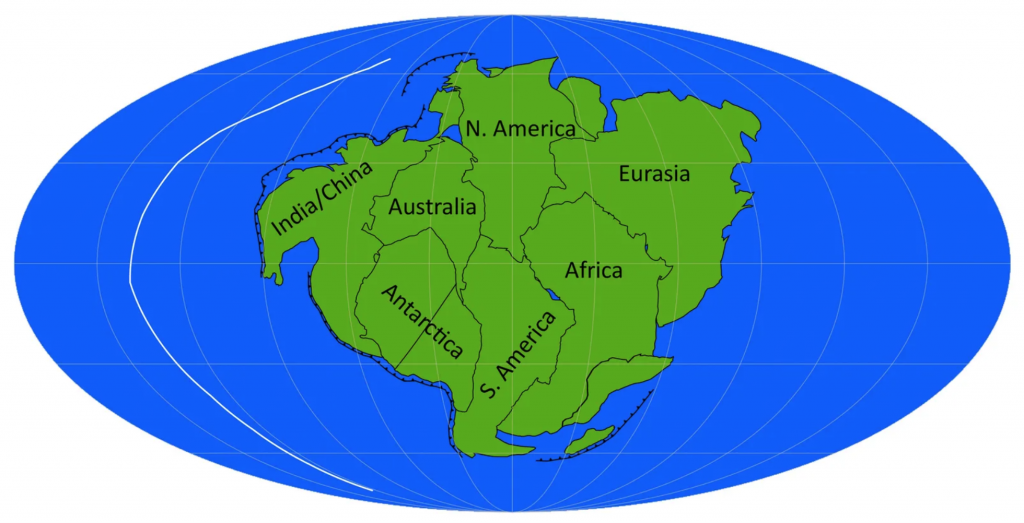
But while that explains historical connections, what does it say about the future? The fact is that we don’t know for certain. Luckily a recent BBC article explored four different scenarios. And they included graphics, here’s a screenshot of one of them.

The graphics are pretty simple with green continents and blue oceans. But they work really well for showing the scenarios. The maps also include black lines for subduction zones, i.e. lines along which the plates that define the ocean floor, and the white lines represent mid-ocean ridges. Those are where the ocean plates diverge and in the process create new ocean floor. The designers also included some labels to help the audience understand just what green shape came from today’s continents.
Credit for the piece goes to the BBC graphics department.
