Today’s post features a simple set of graphics on the BBC, however the creators were actually the Asia Maritime Transparency Initiative. The background? The increasingly tense geopolitical situation in the South China Sea, where China claims numerous islands and reefs claimed by other countries—and to a smaller extent other countries make similar such claims. Just a few weeks back, the Hague ruled against Chinese claims against islands within the Philippines territorial waters. But as these graphics show, it takes more than a legal decision to effect change on the ground.
Satellite photography shows military installations on numerous Chinese-held islands. But what makes the images potent in the communicative sense is the simple overlay of white plane illustrations. They show how many fighter jets, support aircraft, patrol aircraft, &c. that China can base at the various military installations. It is a simple but incredibly effective touch.
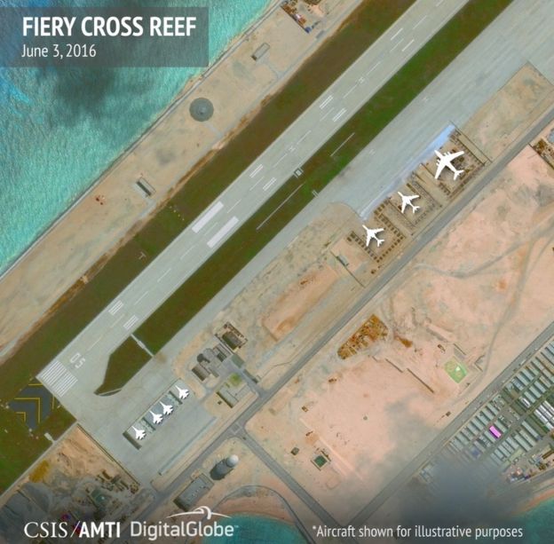
Credit for the piece goes to the Asia Maritime Transparency Initiative.
Leave a Reply
You must be logged in to post a comment.