Who did not like Indiana Jones growing up as a kid? Or better yet, stories of explorers like Heinrich Schliemann, who discovered the lost city of Troy? The ancient world boasted a number of civilisations that no longer exist. But not all lost civilisations date back thousands of years. A recent article in Nature details how modern-day explorers used technology instead of trowels to discover urban centres dating only back 1500 years ago, the time at which Europe was just discovering the American continents.
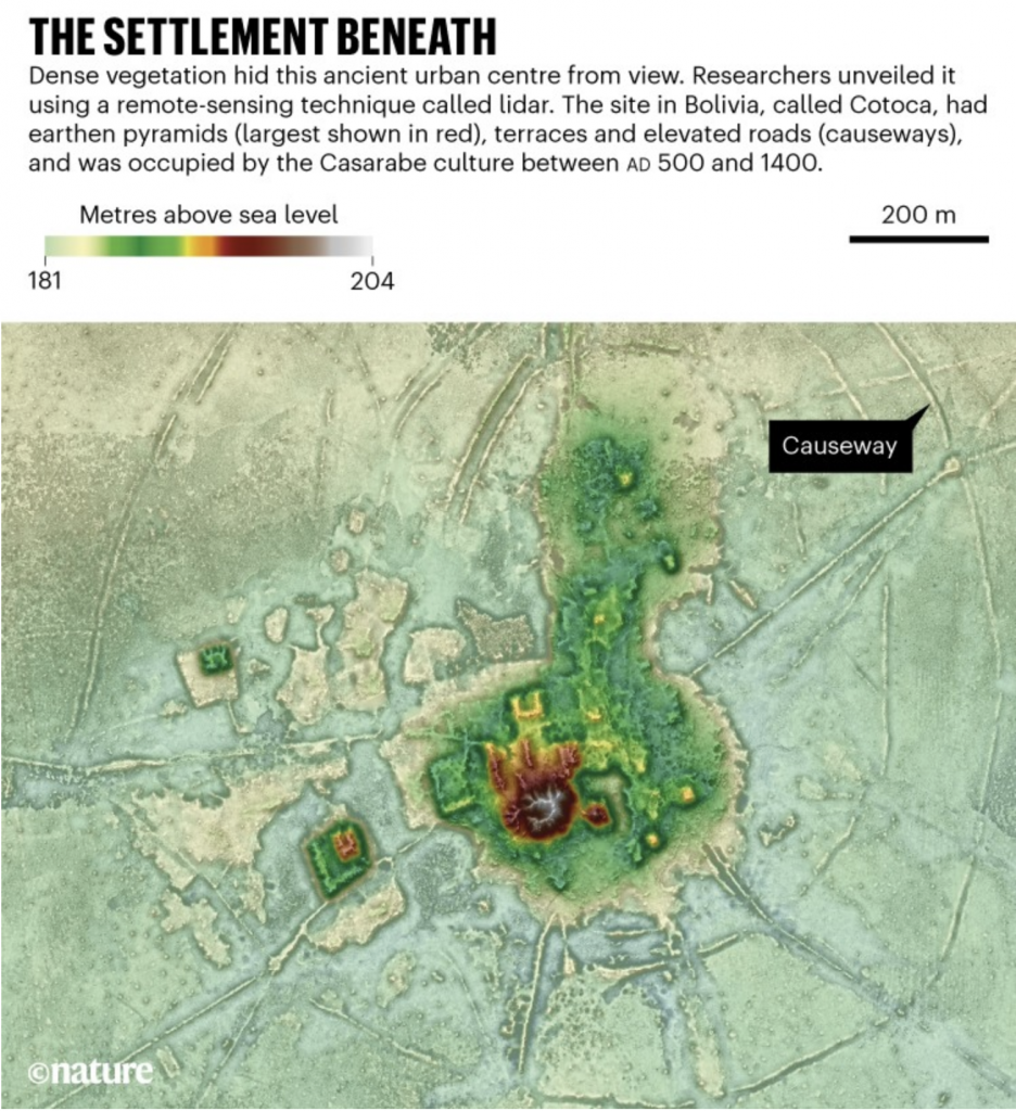
The article includes a map of the elevations uncovered by LIDAR, which is like radar but with lasers. These wavelengths have the ability to penetrate the thick Amazonian jungle and reveal what sits upon the ground and the differences in height between them. This allows human-built structures to become rather apparent in contrast to the natural topography.

You can not only readily discern the pyramids and central civic/religious structures, but also the infrastructure like causeways, moats, and fortifications. They provide a fascinating insight into civilisations whose homelands are not easily accessible being that they are deep within the Amazon rain forest.
Here I like how the designers annotated at least a causeway, though I would also have enjoyed notes pointing out suppositions and hypotheses as to what the other structures may (or may not) be.
Credit for the piece goes to Heiko Prümers, Carla Jaimes Betancourt, José Iriarte, Mark Robinson, and Martin Schaich.
