Over the last several days, along with most of the country, I’ve taken an interest in the spread of the novel coronavirus named COVID-19. Though, to be fair, it’s actually been in the news since early January, though early news reports like this from the Times, simply called it a mysterious new virus. At the time I thought little of it, because the news out of China was that it did not appear it could spread amongst humans. How did that idea…wait for it…pan out?
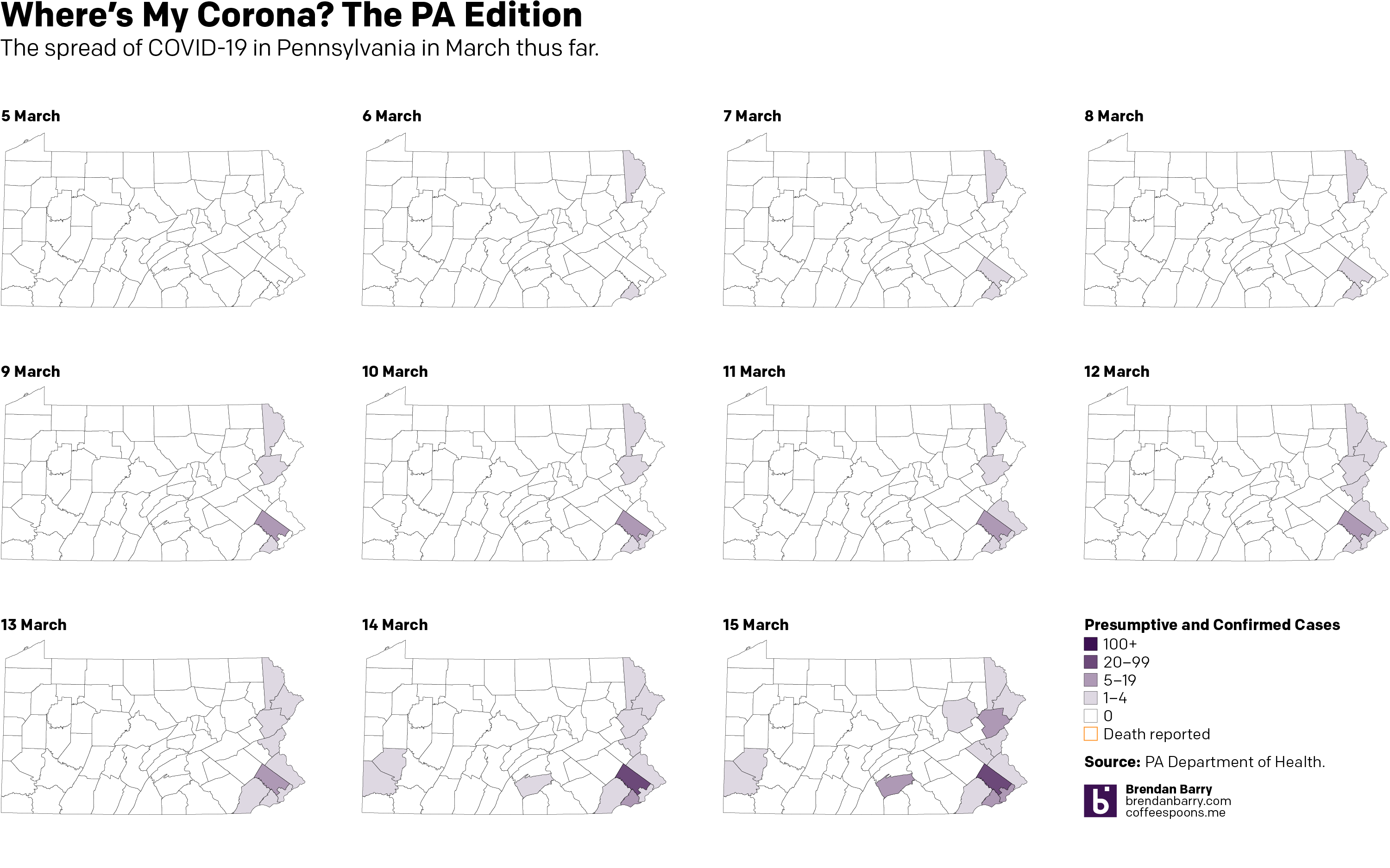
Anyway, over the last couple of days I’ve been making some maps for Instagram because people tend to look at a national map and see every nearly state infected when, in reality, there are pockets and clusters within those states. So I started looking at Pennsylvania. And initially, the cluster was along the Delaware River, namely Pennsylvania as well as its upper reaches near the Lehigh Valley and in the far northeast of the state.
But the spread has grown, and fairly quickly, with Montgomery County, a Philadelphia suburb, a hotspot. Consequently, the Pennsylvania governor has shut down all schools across the state and ordered non-essential shops, restaurants, and bars in the counties surrounding Philadelphia—as well as the county containing Pittsburgh—closed.
So 11 days in, here’s where we stand. (To be fair, I looked at including the early numbers out of today, but nothing has really changed, so I’ll wait until the evening figures are released before I update this again.)
Credit is mine. Data is the Pennsylvania Department of Health.

