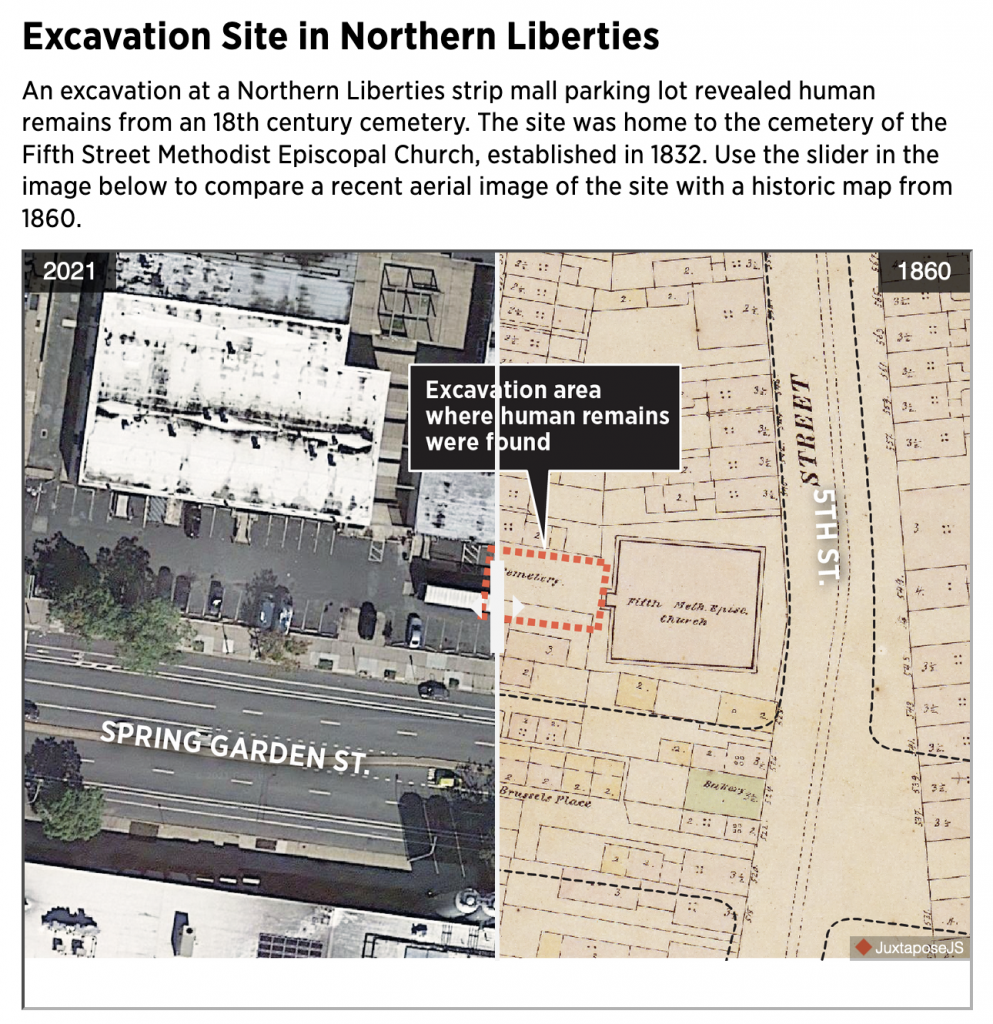
Okay, technically not Spring Garden Street, but a strip mall along one of Philadelphia’s main arterial city streets. Luckily these aren’t some victims of a serial murderer, but rather the result of Philadelphia being an old city (for the United States). As this article from the Philadelphia Inquirer explains, the bodies were discovered during excavations for new construction at the site.
The reason I shared this today was that this past weekend, I had a pint with a colleague of mine at Yards Brewery located at 5th and Spring Garden. We sat at an outside table along Spring Garden and at some point I recall pointing out that Spring Garden hadn’t always been a street. Originally it only existed west of Broad.
Little did I know that the construction site across the street on that sultry Sunday afternoon was home to an archaeological excavation of an old, long since demolished city church cemetery.

You can use the slider in the article to compare the layout of the intersection in 2021 to that of 1860. I love these old timey maps, especially when working on genealogy. Because while we know the cities where we live today, they didn’t look like we know them 150 years ago. And in lieu of photography, it’s otherwise difficult to try and make sense of our ancestors’ world.
Just a few doors south of the Methodist church we had a bakery and a small alley called Brussels Place. And facing the alley we had what look like a number of small homes or perhaps stables. Larger presumably rowhomes lined the main streets of the intersection.
At the right of the screen, I also remember my colleague and I discussing some of the old-looking rowhomes. They may very well be the same ones depicted on this 1860 map. They are the few survivors as most of the area, as the article points out, was eventually turned into a petrol station that later became the strip mall today fenced off to be turned into flats.
Credit for the piece goes to John Duchneskie.
