Today we have a quick piece, but one that I read at the weekend, you know, the 9/11 20th anniversary one. The article served as a quick summary of the day for those who either don’t know or don’t remember. After 20 years, there are a lot of people who have come of age in a post-9/11 world that were either not born or too young to recall those before times.
And so this map helped to identify the location of the three sites impacted by the planes: the World Trade Centre in New York, the Pentagon in Washington, and a field in Shanksville, Pennsylvania.

Except look closely at the graphic.
Little is where it belongs. The World Trade Centre marker is on Sandy Hook, New Jersey. The Pentagon is nearer to Fredericksburg than Washington. And Shanksville is in Maryland.
You can leave the dots for Washington and New York, as they are correctly placed. But why not just use some typography to put the World Trade Centre beneath New York and the Pentagon beneath Washington?
What makes it peculiar is that Shanksville is in Maryland, so it’s dot is just wrong. And so here’s a rough fix for that part of the graphic.
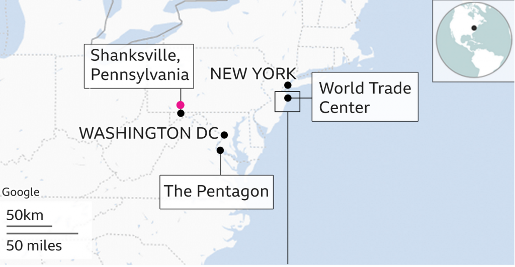
It was just an odd graphic for an article about one of those days that will be long-remembered in history.
Credit for the piece goes to the BBC graphics department.
Leave a Reply
You must be logged in to post a comment.